 W
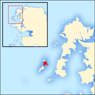
WAchill Island in County Mayo is the largest of the Irish isles, and is situated off the west coast of Ireland. It has a population of 2,594. Its area is 148 km2 (57 sq mi). Achill is attached to the mainland by Michael Davitt Bridge, between the villages of Gob an Choire and Poll Raithní (Polranny). A bridge was first completed here in 1887. Other centres of population include the villages of Keel, Dooagh, Dumha Éige (Dooega), Dún Ibhir (Dooniver), and Dugort. The parish's main Gaelic football pitch and secondary school are on the mainland at Poll Raithní. Early human settlements are believed to have been established on Achill around 3000 BC. The island is 87% peat bog. The parish of Achill consists of Achill Island, Achillbeg, Inishbiggle and the Corraun Peninsula.
 W
WGob an Choire or Gob a' Choire, formerly anglicised as Gubacurra, is a Gaeltacht village in County Mayo, Ireland. It lies on the east coast of Achill Island and is the first settlement one reaches after crossing the Michael Davitt Bridge, a swing bridge that joins Achill Island to Corraun Peninsula on the mainland. In ancient times the southern entrance was guarded by Carrickkildavnet Castle.
WAn Caiseal is a small Gaeltacht village on the east side of Achill Island in County Mayo, Republic of Ireland. Villages neighboring Cashel include Gob an Choire, Bun an Churraigh and Sáile.
 W
WEachléim is a Gaeltacht village and townland in County Mayo, Ireland. It lies on the Mullet Peninsula in Erris, on the R313 regional road. It has a total area of 2.96 km². Its name derives from Irish Each (horse) and Léim (leap), as local folklore has it a horse leapt from the east of the townland to the west, marking out its borders.
 W
WBéal Deirg is a Gaeltacht village and townland in County Mayo, Ireland. At Belderrig Harbour there is a Mesolithic / Neolithic site dating to 4500-2500 cal. BC. The Céide Fields archaeological site lies about 6 km to the east of Belderrig.
 W
WBelmullet is a coastal Gaeltacht town with a population of 1,019 on the Mullet Peninsula in the barony of Erris, County Mayo, Ireland. It is the commercial and cultural heart of the barony of Erris, which has a population of almost 10,000. According to the 2016 census 50% of people in the town were able to speak Irish while only 4% spoke it on a daily basis outside the education system.
WThe environs of Benwee Head County Mayo, with its cliffs, arches, stacks and islands, offers some of the most dramatic coastal scenery in Ireland. These cliffs tower over Broadhaven Bay in the Atlantic Ocean and there are way-marked cliff walking trails along them for which maps can be obtained from Comhar Dún Chaocháin Teo in Carrowteige. To appreciate the cliffs fully, you need to see them from the sea. Benwee Head is in the townland of Kilgalligan in the parish of Kilcommon, Erris, a townland whose microtoponyms and folklore traditions has been studied in detail in the 1975 book, The Living Landscape: Kilgalligan. An Bhinn Bhuí is the 1001st highest summit in Ireland and is all the more spectacular as its north sides drop vertically into the wild Atlantic Ocean. An Bhinn Bhuí is the most northerly summit in the North Mayo area.
 W
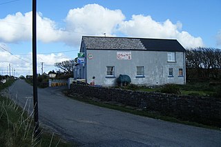
WBun an Churraigh or Bun a' Churraigh is a small Gaeltacht village in the north of Achill Island in County Mayo, Ireland. The village has a national school, a Roman Catholic church, and formerly had a monastery. It had two shops and a post office in the year 2000, but these shut in 2007. Today it is home to the Bunnacurry Business Park, which houses Achill Turbot and Western Woodcraft. The village also has a number of B & Bs.
 W
WCarrowmore Lake is situated in the parishes of Belmullet, Kiltane and Kilcommon Erris, County Mayo between the villages of Bangor Erris and Barnatra at the southern end of Broadhaven Bay. The freshwater lake is over 4 miles (6 km) long and almost 3 miles (5 km) wide at its widest point. Glencullen's two townlands line its eastern shore and Rathmorgan and the Knocknascollop mountains rise up along its western shores. Carrowmore is not a deep lake and it provides the drinking water for the whole of the Erris area. It is fed by the Carrowmore River and drains into the Owenmore River on its way to Blacksod Bay. The lake is designated as a S.P.A. in E.U. law and also as 000476 Complex S.A.C..
 W
WCeathrú Thaidhg is a Gaeltacht village and townland on the Dún Chaocháin peninsula in northwestern County Mayo, Ireland. It is within Kilcommon parish in the barony of Erris. Carrowteige is a relatively small townland with an acreage of just 403 acres (1.63 km2).
WCill Ghallagáin is a small Gaeltacht coastal townland and village in the northwest corner of Kilcommon Parish, County Mayo, Republic of Ireland, an area of 345 hectares in size. Off the northern coast of this townland lies Kid Island, an island of 13 hectares rising on steep cliffs to a height of 95 metres (311 ft) above sea level. The island is used for grazing sheep in the summer months. Kilcommon Parish consists of two peninsulas – Dún Chaocháin and Dún Chiortáin, to the west.
 W
WThe Corraun Peninsula, also spelt Currane, is a peninsula in County Mayo, on the west coast of Ireland. It extends out from the mainland towards Achill Island.
WDún Ibhir, meaning "Ibhir's stronghold", or "Ibhir's fort" is a Gaeltacht village on Achill Island in County Mayo, Ireland.
 W
WErris Head is a promontory at the northernmost tip of the Mullet Peninsula, located in the barony of Erris in northwest County Mayo, Ireland. It is a well known and recognised landmark used by mariners and weather forecasters, and is also a scenic viewpoint, with an unobstructed view of the Atlantic Ocean and steep rocky cliffs. It is not served by any road and can only be reached by crossing a number of fields.
WFaulagh is a townland in Kilcommon, Erris, County Mayo, Ireland, some 946 acres (3.83 km2) in size. It's a remote spot on the main Ballycastle to Belmullet road. Faulagh and its neighbouring townland Muingerroon South are located on a mountain which skirts the townland of Bellanaboy where the contentious Corrib Gas terminal has been constructed over the last ten years. There is a small village cluster of houses and farms in Faulagh along a small road branching off to the village of Knocknalower above Pollathomas, the main village in the parish. Muingerroon South townland is 1,454 acres (5.88 km2) in size—habitation is fairly sparse and the existing houses mainly form a linear pattern along the main road overlooking Carrowmore Lake.
 W
WGlengad is a Gaeltacht village in the parish of Kilcommon in northwest County Mayo, Ireland. It is also known as Dooncarton, a name which comes from an Iron Age tribal chieftain called Ciortan, a character who appears in the Ulster Cycle legend of the Táin Bó Flidhais.
WGlinsk is a townland in the County Mayo Gaeltacht in Ireland. It is in the parish of Kilcommon and barony of Erris. Glinsk Mountain is a remote area of upland blanket bog with sea cliffs descending to Broadhaven Bay and continuing along the coast to a height of 255 metres at Benwee Head. The mountain is the source of the Muingnabo River.
 W
WGweesalia or Geesala is a small village in the barony of Erris in the west of County Mayo, Ireland. The village has a national school, a community centre that contains a cafe and boxing club, two general stores, a post office, St Colmcille's Catholic Church, and one pub.
 W
WIllanmaster or Illaunmaistir is an uninhabited steep rocky island rising to about 100m, lying just off the north coast of County Mayo, Ireland and 19 km (12 mi) west of Ballycastle. Grid ref: F 933 435. The island is separated from the mainland by a narrow sound.
 W
WInishglora is an island off the coast of the Mullet Peninsula in Erris, County Mayo in Ireland. It has some small neighbouring islands, known as Inishkeeragh. The island has been uninhabited since the early 20th century, but there are several ecclesiastical ruins on the island.
 W
WThe Inishkea Islands are situated off the coast of the Mullet peninsula in Ireland. The islands are believed to be named after a saint that lived on the island called Saint Kea. There are two main islands - Inishkea North and Inishkea South. In the nineteenth century, the islands were notable for the pagan religious traditions that were practiced there. One tradition involved a small terracotta statue of a saint known as the Godstone or Naomhog in Irish, which was worshiped as an idol. It is possible that the remoteness of the islands somehow preserved some form of pre-Christian Celtic religion. In the early 1900s the islands were populated with more than 350 people, most of whom were probably monolingual Irish speakers, but the inhabitants left the islands in the 1930s after most of their young men died at sea in a storm. There are currently two people who live on the island, although it increases to around fifteen during the summer months of May to September.
WKilcommon is a civil parish in Erris, north Mayo consisting of two large peninsulas; Dún Chaocháin and Dún Chiortáin. It consists of 37 townlands, some of which are so remote that they have no inhabitants. Habitation is concentrated mainly along both sides of Sruwaddacon Bay which flows into Broadhaven Bay, in villages including Glengad, Pollathomas, Rossport, Inver and Carrowteige, and in the Glenamoy area further inland.
 W
WThis articles lists the islands of County Mayo, the mainland of which is part of the island of Ireland. Included in this list are named offshore and freshwater islands as recorded by Ordnance Survey Ireland or the Placenames Database of Ireland. Additionally, areas of ecological significance related to both offshore and freshwater islands, designated by the National Parks and Wildlife Service, are also listed.
 W
WLough Mask is a limestone lake of about 83 km2 (32 sq mi) in Counties Mayo and Galway, Ireland, north of Lough Corrib. Lough Mask is the middle of the three lakes, which empty into the Corrib River, through Galway, into Galway Bay. Lough Carra flows into Lough Mask, which feeds into Lough Corrib through an underground stream which becomes the River Cong.
 W
WMaumtrasna is the highest peak in the Partry Mountains in south County Mayo, Ireland. The Srahnalong River runs southwest from the peak to the westernmost shore of Lough Mask. The townland of Maumtrasna is on the south bank of the Srahnalong. The townland was the location of the infamous Maumtrasna murders in 1882.
 W
WThe Mullet Peninsula —also known as the Mullet and sometimes as the Erris Peninsula—is a peninsula in the barony of Erris in County Mayo, Ireland. As of 2016 it has a population of 3963. It consists of a large promontory connected to the mainland at Belmullet, a town of about 1,000 inhabitants, by a narrow isthmus. There are several villages on the Mullet peninsula including Aughleam, Elly, Corclough and Binghamstown. The Peninsula is about 33 km long and ranges from 200m-12 km wide. Its northernmost point is Erris Head. The peninsula's doglegged shape forms two bays, Blacksod Bay and Broadhaven Bay.
 W
WRossport is a Gaeltacht village and townland in northwest County Mayo, Ireland. It is within the barony of Erris and parish of Kilcommon. It lies close to the mouth of Broadhaven Bay on the headland where the confluence of three rivers meet flowing into Sruth Fada Conn Bay. Its area is 1,446 acres (5.85 km2).
WSáile is a small Gaeltacht village on an easterly peninsula of Achill Island in County Mayo, Ireland. The village has a national school. Villages neighboring Sáile include Gob an Choire and An Caiseal.
 W
WToormakeady or Tourmakeady is a Gaeltacht in south County Mayo in the west of Ireland. It is located between the shores of Lough Mask and the Partry Mountains, and covers 66.51 square miles. As at the time of the 2011 census, Toormakeady had a total population of 1,007, having dropped from 1,150 in 1991. Toormakeady is also the name of the principal village in the area.