 W
WThe Kura–Araxes culture, also named Kur–Araz culture, Mtkvar-Araxes culture or the Early Transcaucasian culture was a civilization that existed from about 4000 BC until about 2000 BC, which has traditionally been regarded as the date of its end; in some locations it may have disappeared as early as 2600 or 2700 BC. The earliest evidence for this culture is found on the Ararat plain; it spread northward in Caucasus by 3000 BC.).
 W
WAgarak is a village in the Aragatsotn Province of Armenia. It is located on Amberd River. The modern settlement was founded in 1919 by emigrants from Van and Bitlis.
 W
WAkhaltsikhe is a small city in Georgia's southwestern region (mkhare) of Samtskhe–Javakheti. It is situated on the both banks of a small river Potskhovi, which divides the city between the old city in the north and new in the south.
 W
WƏrəbyengicə is a village and municipality in the Sharur District of Nakhchivan Autonomous Republic, Azerbaijan. It is located 12 km in the south from the district center, on the left bank of the Arpachay River. Its population is busy with farming and animal husbandry. There are secondary school, club and a medical center in the village. It has a population of 894.
 W
WAratashen is a town in the Armavir Province of Armenia. It is located on the Ararat plain.
 W
WThe Areni-1 cave complex is a multicomponent site, and late Chalcolithic/Early Bronze Age ritual site and settlement, located near the Areni village in southern Armenia along the Arpa River.
 W
WAşağımollahasan höyük is a höyük (mound) in Özalp, Turkey, and is the first known settlement in prehistory in the area of Van. It was discovered by Charles A. Burney.
WDizə is a village and municipality in the Sharur District of Nakhchivan Autonomous Republic, Azerbaijan. It is located on the left bank of the river Arpachay (Arpa), on the Sharur plain. On the other side of the river is the village of Oglanqala.
 W
WGeoy Tepe is an archaeological site in northwestern Iran, about 7 kilometers south of Urmia (Reżāʾīya). It was found by an aerial survey of ancient sites in Persia done by Erich Schmidt in the 1930s.
 W
WGodin Tepe is an archaeological site in western Iran, situated in the valley of Kangavar in Kermanshah Province. Discovered in 1961, the site was excavated from 1965 to 1973 by a Canadian expedition headed by T. Cuyler Young Jr. and sponsored by the Royal Ontario Museum. The importance of the site may have been due to its role as a trading outpost in the early Mesopotamian trade networks.
 W
WHadishahr is a city in the Central District of Jolfa County, East Azerbaijan Province, Iran. At the 2006 census, its population was 27,842, in 7,552 families.
WII Kultepe is an ancient settlement in Nakhchivan which was the center of one of the first city-states in Azerbaijan. The city was founded 3,500 years ago.
 W
WKhirbet Kerak or Beth Yerah is a tell located on the southern shore of the Sea of Galilee in modern-day Israel. The tell spans an area of over 50 acres—one of the largest in the Levant—and contains remains dating from the Early Bronze Age and from the Persian period through to the Early Islamic period.
WKültəpə is a settlement dated from the Neolithic Age, a village and municipality in the Babek District of Nakhchivan, Azerbaijan. It has a population of 1,859.
WMaxta is a village and municipality in the Sharur District of Nakhchivan Autonomous Republic, Azerbaijan. It is located 7 km in the north-west from the district center, on the plain. Its population is busy with vine-growing, farming and animal husbandry. There are secondary school, library, cultural house and a hospital in the village. It has a population of 2,478. A monument was erected in honor of the compatriots killed in The Great Patriotic War (1941–45). In the north-east of the village, on the right side of the Nakhchivan-Sadarak highway is located the Qarabulaq necropolis of the Iron Age, and on the left side is located the ancient necropolis of Maxta. The municipality consists of the villages of Maxta and Təzəkənd.
 W
WMelid also known as Arslantepe was an ancient city on the Tohma River, a tributary of the upper Euphrates rising in the Taurus Mountains. It has been identified with the modern archaeological site of Arslantepe near Malatya, Turkey.
 W
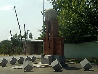
WThe Shengavit Settlement is an archaeological site in present-day Yerevan, Armenia located on a hill south-east of Yerevan Lake. It was inhabited during a series of settlement phases from approximately 3000 BC cal to 2500 BC cal in the Kura Araxes (Shengavitian) Period of the Early Bronze Age and irregularly re-used in the Middle Bronze Age until 2200 BC cal. The town occupied an area of six hectares. It appears that Shengavit was a societal center for the areas surrounding the town due to its unusual size, evidence of surplus production of grains, and metallurgy, as well as its monumental 4 meter wide stone wall. Three smaller village sites of Moukhannat Tepe, Khorumbulagh, and Tairov have been identified and were located outside the walls of Shengavit. Its pottery makes it a type site of the Kura-Araxes or Early Transcaucasian Period and the Shengavitian culture area.
 W
WTell Ta'yinat is a low-lying ancient tell on the east bank at the bend of the ancient Orontes river where it flows throught the Amuq valley, in the Hatay province of southeastern Turkey about 25 kilometers south east of Antakya. It lies near Tell Atchana, the site of the ancient city of Alalakh and has been proposed as the site of Kinalua, the capital city of an Iron Age Neo-Hittite kingdom.
WUzerliktapa — is a middle Bronze Age settlement near the city of Aghdam. The cultural layer was approximately 3.5 m high at the end of the 2nd millennium BC. The Uzerliktapa settlement is one of the rare monuments of the city's first urban culture.
WXələc is a village and municipality in the Sharur District of Nakhchivan, Azerbaijan. It is located near the Khalaj Mount, eight kilometres (5.0 mi) north-west of the district center, on the bank of the Aras River. Its population is mainly busy with farming. There are secondary school, kindergarten, library, club and a medical center in the village. It has a population of 1,268.