 W
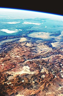
WThe geology of Bolivia comprises a variety of different lithologies as well as tectonic and sedimentary environments. On a synoptic scale, geological units coincide with topographical units. The country is divided into a mountainous western area affected by the subduction processes in the Pacific and an eastern lowlands of stable platforms and shields. The Bolivian Andes is divided into three main ranges; these are from west to east: the Cordillera Occidental that makes up the border to Chile and host several active volcanoes and geothermal areas, Cordillera Central once extensively mined for silver and tin and the relatively low Cordillera Oriental that rather than being a range by its own is the eastern continuation of the Central Cordillera as a fold and thrust belt. Between the Occidental and Central Cordillera the approximately 3,750-meter-high Altiplano high plateau extends. This basin hosts several freshwater lakes, including Lake Titicaca as well as salt-covered dry lakes that bring testimony of past climate changes and lake cycles. The eastern lowlands and sub-Andean zone in Santa Cruz, Chuquisaca, and Tarija Departments was once an old Paleozoic sedimentary basin that hosts valuable hydrocarbon reserves. Further east close to the border with Brazil lies the Guaporé Shield, made up of stable Precambrian crystalline rock.
 W
WThe Altiplano-Puna Magma Body (APMB), a large magma body in Bolivia, is located within the Altiplano-Puna plateau approximately 10-20 km beneath the Altiplano-Puna Volcanic Complex (APVC). High resolution tomography shows that this magma body has a diameter of ~200 km, a depth of 14-20 km, with a total volume of ~500,000 km3, making it the largest known active magma body on Earth. Thickness estimates for the APMB are varied, with some as low as 1 km, others around 10-20 km, and some extending as far down as the Moho. The APMB is primarily composed of 7-10 wt% water andesitic melts and the upper portion may contain more dacitic melts with partial melt percentages ranging from 10-40%. Measurements indicate that the region around the Uturuncu volcano in Bolivia is uplifting at a rate of ~10 mm/year, surrounded by a large region of subsidence. This movement is likely a result of the APMB interacting with the surrounding rock and causing deformation. Recent research demonstrates that this uplift rate may fluctuate over months or years and that it has decreased over the past decade. Various techniques, such as seismic, gravity, and electromagnetic measurements have been used to image the low-velocity zone in the mid to upper crust known as the APMB.
 W
WThe Altiplano–Puna volcanic complex, also known as APVC, is a complex of volcanic systems in the Puna of the Andes. It is located in the Altiplano area, a highland bounded by the Bolivian Cordillera Real in the east and by the main chain of the Andes, the Western Cordillera, in the west. It results from the subduction of the Nazca Plate beneath the South American Plate. Melts caused by subduction have generated the volcanoes of the Andean Volcanic Belt including the APVC. The volcanic province is located between 21° S–24° S latitude. The APVC spans the countries of Argentina, Bolivia and Chile.
 W
WThe Andean orogeny is an ongoing process of orogeny that began in the Early Jurassic and is responsible for the rise of the Andes mountains. The orogeny is driven by a reactivation of a long-lived subduction system along the western margin of South America. On a continental scale the Cretaceous and Oligocene were periods of re-arrangements in the orogeny. Locally the details of the nature of the orogeny varies depending on the segment and the geological period considered.
 W
WThe Famatinian orogeny is an orogeny that predates the rise of the Andes and that took place in what is now western South America during the Paleozoic, leading to the formation of the Famatinian orogen also known as the Famatinian belt. The Famatinian orogeny lasted from the Late Cambrian to at least the Late Devonian and possibly the Early Carboniferous, with orogenic activity peaking about 490 to 460 million years ago. The orogeny involved metamorphism and deformation in the crust and the eruption and intrusion of magma along a Famatinian magmatic arc that formed a chain of volcanoes. The igneous rocks of the Famatinian magmatic arc are of calc-alkaline character and include gabbros, tonalites and granodiorites. The youngest igneous rocks of the arc are granites.
 W
WIturralde Crater is an 8-kilometre (5.0 mi) diameter circular geophysical feature in Madidi National Park in the Bolivian portion of the Amazon Rainforest, first identified from Landsat satellite imagery in 1985. The structure is located in a remote area in the Abel Iturralde Province of La Paz Department and was visited by researchers in 2002. Based on the presence of millions of glass beads, it has been hypothesised that the structure was created in the Late Pleistocene by the air burst of a non-impacting meteorite, similar to the Tunguska event in 1908.
 W
WLake Minchin is a name of an ancient lake in the Altiplano of South America. It existed where today the Salar de Uyuni, Salar de Coipasa and Lake Poopó lie. It was formerly considered the highest lake in the Altiplano but research indicated that the highest shoreline belongs to the later Lake Tauca instead.
 W
WThe South American Plate is a major tectonic plate which includes the continent of South America as well as a sizable region of the Atlantic Ocean seabed extending eastward to the African Plate, with which it forms the southern part of the Mid-Atlantic Ridge.
 W
WLake Tauca is a former lake in the Altiplano of Bolivia. It is also known as Lake Pocoyu for its constituent lakes: Lake Poopó, Salar de Coipasa and Salar de Uyuni. The lake covered large parts of the southern Altiplano between the Eastern Cordillera and the Western Cordillera, covering an estimated 48,000 to 80,000 square kilometres of the basins of present-day Lake Poopó and the Salars of Uyuni, Coipasa and adjacent basins. Water levels varied, possibly reaching 3,800 metres (12,500 ft) in altitude. The lake was saline. The lake received water from Lake Titicaca, but whether this contributed most of Tauca's water or only a small amount is controversial; the quantity was sufficient to influence the local climate and depress the underlying terrain with its weight. Diatoms, plants and animals developed in the lake, sometimes forming reef knolls.