 W
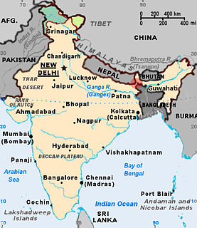
WThe Bangladesh–India border, known locally as the International Border (IB), is an international border running between Bangladesh and India that demarcates the eight divisions of Bangladesh and the Indian states.
 W
WBhogamukh is located in Assam, India. It comes under two districts Jorhat and Sivasagar.
 W
WChatla Wetland: is a seasonal wetland in the state of Assam in India.
 W
WKaziranga National Park is a national park in the Golaghat, Karbi Anglong and Nagaon districts of the state of Assam, India. The sanctuary, which hosts two-thirds of the world's great one-horned rhinoceroses, is a World Heritage Site. According to the census held in March 2018 which was jointly conducted by the Forest Department of the Government of Assam and some recognized wildlife NGOs, the rhino population in Kaziranga National Park is 2,413. It comprises 1,641 adult rhinos ; 387 sub-adults ; and 385 calves. In 2015, the rhino population stood at 2401. Kaziranga is home to the highest density of tigers among protected areas in the world, and was declared a Tiger Reserve in 2006. The park is home to large breeding populations of elephants, wild water buffalo, and swamp deer. Kaziranga is recognized as an Important Bird Area by BirdLife International for conservation of avifaunal species. When compared with other protected areas in India, Kaziranga has achieved notable success in wildlife conservation. Located on the edge of the Eastern Himalaya biodiversity hotspot, the park combines high species diversity and visibility.
WMakhibaha is a historical village passing through so many years with many historic events. It is said that in later 14th century, Sree Sree Sankardev’s ancestor Gadadhar Bhuya was the "bhuya" of its nearby area. At that time it was surrounded by jungle and these jungles are full of bees which is in Assamese are called mou-makhi and so the name of the village is Makhibaha.
WMolai forest is a forest on Majuli Island in the Brahmaputra River near Kokilamukh, Jorhat district, Assam, India.
WMuolhoi is a locality in Haflong Town, of the state of Assam in India. With a resident population 6500+, . The population of Muolhoi strongly reflects the different communities of the ethnic Hmar people.
 W
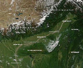
WThis article discusses the geological origin, geomorphic characteristics, and climate of the northeastern Indian state of Assam. Extending from 89° 42′ E to 96° E longitude and 24° 8′ N to 28° 2′ N latitude, it has an area of 78,438 km2, similar to that of Ireland or Austria.
 W
W