 W
WThe Appèlbergen is a forest to the east of the village of Glimmen. It's located in the province of Groningen.
 W
WThe Bevrijdingsbos is a forest on the edge of the city of Groningen between the district Lewenborg and the village of Garmerwolde in the Netherlands.
 W
WThe Ems Dollart Region (EDR), established in 1977, is a cross-border organisation located in the northern Dutch-German border area. The region is named after the Ems River and the Dollart estuary. Its aim is to establish and improve contacts and levels of interaction between people, companies and organisations within the border region. The organization is based in the Dutch village of Bad Nieuweschans. Here, the office has developed into a Dutch-German center, where cross-border functions and other activities take place. The office also serves as an administration base and launching point for many cross-border projects.
 W
WThe Groningen gas field is a giant natural gas field located near Slochteren in Groningen province in the northeastern part of the Netherlands. Discovered in 1959, it is the largest natural gas field in Europe and the tenth-largest in the world.
 W
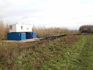
WThe IJkdijk is a facility in the Netherlands to test dikes and to develop sensor network technologies for early warning systems. Furthermore, the sensor network will be able to detect many water-related environmental factors that affect the health of humans such as pollution and biological changes. Disasters on rivers and coastal waters are also detected.
 W
WLauwersmeer National Park is a national park in the provinces of Friesland and Groningen in the Netherlands. It consists of the southern and eastern parts of the Lauwersmeer.
 W
WThe Pieterpad is a long distance walking route in the Netherlands. The trail runs 498 kilometres (309 mi) from Pieterburen, in the northern part of Groningen, south through the eastern part of the Netherlands to end just south of Maastricht, on the top of Mount Saint Peter, at a height of 109 metres (358 ft). The Pieterpad is one of the official Long Distance Paths in the Netherlands and by far the most popular of its long distance walking routes. It is possible to walk the route in either direction, and throughout the year. It is well signposted, and is well served by public transport and accommodation throughout its length. The official guide book is in two volumes, Pieterburen-Vorden and Vorden-Maastricht. A dedicated website also gives updated accommodation details. Although the walking is always easy and never remote, it is a varied and often beautiful walk, passing through woods, polders, heathland, and numerous small Dutch villages.
 W
WThe Semslinie is a part of the border between the Dutch provinces of Groningen and Drenthe that runs right through the former Bourtanger Moor. The almost straight line runs from Wolfsbarge to the Huis ter Haar at Musselkanaal. The border is slightly bent at Stadskanaal. The slightly bent line between Musselkanaal and Stadskanaal is sometimes called Koningsraai. The Semslinie is named after Johan Sems.