 W
WAki is a district located in Hiroshima Prefecture, Japan.
 W
WAki-ku (安芸区) is one of the eight wards of the city of Hiroshima, Japan.
 W
WAkiōta is a town in Yamagata District, Hiroshima Prefecture, Japan.
 W
WAkitsu was a town located in Toyota District, Hiroshima Prefecture, Japan.
 W
WAsakita-ku (安佐北区) is one of the eight wards of the city of Hiroshima.
 W
WAsaminami-ku (安佐南区) is one of the eight wards of the city of Hiroshima, located in the south of former Asa District.
 W
WThe Ashida River is a river that flows through the eastern part of Hiroshima Prefecture, Japan. The river provides the primary drainage for the Bingo region.
 W
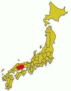
WBingo Province was a province of Japan on the Inland Sea side of western Honshū, comprising what is today the eastern part of Hiroshima Prefecture. It was sometimes grouped together with Bizen and Bitchu Provinces as Bishū (備州). The 備 bi in the names of these provinces is taken from the second character in the name of Kibi Province, whose ambit also included the area that would be divided off as Mimasaka Province in the early 8th century CE. Bingo bordered Bitchū, Hōki, Izumo, Iwami, and Aki Provinces.
 W
WDaishō-in or Daisyō-in (大聖院) is a historic Japanese temple complex with many temples and statues on Mount Misen, the holy mountain on the island of Itsukushima, off the coast of Hatsukaichi, Hiroshima, Japan. It is the 14th temple in the Chūgoku 33 Kannon Pilgrimage and famous for the maple trees and their autumn colors. It is also called "Suishō-ji" (水精寺). Including Mt. Misen, Daishō-in is within the World Heritage Area of Itsukushima Shrine.
 W
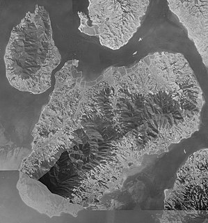
WEtajima (江田島), also called Nōmi-jima, Nomijima, Nomi Island, or Etajima-Nōmijima (江田島・能美島) is an island in Hiroshima Bay located in southwestern Hiroshima Prefecture, Japan. The mess with island name originates from the ancient strait at now town Ōgaki-chō Hitonose (大柿町飛渡瀬).
 W
WFuchū is a city located in Hiroshima Prefecture, Japan. It was originally the capital of the former Bingo Province. The city was founded on March 31, 1954. Fuchū, Tokyo became a city the following day. As of May 1, 2011, population data, the city has an estimated population of 43,932, with 17,602 households and a population density of 224.47 people per km². The total area is 195.71 km². On April 1, 2004, the town of Jōge was merged into Fuchū.
 W
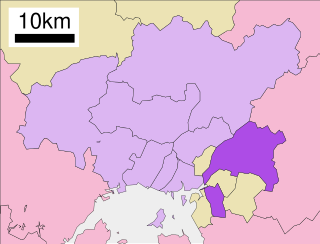
WFuchū is a town located in Aki District, Hiroshima Prefecture, Japan.
 W
WFukutomi was a town located in Kamo District, Hiroshima Prefecture, Japan.
 W
WThe Gōnokawa River is a river that runs through Hiroshima and Shimane prefectures in Japan. It is the largest river in the Chūgoku region. It is also called the Gōgawa River and, in Hiroshima, the Enokawa River.
 W
WHatsukaichi is a city of some 120,000 people located in Hiroshima Prefecture, Japan. The name derives from a market traditionally held on the 20th of each month with hatsuka (廿日) meaning "20th day" and ichi (市) translating to "market". The market continues to this day on a small scale featuring fresh, locally grown vegetables and foodstuffs.
 W
WHigashi-ku is one of the eight wards located in Hiroshima, Japan. It is located on the uppermost delta of the Ōta River.
 W
WHiroshima Bay is a bay in the Inland Sea, Japan. Administratively, the bay is divided between Hiroshima and Yamaguchi Prefectures. The bay's shore is a Ria. Its surface area is about 1,000 km², with a mean depth of 25 meters.
 W
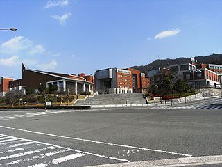
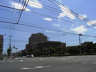
WHiroshima City University is a public university at Hiroshima, Hiroshima, Japan, founded in 1994, educating both undergraduates and graduate students. HCU is especially distinctive for its Peace Studies program, in line with Hiroshima's status as an international city of peace.
 W
WHiroshima Gokoku Jinja (広島護国神社) is a Japanese Shinto Shrine in Hiroshima, Japan.
 W
WHiroshima–Nishi Airport is an airport in Nishi Ward, located 3.1 NM southwest of Hiroshima City, Hiroshima Prefecture, Japan.
 W
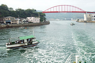
WIkuchi-jima is an island in the Seto Inland Sea, belonging to Hiroshima Prefecture in Japan. Ikuchi-jima is administered as part of Onomichi city. The bridges connecting Ikuchi-jima to the mainland via Innoshima and to Shikoku via Ōmishima Island. The island's highest peak is Mount Kanno 472.3 m (1,550 ft).
 W
WInnoshima was a city in Hiroshima Prefecture, Japan. The city was founded on May 1, 1953.
 W
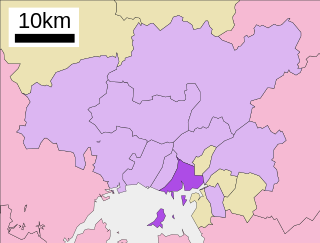
WJinseki is a district located in Hiroshima Prefecture, Japan. The district has an estimated population of 11,863. The total area is 381.81 km².
 W
WJinsekikōgen is a town located in Jinseki District, Hiroshima Prefecture, Japan.
 W
WKaita is a town located in Aki District, Hiroshima Prefecture, Japan.
 W
WKibi Province was an ancient province or region of Japan, in the same area as Okayama Prefecture and eastern Hiroshima Prefecture. It was sometimes called Bishū (備州).
 W
WKitahiroshima is a town in Yamagata District, Hiroshima Prefecture, Japan.
 W
WKurahashi-jima (倉橋島), also called Nagato-jima (長門島) in ancient texts, is an island in Hiroshima Bay located in southwestern Hiroshima Prefecture, Japan.
 W
WKurose was a town located in Kamo District, Hiroshima Prefecture, Japan.
 W
WMinami-ku (南区) is one of the eight wards of the city of Hiroshima, Japan. As of March 1, 2012, the ward had an estimated population of 138,471, with 66,706 households and a population density of 5,307.44 persons per km². The total area was 26.09 km².
 W
WMitaki-dera (三瀧寺) is a historic Japanese temple in the city of Hiroshima, Japan.
 W
WMiyajima was a town located on the island of Itsukushima in Saeki District, Hiroshima Prefecture, Japan.
 W
WMiyajimaguchi (宮島口) is a neighborhood in Hatsukaichi, Hiroshima, Japan. It was a part of the town of Ōno until 2005 when the town was annexed by the city of Hatsukaichi.
WMomijidani Park is one of the most famous maple leaves valley parks in Japan. The park is located at the foot of Mt. Misen, along Momijidani River, behind Itsukushima Shrine in Miyajima, Hatsukaichi, Hiroshima. There are more than 200 maples, including 110 acer palmatum thunberg, 60 palmatum var. matsumurae, 10 acer rufinerve, acer buergerianum, acer sieboldianum miquel and acer amoenum carriere var. amoenum.
 W
WMount Amida is an 837-metre-high (2,746 ft) mountain in Saeki-ku, Hiroshima, Japan.
WMount Hiba is a mountain in Shōbara, Hiroshima Prefecture, Japan, with a height of 1,299 metres. It is within Hiba-Dogo-Taishaku Quasi-National Park.
 W
WMukaishima Island is the northernmost island in Geiyo Islands chain accommodating Nishiseto Expressway connecting Honshu and Shikoku islands. Its coasts are washed by Seto Inland Sea. The island's highest peak is Takamiyama (高見山) 283.2 m (929 ft) high.
 W
WMukaishima was a town in Mitsugi District, Hiroshima Prefecture, Japan.
 W
WNaka-ku is the heart of Hiroshima, Hiroshima Prefecture, Japan. Naka-ku is home to Hiroshima's central business district and Peace Memorial Park. Major attractions include the Hondori shopping arcade, a covered mall-like street of shops extending east from the Hiroshima Peace Memorial Park to Hatchobori. Also in Naka-ku is Okonomi-mura - a building housing a number of restaurants that serve Hiroshima's famous food, okonomiyaki.
 W
WNishi-Chūgoku Sanchi Quasi-National Park is a Quasi-National Park in Shimane Prefecture, Hiroshima Prefecture, and Yamaguchi Prefecture, Japan. It was founded on 10 January 1969 and has an area of 285.53 km2 (110.24 sq mi).
 W
WNishi-ku (西区) is one of eight wards in the city of Hiroshima, Japan. The Hiroshima–Nishi Airport is located in Nishi-ku.
 W
WOkimi was a town located in Saeki District, Hiroshima Prefecture, Japan.
Okonomi-mura is a Hiroshima-style okonomiyaki food theme park located at 5-13 Shintenchi in Naka-ku, Hiroshima, Hiroshima Prefecture, Japan. It is near the east end of Hondōri and has 24 okonomiyaki restaurants, each with a slightly different style and set of ingredients. The restaurants there use a specialty okonomiyaki sauce created especially for Okonomi-mura by Sun Foods.
 W
WOndo-no-seto (音戸の瀬戸) is a strait in Seto Inland Sea in Kure, Hiroshima between the main island of Japan and Kurahashi island.
 W
WŌsakikamijima is a town located in Toyota District, Hiroshima Prefecture, Japan.
 W
WŌta River is a 103 kilometer long river in Hiroshima Prefecture, Japan. Its main stream originates in Mt. Kanmuri (1,339m) and empties into the Seto Inland Sea. The river is one of the major rivers in the prefecture and descends through steep topography, with hydroelectric power plants situated along the river.
 W
WŌtake is a city located in Hiroshima Prefecture, Japan.
 W
WPrefectural University of Hiroshima is a public university in Hiroshima Prefecture, Japan, established in 2005.
 W
WSaeki-ku (佐伯区) is one of the eight wards of the city of Hiroshima, Japan.
 W
WSaka is a town located in Aki District, Hiroshima Prefecture, Japan.
 W
WThe San'yō Region is an area in the south of Honshū, the main island of Japan. It consists of the southern part of the Chūgoku region, facing the Seto Inland Sea. The name San'yō means "southern, sunny (yō) side of the mountains" and contrasts with the San'in or "northern, shady (in) side of the mountains".
 W
WSenkō-ji (千光寺) is a historic Japanese temple in Senko-ji Park in Onomichi, Hiroshima, Japan.
 W
WSera is a district located in Hiroshima Prefecture, Japan.
 W
WSera is a town located in Sera District, Hiroshima Prefecture, Japan.
 W
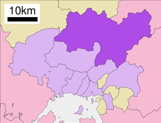
WShōbara is a city located in northeastern Hiroshima Prefecture, Japan. The city was founded on March 31, 1954.
WTaishaku Valley is a ravine in Japan noted for its beauty.
 W
WYamagata is a district located in northwestern Hiroshima Prefecture, Japan.