 W
WThe West Bank is a landlocked territory near the Mediterranean coast of Western Asia, bordered by Jordan to the east and by Israel to the south, west and north. The West Bank also contains a significant section of the western Dead Sea shore.
 W
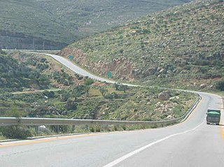
WAllon Road is the name given by Israel to Routes 458, 508, and 578 in the West Bank, running roughly south-north along the eastern watershed of the Samarian and Judaean Mountains between Highway 1 near Kfar Adumim east of Jerusalem and Highway 90 at Mehola in the central Jordan Valley.
 W
WAnnexation of the Jordan Valley is the proposed application of Israeli sovereignty over the Jordan Valley. The idea has been advocated by some Israeli politicians since the Israeli occupation of the West Bank began in 1967, most notably with the Allon Plan and the 2020 Trump peace plan.
 W
WAriel University, previously a public college known as the Ariel University Center of Samaria, is an Israeli university located in the Israeli settlement of Ariel in the West Bank.
 W
WBeit HaArava is an Israeli settlement and kibbutz in the West Bank. Located near the Dead Sea and Jericho at the eponymous Beit HaArava Junction, the intersection of Highway 1 and Highway 90, it falls under the jurisdiction of Megilot Regional Council. In 2019 it had a population of 350.
 W
WBeit HaShalom, or the Rajabi House, also known as Beit HaMeriva, is a four-story apartment building located in the H-2 Area of Hebron.
 W
WCanada Park is a declared Israeli national park stretching over 7,000 dunams, and extending from No man's land into the West Bank.
 W
WThis article is about the demographic features of the population of the area which is commonly described as Palestinian territories and includes information on ethnicity, education level, health of the populace, economic status, religious affiliations and other aspects of that population.
 W
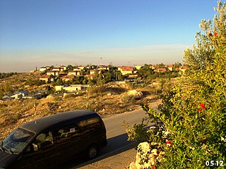
WEfrat, or previously officially Efrata, is an Israeli settlement established in 1983 and a local council in the Judean Mountains of the West Bank. Efrat is located 12 kilometers (7.5 mi) south of Jerusalem, between Bethlehem and Hebron, 6.5 km (4 mi) east of the Green Line, inside of the Security Barrier. The settlement stands at an altitude of up to 960 metres above sea level and covers about 6,000 dunam. The international community considers Israeli settlements in the West Bank illegal under international law, but the Israeli government disputes this.
 W
WElkana or Elqana is an Israeli settlement and local council in the north-western Samarian hills in the West Bank, located 3.1 km to the east of the Green Line and the city of Rosh HaAyin. It was founded in 1977 by a group from Gush Emunim of religious and non-religious Jews, and by July 2020 it had a population of 3858.
 W
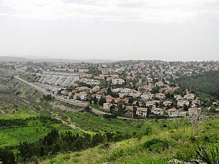
WGiv'at Ze'ev is an Israeli settlement in the West Bank, five kilometers northwest of Jerusalem. The town was founded in 1977 on the site of the abandoned Jordanian military camp, adjacent to the site of ancient Gibeon. While it lies within the borders of the Matte Binyamin Regional Council, it is a separate municipal entity. In 2019 it had a population of 18,420.
 W
WGush Etzion Junction ("Tzomet HaGush") also known as Gush Junction is a 120-dunam business, commercial and tourism center in the southern West Bank, which serves as the entry point to the Gush Etzion bloc of settlements. It is administered by the Gush Etzion Regional Council.
 W
WThe Gush Etzion Regional Council is a regional council in the northern Judean Hills, the northern part of the southern area of the West Bank, administering the settlements in the Gush Etzion region, as well as others nearby. The headquarters are located adjacent to Alon Shvut.
 W
WThe Har Hevron Regional Council is an Israeli regional council in the southern Judean Hills area of Mount Hebron, in the southern West Bank, administering Israeli settlements. The headquarters are located adjacent to Otniel. The council was established in 1983. The chairman of the council is Yochay Damri.
 W
WThe history of the State of Palestine describes the creation and evolution of the State of Palestine in the West Bank and Gaza Strip.
 W
WThe Huwwara checkpoint or Huwara checkpoint or Hawara checkpoint is a major Israel Defense Forces checkpoint at one of the four main exits of Nablus. It is located south of the city. It was established on October 2000. The facility was named after the nearby village of Huwara.
 W
WImmanuel, also spelled Emmanuel or Emanuel, is an Israeli settlement organized as a local council located in the West Bank. Immanuel was established in 1983. In 2019 it had a population of 3,906; its jurisdiction is spread out over 2,750 dunams (2.75 km²).
 W
WThe Israel Border Police is the gendarmerie and border security branch of the Israel National Police. It is also commonly known by its Hebrew abbreviation Magav, meaning border guard; its members are colloquially known as Magavnikim. Border Guard is often used as the official name of the Israel Border Police in English. While its main task is securing Israel's borders, it has also been deployed in assisting the Israel Defense Forces, and for counter-terrorism and law enforcement operations in the West Bank, as well as in Jerusalem.
 W
WThe Israeli occupation of the West Bank began on 7 June 1967 during the Six-Day War when Israel occupied the West Bank, including East Jerusalem, and continues to the present day. The status of the West Bank as an occupied territory has been affirmed by the International Court of Justice and, with the exception of East Jerusalem, by the Israeli Supreme Court. The official Israeli government view is that the law of occupation does not apply and it claims the territories are "disputed". Considered to be a classic example of an "intractable" conflict, the length of Israel's occupation was already regarded as exceptional after two decades and is now the longest in modern history. Israel has cited several reasons for retaining the West Bank within its ambit: a claim based on the notion of historic rights to this as a homeland as affirmed in the Balfour Declaration; security grounds, internal and external; and the deep symbolic value for Jews of the area occupied.
 W
WThe Israeli permit system in the West Bank, also called the Israeli permit(s) regime, requires a number of separate permits from the Israeli military authorities governing Palestinians in the Israeli-occupied West Bank for a wide range of activities. The first military order requiring permits for the Palestinians was issued before the end of the 1967 Six-Day War. The two uprisings of 1987 and 2001 were met by increased security measures, differentiation of IDs into green and red, policies of village closures, curfews and more stringent restrictions on Palestinian movement, with the general exit permit of 1972 replaced by individual permits. The stated Israeli justification for this new permit regime regarding movements was to contain the expansion of the uprisings and protect both the IDF and Israeli civilians from military confrontations with armed Palestinians. The system has since expanded to 101 different types of permits covering nearly every aspect of Palestinian life, governing movements in Israel, in Israeli settlements, transit between Gaza and the West Bank, Jerusalem, the seam zone and travel abroad via international borders. The Israeli High Court has rejected petitions against the permit system, allowing that it severely impinges on the rights of Palestinian residents but that the harm was proportionate.
 W
WIsraeli settler violence refers to acts of violence committed by Jewish Israeli settlers and their supporters against Palestinians and Israeli security forces, predominantly in the West Bank. Although the majority of settlers do not engage in violence, there has been a rise in violent acts by extremists against Palestinians, non-Jews, Israel Police, and IDF troops in the early twenty-first century. Between January and November 2008, 515 criminal suits were opened by Israel against settlers for violence against Arabs or Israeli security forces; 502 of these involved "right wing radicals" while 13 involved "left wing anarchists". In 2008, the senior Israeli commander in the West Bank said that a hard core of a few hundred activists were involved in violence against the Palestinians and Israeli soldiers.
 W
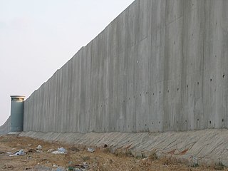
WOn two occasions the Israeli Government has been instructed by the Supreme Court of Israel (SCI) to alter the route of the barrier to ensure that negative effects on Palestinians would be minimized and proportional.
 W
WKarnei Shomron is an Israeli settlement organized as a local council established in 1977 in the West Bank, east of Kfar Saba. Karnei Shomron is located 48 kilometres (30 mi) northeast of Tel Aviv and 85 kilometres (53 mi) north of Jerusalem. In 2019 it had a population of 8,135.
 W
WKedumim, is an Israeli settlement organized as a local council located in the northern West Bank. Founded on Hanukkah 1975 by members of the Gush Emunim settlement movement, it later became a local council. In 2019 it had a population of 4,544.
 W
WThe Law in These Parts is a 2011 Israeli documentary film, written and directed by Ra'anan Alexandrowicz, about the court system operated by the Israel Defense Forces in the West Bank. It won the Best Documentary award at the 2011 Jerusalem Film Festival and the World Cinema Grand Jury Prize in Documentary at the 2012 Sundance Film Festival. At the Hot Docs Canadian International Documentary Festival, The Law in These Parts won the "Special Jury Prize – International Feature".
 W
WMa'ale Efrayim is a secular Israeli settlement and local council located along the eastern slopes of the Samarian mountains in the Jordan Valley, within the West Bank. It was founded in 1978 and named after the Biblical tribe of Ephraim. The settlement's municipal status was upgraded to local council in 1981. In 2019 it had a population of 1,260.
 W
WMa'on is an Israeli settlement organized as a moshav shitufi in the West Bank. Located in the Judean Hills south of Hebron and north of Beersheba, it falls under the jurisdiction of Har Hevron Regional Council. In 2019 it had a population of 595.
 W
WMitzpe Shalem is an Israeli settlement and former kibbutz in the eastern West Bank. Located near Highway 90 about 21 kilometres (13 mi) north of Ein Gedi and 10 kilometres (6.2 mi) north of the Green Line about 1 km from the western shores of the Dead Sea, it is the southernmost community under the jurisdiction of Megilot Regional Council. In 2019 it had a population of 207.
WNegohot is an Israeli settlement in the southern Hebron Hills of the West Bank. Located on a hill 700 metres above sea level to the west of the Hebron area, it is organised as a community settlement and falls under the jurisdiction of Har Hevron Regional Council. In 2019 it had a population of 352.
 W
WOranit is an Israeli settlement and local council located in the Seam Zone, abutting the Green Line. It is surrounded by Horshim forest to the west, Rosh HaAyin and Kfar Qasim to the southwest, Sha'arei Tikva to the east, and Khirbet Abu Salman to the northeast. In 2019 it had a population of 8,955.
 W
WThe restriction of the movement of Palestinians in the Israeli-occupied territories by the Israeli government is an issue in the Israeli–Palestinian conflict. According to B'Tselem, following the 1967 war, the Occupied Territories were proclaimed closed military zones. In 1972, general exit orders were issued allowing residents of those territories to move freely between the West Bank, Israel and Gaza. Following the first Intifada by 1991, these general exit orders were revoked, and personal exit permits were required. According to B'Tselem, a measure of overall closure of the Occupied Territories was enacted for the first time in 1993, and would result in total closures following rises in Palestinian political violence.
 W
WThe population statistics for Israeli settlements in the West Bank are collected by the Israel Central Bureau of Statistics. As such, the data contains only population of settlements recognized by the Israeli authorities. Israeli outposts are not tracked, and their population is hard to establish. In addition to these, Nahal settlements are formally considered military outposts, and their population is counted, but not reported. Once a Nahal settlement becomes a civilian locality, it starts to be reported.
 W
WThe Shahak Industrial Park is located in the northern region of the jurisdiction of the Shomron Regional Council, between Afula and Hadera near the 'Barkai/Iron Interchange' of Highway 6. The industrial park is adjacent to Shaked, Hinanit, and Katzir, hence the initials making up the acronym in Hebrew that is the name of the park. The area is located within the Israeli West Bank barrier and employs Israelis, Palestinians and Arab citizens of Israel.
 W
WThe Shomron Regional Council is an Israeli regional council in the northern West Bank. It provides municipal services for the 35 Israeli Settlements in the Samarian hills within its jurisdiction with a total population of about 23,600 people. The main offices are located in the Barkan Industrial Park. The Council's logo is inscribed with Biblical words from Jeremiah 31:5: "Again You will plant vineyards on the hills of Samaria," reflecting the region's wine industry.
 W
WThe Tomb of Samuel, commonly known as Nebi Samuel or Nebi Samwil, is the traditional burial site of the biblical Hebrew and Islamic prophet Samuel, atop a steep hill at an elevation of 908 meters above sea level.
 W
WThe Oslo II Accord divided the Israeli-occupied West Bank into three administrative divisions: Areas A, B and C. The distinct areas were given different statuses, according to their governance pending a final status accord: Area A is exclusively administered by the Palestinian National Authority; Area B is administered by both the Palestinian Authority and Israel; and Area C, which contains the Israeli settlements, is administered by Israel. Areas A and B were chosen in such a way as to just contain Palestinians, by drawing lines around Palestinian population centers at the time the Agreement was signed; all areas surrounding Areas A and B were defined as Area C.