 W
WThe former Royal Air Force Station Brüggen, more commonly known as RAF Brüggen, in Germany was a major station of the Royal Air Force until 15 June 2001. It was situated next to the village of Elmpt, approximately 43 kilometres (27 mi) west of Düsseldorf near the Dutch-German border. The base was named after the village of Brüggen, the nearest rail depot. Construction began in mid-1952, which involved the clearing of forest and draining of marshland. The station became active in 1953 during the rapid expansion of NATO forces in Europe. In 2002, it was handed over to the British Army and renamed Javelin Barracks.
 W
WCape Lisburne Air Force Station is a closed United States Air Force General Surveillance Radar station. It is located 276.5 miles (445.0 km) west-southwest of Point Barrow, Alaska.
 W
WCartwright Air Station is a closed General Surveillance Radar station. It is located 145.2 miles (233.7 km) east-northeast of CFB Goose Bay, Newfoundland and Labrador. It was closed in 1968.
 W
WCanadian Forces Station Baldy Hughes is a closed General Surveillance Radar station. It is located 22.3 miles (35.9 km) south-southwest of Prince George, British Columbia. It was closed in 1988.
 W
WCanadian Forces Station Beausejour is a closed General Surveillance Radar station. It is located 45.1 miles (72.6 km) east-northeast of Winnipeg, Manitoba. It was closed in 1986.
 W
WCanadian Forces Station Beaverlodge is a closed General Surveillance Radar station. It is located 4.9 miles (7.9 km) east-northeast of Beaverlodge, Alberta. It was closed in 1988.
 W
WCanadian Forces Station Ramore is a closed General Surveillance Radar station. It is located 4 miles (6.4 km) east of Ramore, Ontario. It was closed in 1974. It was operated as part of the Pinetree Line network controlled by NORAD. It has since been sold and is now private property.
 W
WCFS Resolution Island (BAF-5) is a short-range radar site. It is located 593 miles (954 km) north-northwest of CFB Goose Bay, Labrador on Resolution Island, Nunavut. It is part of the North Warning System. During the Cold War, it was operated as part of the Pinetree Line network controlled by NORAD.
WCanadian Forces Station Sioux Lookout is a closed General Surveillance Radar station. It is located 3.7 miles (6.0 km) west of Sioux Lookout, Ontario. It was closed in 1987.
 W
WHopedale Air Station is a General Surveillance Radar station that the USAF closed in 1968. It is located north of the community of Hopedale, Newfoundland and Labrador 147.8 miles (237.9 km) west-northwest of CFB Goose Bay, Newfoundland and Labrador, Canada.
 W
WThe Korean Demilitarized Zone is a strip of land running across the Korean Peninsula. It is established by the provisions of the Korean Armistice Agreement to serve as a buffer zone between North Korea and South Korea. The demilitarized zone (DMZ) is a border barrier that divides the Korean Peninsula roughly in half. It was created by agreement between North Korea, China and the United Nations Command in 1953. The DMZ is 250 kilometres long, and about 4 kilometres wide.
 W
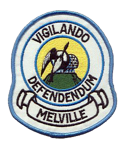
WMelville Air Station was a General Surveillance Radar station. It was located on the summit of Dome Mountain, 5.4 miles (8.7 km) west of CFB Goose Bay, Newfoundland and Labrador. It was closed in 1988.
 W
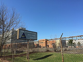
WNaval Air Warfare Center Trenton is the former site of United States Navy facility in the West Trenton section of Ewing Township, New Jersey, just outside the city of Trenton. Opened during the final year of the Korean War in 1953, the center encompassed 528 acres (214 ha) on Parkway Avenue in Ewing, directly adjacent to the Trenton–Mercer Airport. It was used as a jet engine test facility for the US Navy until its closure per recommendations of the 1993 Base Closure and Realignment Commission, due to Navy decision making under President George H. W. Bush. Nearly 700 civilian positions were lost, most of which were relocated to other facilities in Maryland and Tennessee. The base's Marine operations were transferred to Fort Dix, which has since become Joint Base McGuire-Dix-Lakehurst. HomeFront, a charity to end homelessness, acquired the base at no cost in October 2013 in a process involving the United States Department of Defense, the United States Department of Housing and Urban Development, Mercer County and Ewing Township.
Naval Station Rota, also known as NAVSTA Rota,, is a Spanish-American naval base commanded by a Spanish rear admiral. Located in Rota in the Province of Cádiz, NAVSTA Rota is the largest American military community in Spain, housing US Navy and US Marine Corps personnel. There are also small US Army and US Air Force contingents on the base.
 W
WRed Cliff Air Station was a General Surveillance Radar station. The remains of which are located 5.8 miles (9.3 km) north-northeast of St. John's, Newfoundland and Labrador, Canada. It was closed in 1961.
 W
WCanadian Forces Station Saglek is a Canadian Forces Air Command radar base in the former Pinetree Line and currently part of the North Warning System, located near Saglek Bay in Newfoundland and Labrador, 367.7 miles (591.8 km) north-northwest of CFB Goose Bay.
 W
WSaint Anthony Air Station is a closed General Surveillance Radar station. It is located 292.5 miles (470.7 km) north-northwest of St. John's, Newfoundland and Labrador, Canada. It was closed in 1968.