 W
WApple Island is a 35-acre (140,000 m2) island that lies in the middle of Orchard Lake, in Orchard Lake Village, Michigan. The island was formed during the region's last ice age, 10,000 to 12,000 years ago. Over 400 species of flora currently inhabit the island, including many rare varieties in Oakland County. Native Americans previously inhabited Apple Island, until ceding the island to the United States in the Treaty of Detroit. Currently, the West Bloomfield School District uses the island as an educational nature center.
 W
WThe Dumaw Creek Site is an archaeological site designated 20OA5, located along Dumaw Creek northeast of Pentwater, Michigan, that was the location of a 17th-century village and cemetery. It is one of the youngest pre-historic sites in Michigan, dating to the terminal Late Woodland Period just prior to European contact. It was listed on the National Register of Historic Places in 1972.
 W
WThe Fletcher Site, also designated 20BY28, is a Native American cemetery and archaeological site, located on the west bank of the Saginaw River in Bay City, Michigan. It was listed on the National Register of Historic Places in 1971.
 W
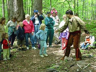
WFort Michilimackinac was an 18th-century French, and later British, fort and trading post at the Straits of Mackinac; it was built on the northern tip of the lower peninsula of the present-day state of Michigan in the United States. Built around 1715, and abandoned in 1783, it was located along the Straits, which connect Lake Huron and Lake Michigan of the Great Lakes of North America. Present-day Mackinaw City developed around the site of the fort, which has been designated as a National Historic Landmark. It is preserved as an open-air historical museum, with several reconstructed wooden buildings and palisade.
 W
WFort Michilimackinac State Park is a state park in the U.S. state of Michigan. It is located in Mackinaw City along the Straits of Mackinac. The park contains Fort Michilimackinac, which itself is dedicated a National Historic Landmark and Old Mackinac Point Lighthouse as well as the Old Mackinac Point Lighthouse Signal Tower which contains a foghorn.
 W
WFort Saint Joseph was a fort established on land granted to the Jesuits by King Louis XIV; it was located on what is now the south side of the present-day town of Niles, Michigan. Père Claude-Jean Allouez established the Mission de Saint-Joseph in the 1680s. Allouez ministered to the local Native Americans, who were primarily Odawa and Ojibwe.
WThe Fort Wayne Mound Site was a Prehistoric burial mound located on the grounds of the Ordinance Department of the former Fort Wayne in Detroit, Michigan. It was one of a series of mounds in Detroit, including the Springwells Mound Group, the Carsten Mound and the Great Mound at the River Rouge. By the mid-20th century only the Fort Wayne Mound was still standing. As of today it has been completely destroyed.
 W
WKeweenaw National Historical Park is a unit of the U.S. National Park Service. Established in 1992, the park celebrates the life and history of the Keweenaw Peninsula in the Upper Peninsula of the U.S. state of Michigan. As of 2009, it is a partly privatized park made up of two primary units, the Calumet Unit and the Quincy Unit, and 21 cooperating "Heritage Sites" located on federal, state, and privately owned land in and around the Keweenaw Peninsula. The National Park Service owns approximately 1,700 acres (690 ha) in the Calumet and Quincy Units. Units are located in Baraga, Houghton, Keweenaw, and Ontonagon counties.
 W
WMackinac Island State Park is a state park located on Mackinac Island in the U.S. state of Michigan. A Lake Huron island, it is near the Straits of Mackinac. The island park encompasses 1,800 acres (7.3 km2), which is approximately 80% of the island's total area. The park is also within the boundaries of the city of Mackinac Island and has permanent residents within its boundaries. M-185 circles the perimeter of the park as the only motorless highway in the state due to the island's ban of automobiles. The park is governed by the Michigan Department of Natural Resources and the Mackinac Island State Park Commission. On July 15, 2009, the park celebrated its 20 millionth visitor.
 W
WThe Moccasin Bluff Site is an archaeological site located along Red Bud Trail and the St. Joseph River north of Buchanan, Michigan. It was listed on the National Register of Historic Places in 1977, and has been classified as a multi-component Prehistoric site with the major component dating to the Late Woodland/Upper Mississippian period.
 W
WThe North Maumee Bay Archeological District is a historic district containing archeological sites located in the southeasternmost corner of Erie Township in Monroe County, Michigan. It was added to the National Register of Historic Places on December 5, 1980.
WThe Ponshewaing Point Site is an archaeological site located on Ponshewaing Point in Crooked Lake in Emmet County, Michigan. It was places on the National Register of Historic Places in 1972.
 W
WThe River Raisin National Battlefield Park was established as the 393rd unit of the United States National Park Service under Title VII of the Omnibus Public Land Management Act, which was signed into law on March 30, 2009. The park is located in the city of Monroe in Monroe County, Michigan. It was designated as a Michigan Historic Site on February 18, 1956 and was added to the National Register of Historic Places on December 10, 1982. The house at 1403 East Elm Avenue was added to the National Register listing in 2019. It officially began operation as a national park unit on October 22, 2010 and, of the four National Battlefield Parks in the country, it is the only one marking a site of the War of 1812.
WThe Riviere au Vase site (20MB3) is located in Chesterfield Township, Macomb County, in southeastern Michigan. The site is on the Riviere au Vase near where it empties into Lake St. Clair. It is classified as a Prehistoric, Late Woodland site.
 W
WSanilac Petroglyphs Historic State Park is a state park in the U.S. state of Michigan. The park, also known as ezhibiigadek asin consists of 240 acres (97 ha) in Greenleaf Township, Sanilac County, in Michigan's Thumb. It contains the largest collection of Native American petroglyphs in Michigan. The carvings were created in the pre-Columbian era and represents aspects of Native American spiritually. There is also an interpretive hiking trail within the park along the nearby Cass River.
WThe Schwerdt Site (20AE127) is located on the Kalamazoo River in Allegan County, Michigan. It is classified as a single-component Berrien Phase site dating to the late prehistoric period. The Berrien Phase is associated with the late Woodland but also has some Upper Mississippian influences.
 W
WThe Spoonville site, also designated 20OT1, is a historic archeological site, located on the banks of the Grand River in Crockery Township, Ottawa County, Michigan, United States. It was placed on the National Register of Historic Places in 1973.
 W
WThunder Bay National Marine Sanctuary and Underwater Preserve is a United States National Marine Sanctuary on Lake Huron's Thunder Bay, within the northeastern region of the U.S. state of Michigan. It protects an estimated 116 historically significant shipwrecks ranging from nineteenth-century wooden side-wheelers to twentieth-century steel-hulled steamers. There are a great many wrecks in the sanctuary, and their preservation and protection is a concern for national policymakers. The landward boundary of the sanctuary extends from the western boundary of Presque Isle County to the southern boundary of Alcona County. The sanctuary extends east from the lakeshore to the international border. Alpena is the largest city in the area.
 W
WThe Whitefish Point Underwater Preserve was established in 1987 to protect and conserve shipwrecks and historical resources on 376 square miles (970 km2) of Lake Superior bottomlands in Whitefish Bay and around Whitefish Point, Michigan. The formation of the Michigan Underwater Preserves helped stop controversy over artifact removal from shipwrecks of this area. The preserve is now known for deep, well preserved shipwrecks in clear water accessible to scuba divers with technical skill and experience. The preserve is one of the last places in the Great Lakes to observe shipwrecks without zebra mussel encrustation.
WThe Wycamp Creek Site is an archaeological site located near Levering, Michigan. It was placed on the National Register of Historic Places in 1971.
 W
WThe Younge Site is an archeological site located in Goodland Township, Lapeer County, Michigan. It is classified as a Prehistoric Late Woodland site and was designated as a Michigan State Historic Site on October 29, 1971. It was added to the National Register of Historic Places on October 29, 1976.