 W
WThe 2010–11 North American winter was influenced by an ongoing La Niña, seeing winter storms and very cold temperatures affect a large portion of the continental United States, even as far south as the Texas Panhandle. Notable events included a major blizzard that struck the Northeastern United States in late December with up to 2 feet (24 in) of snowfall and a significant tornado outbreak on New Year's Eve in the southern United States. By far the most notable event was a historic blizzard that impacted areas from Oklahoma to Michigan in early February which broke numerous snowfall records, and one of the few winter storms to rank as a Category 5 on the Regional Snowfall Index.
 W
WThe 2011 New Zealand snowstorms were a series of record breaking snow falls that affected both the North Island and South Island. The storms occurred over the span of a few weeks, beginning on 25 July 2011 in the North Island and subsequently spreading to the South. The storms subsided in late July and returned in August. It was the worst winter storm to hit New Zealand in seventy years. The heavy snowfalls caused widespread closures in many cities, including Christchurch, Wellington and Dunedin.
 W
WThe January 8–13, 2011 North American blizzard was a major Mid-Atlantic nor'easter and winter storm, and a New England blizzard. The storm also affected portions of the Southeastern regions of the United States. This storm came just two weeks after a previous major blizzard severely affected most of these same areas in December 2010. It was the second significant snowstorm to affect the region during the 2010–11 North American winter storm season.
WThe 2011 Groundhog Day blizzard was a powerful and historic winter storm that affected large swaths of the United States and Canada from January 31 to February 2, 2011, especially on Groundhog Day. During the initial stages of the storm, some meteorologists predicted that the system would affect over 100 million people in the United States. The storm brought cold air, heavy snowfall, blowing snow, and mixed precipitation on a path from New Mexico and northern Texas to New England and Eastern Canada. The Chicago area saw 21.2 inches (54 cm) of snow and blizzard conditions, with winds of over 60 mph (100 km/h). With such continuous winds, the Blizzard continued to the north and affected Eastern and Atlantic Canada. The most notable area affected in Canada was Toronto and the Greater Toronto Area. Blizzard conditions affected many other large cities along the storm's path, including Tulsa, Oklahoma City, Kansas City, St. Louis, Springfield, El Paso, Las Cruces, Des Moines, Milwaukee, Detroit, Chicago, Indianapolis, Dayton, Cleveland, New York City, New York's Capital District, and Boston. Many other areas not normally used to extreme winter conditions, including Albuquerque, Dallas and Houston, experienced significant snowfall or ice accumulation. The central Illinois National Weather Service in Lincoln, Illinois, issued only their fourth blizzard warning in the forecast office's 16-year history. Snowfall amounts of 20 to 28 inches were forecast for much of Northern and Western Illinois.
 W
WThe 2011 Super Outbreak was the largest, costliest, and one of the deadliest tornado outbreaks ever recorded, taking place in the Southern, Midwestern, and Northeastern United States and leaving catastrophic destruction in its wake. Over 175 tornadoes struck Alabama, Mississippi, and Tennessee, the most severely damaged states. Other destructive tornadoes occurred in Arkansas, Georgia, Kentucky, Louisiana, New York, and Virginia, with storms also affecting other states in the Southern and Eastern United States.
 W
WThe 2011–12 North American winter by and large saw above normal average temperatures across North America, with the contiguous United States encountering its fourth-warmest winter on record along with an unusually low number of significant winter precipitation events. The primary outlier was Alaska, which experienced its coldest January on record.
 W
WHurricane Bawbag, also known as Cyclone Friedhelm was an intense extratropical cyclone which brought hurricane-force winds to Scotland at the beginning of December 2011. The storm also brought prolonged gales and rough seas to the rest of the British Isles, as well as parts of Scandinavia. On 8 December, winds reached up to 165 mph (266 km/h) at elevated areas, with sustained wind speeds of up to 80 mph (130 km/h) reported across populous areas. The winds uprooted trees and resulted in the closure of many roads, bridges, schools and businesses. Overall, the storm was the worst to affect Scotland in 10 years, though a stronger storm occurred less than a month afterwards, on 3 January 2012. Although the follow-up storm was more intense, the winter of 2011–12 is usually remembered for Bawbag among Scots.
 W
WThe November 2011 Bering Sea cyclone was one of the most powerful extratropical cyclones to affect Alaska on record. On November 8, the National Weather Service (NWS) began issuing severe weather warnings, saying that this was a near-record storm in the Bering Sea. It rapidly deepened from 973 mb (28.7 inHg) to 948 mb (28.0 inHg) in just 24 hours before bottoming out at 943 mbar, roughly comparable to a Category 3 or 4 hurricane. The storm had been deemed life-threatening by many people. The storm had a forward speed of at least 60 mph (97 km/h) before it had reached Alaska. The storm began affecting Alaska in the late hours of November 8, 2011. The highest gust recorded was 93 mph (150 km/h) on Little Diomede Island. One person was reported missing after being swept into the Bering Sea, and he was later pronounced dead.
 W
WCyclone Berit was a very strong European windstorm that formed as a tropical wave near the Lesser Antilles in mid-November 2011. The storm began producing heavy rain and snow over Northern Europe on 24 and 25 November. Scotland saw its first snowfall since March, earlier in the year. The Faroe Islands also reported winds up to 198 km/h and excessive damage. On 25 November, the Norwegian Weather Service named the storm 'Berit'. Another storm, called Yoda, hit Scotland just a day after Xaver. The storm Yoda was widely known as Lille-Berit (Little-Berit) in Scandinavia, as the Norwegian Weather Service did not issue it with an official name.
 W
WCyclone Dagmar and as Cyclone Patrick by the Free University of Berlin) was a powerful European windstorm which swept over Norway on Christmas Day 2011, causing severe damage in central coastal areas, before continuing over the Scandinavian peninsula towards the Baltic Sea and Gulf of Finland. The storm caused $45 million in damage.
 W
WCyclone Hergen was an intense European windstorm that moved across Northern Europe during mid December 2011. It was first noted over the central North Atlantic Ocean by the Met Office. It then later reached peak intensity just northwest of Ireland and then crossed the north of Scotland hours later. It hung around the coast of Norway for the next week before being absorbed by another strong windstorm named Joachim.
 W
WJoachim is the name given to a European windstorm which caused major damage in much of Western Europe between December 16–17, 2011. Winds gusting to 212 km/h (132 mph) were recorded on the summit of Puy de Dôme in France. Joachim explosively deepened under the influence of a shortwave trough during its development.
 W
WThe 2011 Halloween nor'easter, sometimes referred to as "Snowtober," "Shocktober," "Storm Alfred," and "Oktoberblast," was a large low pressure area that produced unusually early snowfall across the northeastern United States and the Canadian Maritimes. It formed early on October 29 along a cold front to the southeast of the Carolinas. As it moved up the East Coast, its associated snowfall broke records in at least 20 cities for total accumulations, resulting in a rare "white Halloween" two days later.
 W
WA destructive derecho event struck the states of Iowa, Illinois, Michigan, and Ohio on July 11, 2011 and was the most damaging portion of a much larger derecho event known as The Cross Country Derecho of July 2011. It started on the morning of July 11, 2011 when a powerful long-lasting straight-line windstorm, known as a derecho, developed over central Iowa and carved a path of extensive damage across east central Iowa. The storms first took shape as a cluster of low end severe storms over Southern Nebraska during the late afternoon of July 10. The system continued northeastward and entered western Iowa at 1:00 a.m, still only as a marginal line of severe storms. As the system passed through the Northern Des Moines metro area at 3:30 a.m., it interacted with an outflow boundary from the storms to the north and rapidly intensified as it accelerated eastward. Over the next hour and a half the storm plowed eastward through Story, Marshall, and Tama Counties, blasting the area with winds of up to 105 miles per hour (169 km/h). The storm continued to track eastward, plowing through eastern Iowa and the Southern Great Lakes region before dissipating in West Virginia in the mid-afternoon. Thousands of trees were downed in western Iowa alone, and numerous structures were either damaged or destroyed. The peak winds were estimated to be in the range of 130 miles per hour (210 km/h), equal to a Category 4 hurricane. One man was killed in Grand Rapids, Michigan due to a falling tree.
 W
WThis page documents the tornadoes and tornado outbreaks of 2011. Extremely destructive tornadoes form most frequently in the United States, Bangladesh, Brazil and Eastern India, but they can occur almost anywhere under the right conditions. Tornadoes also appear regularly in neighboring southern Canada during the Northern Hemisphere's summer season, and somewhat regularly in Europe, Asia, and Australia.
 W
WThe 2011 Tuvalu drought was a period of severe drought afflicting Tuvalu, a South Pacific island country of approximately 10,500 people, in the latter half of 2011. A state of emergency was declared on September 28, 2011; with rationing of available fresh-water. The La Niña event that caused the drought ended in April–May 2012. By August 2012 the El Niño-Southern Oscillation (ENSO) Conditions indicated that the tropical Pacific Ocean was on the brink of an El Niño event.
 W
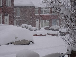
WThe winter of 2010–11 was a weather event that brought heavy snowfalls, record low temperatures, travel chaos and school disruption to the islands of Great Britain and Ireland. It included the United Kingdom's coldest December since Met Office records began in 1910, with a mean temperature of −1 °C (30 °F), breaking the previous record of 0.1 °C (32.2 °F) in December 1981. Also it was the second-coldest December in the narrower Central England Temperature (CET) record series which began in 1659, falling 0.1 °C short of the all-time record set in 1890. Although data has never officially been compiled, December 2010 is thought to be colder than December 1890 over the United Kingdom as a whole, as Scotland was up to 2 °C warmer than England. Hence, it is thought to be the coldest December across the UK as a whole since before 1659.