 W
WBecause of its natural structure, Venezuela can be divided into eight very distinct natural regions. In the evaluation of a natural region, the human element is not present. The natural region groups of Venezuela formed as a consequence of the association of geo-physical elements such as: geological constitution, relief, climate, hydrography, vegetation, soils, among others.
 W
WThe Venezuelan Andes also simply known as the Andes in Venezuela, are a mountain system that form the northernmost extension of the Andes. They are fully identified, both by their geological origin as by the components of the relief, the constituent rocks and the geological structure.
 W
WThe Venezuelan Coastal Range, also known as Venezuelan Caribbean Mountain System is a mountain range system and one of the eight natural regions of Venezuela, that runs along the central and eastern portions of Venezuela's northern coast. The range is a northeastern extension of the Andes, and is also known as the Maritime Andes. It covers around 48,866 km2, being the 4th largest natural region in Venezuela.
 W
WThe Sistema Coriano also known as Lara-Falcón Formation, Coro region or Coriano system is one of the eight natural regions of Venezuela. Is the hilly and semi-mountainous area in northwest Venezuela, north of the Mérida Andes and east of the Maracaibo Basin, extending north to the Caribbean coast. It consists mostly of east-west running ridges, with the exception of the Sierra de Siruma or Empalado which run north-south.
 W
WThe Orinoco Delta is a vast river delta of the Orinoco River, located in eastern Venezuela.
 W
WThe Guayana natural region also simply known as Guayana in Venezuela, is a large massif of approximately 441,726 km2 area, equivalent to 48.2% of the total continental territory of the country.
 W
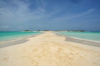
WThe Insular Region is one of the eight natural regions of Venezuela and also, one of the 10 administrative regions in which Venezuela was divided for its development plans; it comprises all of the nation's islands, and is formed by the state of Nueva Esparta and the Federal Dependencies.
 W
WThe Venezuelan Llanos also simply known as Los Llanos in Venezuela, is a large central depression very flat in a vast natural region of approximately 243,774 km2 of extension, equivalent to 26.6% of the total continental territory of the country.
 W
WThe Maracaibo Basin, also known as Lake Maracaibo natural region, Lake Maracaibo depression or Lake Maracaibo Lowlands, is a foreland basin and one of the eight natural regions of Venezuela, found in the northwestern corner of Venezuela in South America. Covering over 36,657 square km, it is a hydrocarbon-rich region that has produced over 30 billion bbl of oil with an estimated 44 billion bbl yet to be recovered. The basin is characterized by a large shallow tidal estuary, Lake Maracaibo, located near its center. The Maracaibo basin has a complex tectonic history that dates back to the Jurassic period with multiple evolution stages. Despite its complexity, these major tectonic stages are well preserved within its stratigraphy. This makes The Maracaibo basin one of the most valuable basins for reconstructing South America's early tectonic history.