 W
WThe Bolshaya is a river in the western Kamchatka Peninsula, Russia. It is used for spawning by various species of Pacific salmon. The Bolshaya is 275 kilometres (171 mi) long and has a catchment area of 10,800 square kilometres (4,200 sq mi).
 W
WThe Kikhchik is a river in the western Kamchatka Peninsula, Russia. It is used for spawning by various species of Pacific salmon.
 W
WThe Lyutoga is a river on Sakhalin island, third by size within the island. It flows through Kholmsk and Aniva districts of Sakhalin Oblast. Starting at the western slope of the Mitsulsky Mountain Ridge, which belongs to the system of Western Sakhalin Mountains. It flows along a wide valley from North to South, and discharges into the Aniva Bay of the Sea of Okhotsk. There is a town of Aniva in the mouth of the river, the town used to have the same name as the river before 1905. There are several comparatively large villages located on Lyutoga banks : Pyatirechie, Chaplanovo, Ogon'ki and Petropavlovskoye.
 W
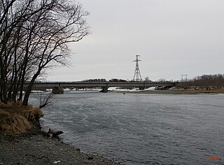
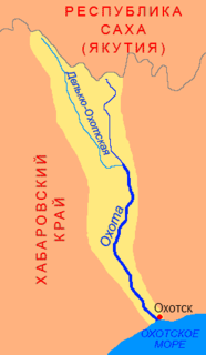
WThe Okhota is a river in Khabarovsk Krai which flows south to the Sea of Okhotsk near the port town of Okhotsk.
 W
WThe Ola is a river in Magadan Oblast, Russian Far East. It is 166 kilometres (103 mi) long, with a drainage basin of 8,570 square kilometres (3,310 sq mi).
WThe Paren is a river in northeastern Russia which drains in to the Penzhina Bay of the Sea of Okhotsk. It is 310 kilometres (190 mi) long, and has a drainage basin of 13,200 square kilometres (5,100 sq mi). There is a village along with the riverbank also named Paren.
 W
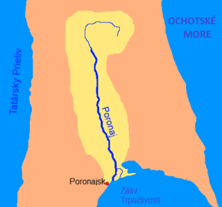
WThe Poronay is the longest river on the island of Sakhalin in Russia. It flows in a southerly direction through Tym, Smirnykhovsky and Poronaysky Districts.
 W
WThe Tym is a river on the island of Sakhalin, Russia, and the second longest river on the island after the Poronay. It is 330 kilometres (210 mi) long, and has a drainage basin of 7,850 square kilometres (3,030 sq mi). The name of the river is translated from Nivkh as "spawning river." The river flows through Tymovsky and Nogliki Districts of Sakhalin Oblast. It begins on the southern slopes of Mount Lopatin in the East Sakhalin Mountains, flows through swampy lowlands in the Tym-Poronaiskaya Valley, and finally flows into Nyisky Bay in the Sea of Okhotsk. The villages of Tymovskoye and Nogliki are located beside the river.
 W
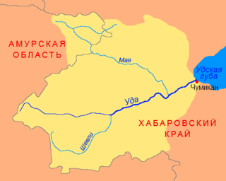
WThe Uda is a river in Khabarovsk Krai, in the Russian Far East. It is 457 kilometres (284 mi) long, and has a drainage basin of 61,300 square kilometres (23,700 sq mi).