 W
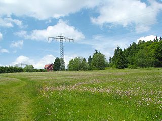
WThe Barnbruch is a wetland of international importance in the old glacial valley of the river Aller that provides a habitat for endangered species of birds, amphibians and insects. It lies between the city of Wolfsburg and town of Gifhorn and consists of an enclosed woodland area of around 1,500 hectares with surrounding meadows and pastures. This low-lying depression lies partly within the territory of the city of Wolfsburg and partly within Gifhorn district. Together with the Drömling around 15 km to the east, the Barnbruch is the most valuable ecological lowland region along the upper course of the Aller.
 W
WThe Ebertswiese, is a boggy area of grassland in the Thuringian Forest in central Germany. It has been a nature conservation area since 1936 and is a recreation area in the municipality of Floh-Seligenthal on the Rennsteig trail. The River Spitter has its source within the reserve.
 W
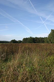
WThe Eider-Treene Depression is a landscape in west Schleswig-Holstein in North Germany. It covers 500 square kilometres (190 sq mi) around the rivers Eider, Treene and Sorge. The Eider-Treene Depression is the largest wetland in the German state of Schleswig-Holstein. It includes one third of the moorland (bog) in the state and is a habitat to the largest inland group of meadow birds. To the north, its border runs between Hollingstedt and Treia, to the east near Rendsburg, to the south the boggy depression reaches to the Hanerau and Haalerau beyond the Kiel Canal. Its western boundary with the Eiderstedt Marsh is unclear as marsh, bog and geest are interspersed. The region comprises the river valleys and their interfluvial geest ridges (Geestkernen). The landscape was formed during the ice ages, and altered by man as a result of dams and weirs built across the Eider, which was still a tidal river as far as Rendsburg until the 1920s. The region recently is encouraging "nature tourism" with walking, riding, cycling and canoe trips.
 W
WFedersee is a lake located just north of Bad Buchau in the region of Upper Swabia in Southern Germany. It is surrounded by moorland, partially overgrown with reeds. With a size of 33 km2, the area is one of the largest, groundwater fed, connected moorlands in Southern Germany. At its deepest point, Lake Federsee has a depth of 2 metres. Federsee translates to 'feather lake' and its shape resembles that of a feather. However, the origin of its name is locally debated, with one camp defending the shape theory, and another championing the idea that the amount of feathers found on the lake's surface gave rise to its name. The most probable explanation for the origin of the name is, however, the Celtic word "pheder" which means marsh. Therefore, the name refers to the origin of the lake itself and the surrounding landscape. The lake is encircled by the town of Bad Buchau, and the villages of Moosburg, Alleshausen, Seekirch, Tiefenbach, and Oggelshausen.
 W
WThe High Fens, which were declared a nature reserve in 1957, are an upland area, a plateau region in the province of Liège, in the east of Belgium and adjoining parts of Germany, between the Ardennes and the Eifel highlands. The High Fens are the largest nature reserve or park in Belgium, with an area of 4,501.2 hectares ; it lies within the German-Belgian natural park Hohes Venn-Eifel, in the Ardennes. Its highest point, at 694 metres (2,277 ft) above sea level, is the Signal de Botrange near Eupen, and also the highest point in Belgium. A tower 6 metres (20 ft) high was built here that reaches 700 metres (2,297 ft) above sea level. The reserve is a rich ecological endowment of Belgium covered with alpine sphagnum raised bogs both on the plateau and in the valley basin; the bogs, which are over 10,000 years old, with their unique subalpine flora, fauna and microclimate, are key to the conservation work of the park.
 W
WThe Kremmener Luch is a shallow fen, known locally as a luch, between the Glien plateau in the south, and the Beetzer Heath in the north. The western Rhin flows through the Kremmener Luch, where it is called the Kremmener Rhin, or the Ruppiner Canal.
 W
WRotes Luch is a reclaimed fen area, known locally as a luch, and extends to a width of about 1 kilometre (0.62 mi) over a length of approximately 10 kilometres (6.2 mi) from southwest to northeast. It is located in the southwestern corner of the nature reserve Märkische Schweiz of Brandenburg, Germany.
 W
WThe Teufelsbäder is the name of a moor landscape near Osterode am Harz in the Harz Mountains of central Germany. It lies within the nature reserve of the same name southeast of Augustental on the B 243 federal road.