 W
WMedicine Bow–Routt National Forest is the official title to a U.S. Forest Service managed area extending over 2,222,313 acres (8,993.38 km2) in the states of Wyoming and Colorado, United States. What were once three separate areas, Medicine Bow National Forest, Routt National Forest, and Thunder Basin National Grassland were administratively combined in 1995 due to similarity of the resources, proximity to each other and for administrative purposes.
 W
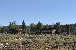
WThe Brush Creek Work Center in Medicine Bow National Forest near Saratoga, Wyoming is a ranger station of the USDA Forest Service, Region 2 that was built during 1937-41 and is listed on the National Register of Historic Places. It was designed by architects of the United States Forest Service in rustic style. The designs were applications of standard plans.
 W
WThe Encampment River Wilderness is a designated wilderness area located in south central Wyoming in the United States. Entirely within Medicine Bow National Forest, the wilderness was designated to increase protection of the Encampment River and the canyon through which it flows.
WThe Huston Park Wilderness is located in south central Wyoming in the United States. Entirely within Medicine Bow National Forest, the wilderness was designated in 1984 to preserve the northernmost section of the central Rocky Mountains, an area of high mountain peaks and coniferous forest.
 W
WNorthgate Canyon is the 9.8-mile (15.8 km) long stretch of the North Platte River between Routt Access (Colorado) and Six-Mile Gap (Wyoming).
WThe Platte River Wilderness is primarily located in south central Wyoming, with a small section extending into Colorado in the United States. Located entirely within Medicine Bow - Routt National Forest, the wilderness was created in 1984 to protect the forestlands adjacent to the North Platte River. These forestlands were almost entirely consumed by the Mullen Fire in 2020.
WThe Savage Run Wilderness is located in south central Wyoming in the United States. Entirely within Medicine Bow National Forest, the wilderness was designated in 1978 in an effort to protect vital rangeland for a large elk population.
 W
WThe Thunder Basin National Grassland is located in northeastern Wyoming in the Powder River Basin between the Big Horn Mountains and the Black Hills. The Grassland ranges in elevation from 3,600 feet (1,100 m) to 5,200 feet (1,600 m), and the climate is semi-arid. The Grassland provides opportunities for recreation, including hiking, sightseeing, hunting, and fishing. There are no developed campgrounds; however, camping is allowed. Land patterns are very complex because of the intermingled federal, state, and private lands.