 W
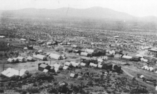
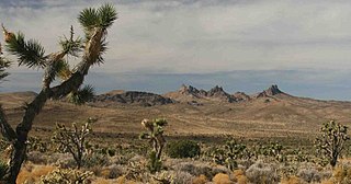
WLanfair Valley is located in the Mojave Desert in southeastern California near the Nevada state line. It is bounded on the north by the New York Mountains and Castle Mountains, on the east by the Piute Range, and on the south by the Woods Mountains and Vontrigger Hills. Joshua Trees can be found in most of the valley. Elevation is 4,045 feet.
 W
WThe Castle Mountains are located in the Eastern Mojave Desert, in northeastern San Bernardino County, California and Clark County, Nevada. The range lies south and east of the New York Mountains, southwest of Searchlight and west of Cal-Nev-Ari, Nevada.
 W
WCastle Mountains National Monument is a U.S. National Monument located in the eastern Mojave Desert and northeastern San Bernardino County, in the state of California.
 W
WGoffs, an unincorporated community in San Bernardino County, California, is a nearly empty one-time railroad town at the route's high point in the Mojave Desert. Goffs was a stop on famous U.S. Route 66 until 1931 when a more direct road opened between Needles and Essex. Goffs was also home to workers of the nearby Santa Fe Railroad, with Homer east, Fenner south, and Blackburn and Purdy north.
 W
WHart was a short-lived gold mining town located in the Mojave desert, in San Bernardino County, California. It existed between 1908 and 1915, and was located on the northeastern edge of Lanfair Valley near the New York Mountains. The area is now in the Castle Mountains National Monument, administered by the National Park Service.
 W
WThe Sacramento Wash (California) is the drainage southward, then east from the Lanfair Valley of extreme eastern San Bernardino County, California. The drainage combines with the Piute Wash-(mostly of Nevada) at the south terminus of the Dead Mountains, and immediately enters the Colorado River, just north of Needles, California. Another Sacramento Wash occurs across the Colorado, as an eastern drainage from northwest Arizona, also at Needles, CA.
 W
WThe Vontrigger Hills are a low mountain range in the eastern Mojave Desert, in eastern San Bernardino County, California.
 W
WThe Woods Mountains are found in southeastern California in the Mojave Desert, at the southwestern end of the Lanfair Valley just east of Hole-in-the-Wall. The mountains are located in the Mojave National Preserve north of Interstate 40 and the Clipper Valley in San Bernardino County. The range reaches an elevation of 4,600 feet (1,400 m) at Tortoise Shell Mountain. The mountain was named in 1971 by Stephen Castagneto due to fragments of shells found atop from birds dropping tortoises so as to break their shells and feed on the inner meat. There are at least two known protected overhangs that show fire scoring as evidence of habitation by pre-contact Chemehuevi Indians.