 W
WHinulugang Taktak Protected Landscape, also known as Hinulugan Taktak, is a protected area located in Rizal, Philippines. Initially assigned as a recreation area, the waterfall area has been designated as a national park by virtue of Republic Act No. 6964 in 1990. Ten years later, it became a protected landscape in accordance to Proclamation No. 412. It is being managed by the Department of Environment and Natural Resources and the Rizal Provincial Government. As of 2003 and 2004, Hinulugang Taktak is the second most popular national park in the Philippines in terms of number of visitors.
 W
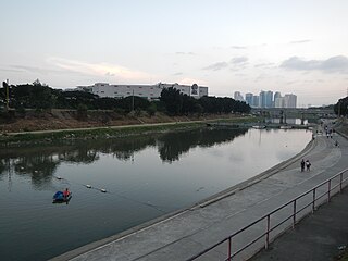
WMarikina River is a river in eastern Metro Manila, Philippines. It is the largest tributary of Pasig River with headwaters located in the Sierra Madre Mountains in Rodriguez, Rizal province.
 W
WThe Morong River, also referred to as the Morong-Teresa River, is a river system in Rizal, Philippines. It is one of 21 major tributaries of Laguna de Bay. It covers 14 barangays and stretches 10 kilometres (6.2 mi) from Antipolo City down to Teresa, Rizal, Morong, Rizal and finally to Laguna de Bay.
 W
WMount Tagapo, also known as Susong Dalaga mountain, is a conical peak on the lake island of Talim on Laguna de Bay, the largest lake in the Philippines. The mountain ridge is 438 m (1,437 ft) in elevation and the highest point of Talim Island. The peak falls under the jurisdiction of the towns of Binangonan and Cardona in Rizal province.
 W
WPamitinan Cave is a limestone cave in the foothills of the Sierra Madre mountain range near Wawa Dam in Rizal, the Philippines. It is located in the Pamitinan Protected Landscape, in the barangay of San Rafael, municipality of Rodriguez. The cave was formerly known as the '"Cave of Bernardo Carpio"'. Its former name was derived from Bernardo Carpio, a figure in Philippine mythology who was rebuked by the gods because of his insolence. Legend states that he was chained forever in the Montalban gorge, cursed to keep two mountains from colliding with each other.
 W
WMount Sembrano is a mountain located between Rizal and Laguna of the Calabarzon region in the Philippines. Mt. Sembrano is situated about 60 kilometres (37 mi) east by road from the capital city of Manila.
 W
WThe Sierra Madre is the longest mountain range in the Philippines. Spanning for over 540 kilometers (340 mi), it runs from the province of Cagayan down to the province of Quezon, forming a north–south direction on the eastern portion of Luzon, the largest island of the archipelago. It is bordered by the Pacific Ocean to the east, Cagayan Valley to the northwest, Central Luzon to the midwest, and Calabarzon to the southwest. The Pacific coast of Luzon along the Sierra Madre is less developed as the lofty and continuous mountains form a bold and almost inaccessible shore, exposed to the full force of the northeast monsoon and the waves of the Pacific Ocean. Some of communities east of the mountain range and along the coast are so remote they are only accessible by plane or boat.
 W
WThe Upper Marikina River Basin Protected Landscape is a protected area in the Province of Rizal in the Philippines, which forms the upper area of the drainage basin of the Marikina River.