 W
WFukutoku-Okanoba (福徳岡ノ場) is a submarine volcano that is part of the Volcano Islands in the Bonin Islands of Japan. It is located 5 kilometers northeast of the island of South Iwo Jima.
 W
WIwo Jima, known in Japan as Iō Tō , is one of the Japanese Volcano Islands and lies south of the Bonin Islands. Together with other islands, they form the Ogasawara Archipelago. The highest point of Iwo Jima is Mount Suribachi at 169 m (554 ft) high.
 W
WMount Mihara is an active volcano on the Japanese isle of Izu Ōshima. Although the volcano is predominantly basaltic, major eruptions have occurred at intervals of 100–150 years.
 W
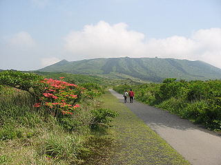
WMiyake-jima is an inhabited volcanic island in the Izu archipelago in the Philippine Sea approximately 180 kilometers (110 mi) southeast of Tokyo, Japan. As with the other islands in the Izu Island group, Miyake-jima forms part of the Fuji-Hakone-Izu National Park.
 W
WNishi-no-shima is a volcanic island located around 940 km (584 mi) south-southeast of Tokyo, that is part of the Volcano Islands arc.
 W
WNorth Iwo Jima is the northernmost island of the Volcano Islands group of the Bonin Islands, 80 km north of Iwo Jima. It is located 1,170 kilometers (730 mi) south of Tokyo, and 207 kilometers (129 mi) south-southwest of Chichijima.
 W
WMount Suribachi is a 169-metre (554 ft)-high mountain on the southwest end of Iwo Jima in the northwest Pacific Ocean under the administration of Ogasawara Subprefecture, Tokyo Metropolis, Japan.