 W
W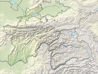 W
WThe Beyik Pass, also written and Payik Pass and Bayik Pass, is a mountain pass in the Sarikol Range between Gorno-Badakhshan Autonomous Province in Tajikistan and the Taghdumbash Pamir region of Tashkurgan Tajik Autonomous County in Xinjiang, China. It is situated at an elevation of 4,742 metres (15,558 ft). There is an ethnic Kyrgyz village on the Chinese side with the same name, though the village is more commonly referred to by a different name in Chinese and Beyik is reserved for the border guard outpost.
WThe Kulma Pass or Qolma Pass, also referred to as Karasu Pass, is a mountain pass across the Pamir Mountains on the border between Murghob District, Gorno-Badakhshan Autonomous Region in Tajikistan and Taxkorgan Tajik Autonomous County, Kashgar Prefecture, Xinjiang Uygur Autonomous Region in China. Asian Highway AH66 runs through the pass, which provides for the only modern day overland border crossing along the 450 km boundary between the two nations.
WKyzylart Pass is a mountain pass and border crossing in the Trans-Alay Range on the border of Tajikistan and Kyrgyzstan. The highest point is 4,280 m (14,042 ft). The area is typically rugged and dry. It is crossed by the Pamir Highway which leads south from Sary-Tash in the Alay Valley up onto the Pamir plateau toward Karakol Lake and Murghab, Tajikistan. In the late nineteenth century the Russians explored and eventually occupied the Pamir plateau.
WThe Nezatash Pass or Neza-Tash Pass is a mountain pass in the Sarikol Range between Gorno-Badakhshan Autonomous Province in Tajikistan and Tashkurgan Tajik Autonomous County in Xinjiang, China. It is situated at an elevation of 4,476 metres (14,685 ft). The name of the path means "spear stone" in Kyrgyz as it is named after a rock near the location.
 W
WTegermansu Pass or Tigarman Su Pass is a closed mountain pass on the border between Afghanistan and China in the Hindu Kush or Pamirs mountain range. It is located between the Tegermansu Valley on the eastern end of the Little Pamir and Chalachigu Valley in Xinjiang, China. Historically, it was one of the three routes between China and Wakhan.
 W
WThe Wakhjir Pass, also spelled Vakhjir Pass, is a mountain pass in the Hindu Kush or Pamirs at the eastern end of the Wakhan Corridor, the only potentially navigable pass between Afghanistan and China in the modern era. It links Wakhan in Afghanistan with the Tashkurgan Tajik Autonomous County in Xinjiang, China, at an altitude of 4,923 metres (16,152 ft), but the pass is not an official border crossing point. With a difference of 3.5 hours, the border has the sharpest official change of clocks of any international frontier. China refers to the pass as South Wakhjir Pass, as there is a northern pass on the Chinese side.