 W
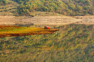
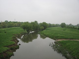
WThe Aheloy River or Achelous is a river in eastern Bulgaria. It originates in the Aytos-Karnobat mountain, 1.5 kilometres from Dryankovets, and flows directly into the Black Sea south of the village of Aheloy. The Aheloy River has a length of 39.9 kilometres and has an irrigation reservoir, the Aheloy Reservoir, built along its flow. The river's drainage basin covers 141 square kilometres and its average discharge is 0.7 cubic metres per second.
 W
WThe Archar or Archaritsa is a river in the western Danubian Plain of northern Bulgaria and a right tributary of the Danube. It originates in the western Balkan Mountains and is around 60 kilometres in length, with a drainage basin of 364 square kilometres. The river runs through limestone terrain and has steep banks, in certain sections up to 100 metres high. The Archar flows into the Danube at the large village of Archar in Dimovo municipality, Vidin Province. It also passes through Rayanovtsi, Rabisha, Kladorub, Ostrokaptsi, Dimovo, Lagoshevtsi and Darzhanitsa.
 W
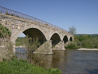
WThe Arda is a 290-kilometre-long (180 mi) river in Bulgaria and Greece. It is a tributary of the Maritsa. Its source lies in the Bulgarian Rhodope Mountains near the village Arda, part of the municipality of Smolyan. It flows eastward past Rudozem, Kardzhali and Ivaylovgrad and enters Greece in the northern part of the Evros regional unit. It flows into the Maritsa on the border of Greece and Turkey, between the Greek village Kastanies and the Turkish city Edirne. In the Bulgarian section there are three hydroelectric and irrigation dams, Kardzhali Dam, Studen Kladenets and Ivaylovgrad Dam. The Bulgarian section is 229 kilometres (142 mi) long, making the Arda the longest river in the Rhodopes. The medieval Dyavolski most arch bridge crosses the river 10 kilometres (6 mi) from Ardino.
 W
WThe Banska is a river in Haskovo Province, southeastern Bulgaria. The river is 37 kilometres (23 mi) long.
 W
WThe Boyanska reka is a river in western Bulgaria, a left tributary to the river Perlovska.
 W
WByala reka is a river in the Rhodope Mountains in Southern Bulgaria, the longest tributary of Luda reka.
 W
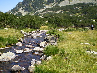
WThe Chepelare is a river in Bulgaria that takes its source from Rozhen Peak in the Rhodopes. The river's length is about 82 km and two hydroelectric plants are constructed on it, with a total maximum power of 2,400 kW.
 W
WThe Danube is Europe's second-longest river, after the Volga. It is located in Central and Eastern Europe.
 W
WThe Dospat is a river in the Western Rhodope Mountains, the most important tributary of the Mesta.
 W
WThe Dragovištica or Dragovishtitsa is a river in southeastern Serbia and western Bulgaria, a 63 km-long right tributary to the River Struma.
 W
WThe Dyavolska reka is a river in Burgas Province, southeastern Bulgaria. It originates in the Strandzha mountains, runs near the coastal town of Primorsko, and flows into the Black Sea. In its middle course, it forms a marshy area known as Dyavolsko blato.
 W
WThe Erythropotamos or Luda reka is a river in southern Bulgaria and northeastern Greece. Its Turkish name was Kızıldelisu. Its source is near Mega Dereio. It flows into the Maritsa (Evros) near Didymoteicho.
 W
WThe Iskar is a right tributary of the Danube. With a length of 368 km it is the longest river that runs entirely within Bulgaria. Originating as three forks in Balkan's highest mountain range Rila, it flows in northern direction until its confluence with the Danube River. As it flows northwards it fuels the largest artificial lake in the country, the Iskar Reservoir, forms the divide between the Vitosha and Plana Mountains in the west and the Sredna Gora mountain range in the east before entering the Sofia Valley, which contains the nation's capital Sofia. From there the Iskar runs through the Balkan Mountains forming the spectacular 84 km long Iskar Gorge and as it crosses the mountains its water course turns in north-eastern direction at Lakatnik. North of the Balkan Mountains the river crosses the Danubian Plain and finally flows into the Danube between the villages of Baykal and Gigen. Geologically, Iskar is the oldest river in the Balkan Peninsula.
 W
WThe Jerma or Erma is a river in southeastern Serbia and western Bulgaria. Though not very long (72 km), it is notable for passing the Serbian-Bulgarian border twice.
 W
WThe Kamchiya is a 191-kilometre (119 mi) river in eastern Bulgaria, the longest river on the Balkan Peninsula to flow directly into the Black Sea. It starts from the confluence of two rivers springing from Eastern Stara Planina, Golyama Kamchiya and Luda Kamchiya, flows eastward to the Black Sea and empties into it 25 km south of Varna, in the Resort of Kamchiya.
 W
WThe Karaagach is a small river in south-eastern Bulgaria which flows to the south of the town of Kiten on the territory of the Tsarevo Municipality. It forms a deep estuary on the coast of the Black Sea which is 11–14 metres (36–46 ft) deep. The river is rich in rare fish species and has varied flora. Karaagach is 15 kilometres (9.3 mi) long.
 W
WThe Krumovitsa is a river in the eastern Rhodope Mountains of Bulgaria. The river valley is formed by the Krumovitsa River and the Djushun River together with the surrounding low mountain slopes.
 W
WThe Lom is a river in northwestern Bulgaria, a right tributary of the Danube flowing into it 1 km east of the town of Lom.
 W
WLuda Kamchiya is a river in eastern Bulgaria, the main tributary of the Kamchiya river. The river has a total length of 180 km and a drainage basin of 1610 km², with an average slope of 5.3‰.
WThe Erythropotamos or Luda reka is a river in southern Bulgaria and northeastern Greece. Its Turkish name was Kızıldelisu. Its source is near Mega Dereio. It flows into the Maritsa (Evros) near Didymoteicho.
 W
WThe Luda Yana is a 74 km-long river in southern Bulgaria, a northern tributary of the Maritsa River. It runs through the towns of Panagyurishte and Strelcha, as well as a number of villages, including Popintsi, where there are considerable driftage gold deposits. The river flows into the Maritsa several kilometres east of Pazardzhik, at the village of Sinitovo.
 W
WMaritsa, also known as Meriç or Evros, is a river that runs through the Balkans in Southeast Europe. With a length of 480 km (300 mi), it is the longest river that runs solely in the interior of the Balkans, and one of the largest in Europe by discharge. It flows through Bulgaria in its upper and middle reaches, while its lower course forms much of the border between Greece and Turkey. Its drainage area is about 53,000 km2 (20,000 sq mi), of which 66.2% is in Bulgaria, 27.5% in Turkey and 6.3% in Greece. It is the main river of the historical region of Thrace, most of which lies in its drainage basin.
 W
WNestos, Mesta, or formerly the Mesta Karasu in Turkish, is a river in Bulgaria and Greece. It rises in the Rila Mountains and flows into the Aegean Sea near the island of Thasos. It plunges down towering canyons toward the Aegean Sea through mostly metamorphic formations. At the end, the main stream spreads over the coastal plain of Chrysoupolis and expands as a deltaic system with freshwater lakes and ponds forming the Nestos delta. The length of the river is 230 km (140 mi), of which 126 km (78 mi) flow through Bulgaria and the rest in Greece. Its drainage area is 5,184 km2 (2,002 sq mi), of which 66% in Bulgaria. It forms some gorges in Rila and Pirin.
 W
WThe Nišava or Nishava is a river in Bulgaria and Serbia, a right tributary, and with a length of 218 km also the longest one, of the South Morava.
 W
WThe Ogosta, is the largest river in Northwestern Bulgaria, a right tributary of the Danube. It originates at the peak of the Chiprovska Mountain and the West Stara Planina Mountain on the border with Serbia. The towns of Chiprovtsi, Montana, and Miziya are situated on the river's banks.
 W
WThe Osam is a river in northern Bulgaria. Its drainage basin is in between that of the river Vit to the west and the Yantra system to the east. The river has two main tributaries in its upper course: the Black Osam takes its source from the foot of Levski Peak in the Balkan Mountains, at an altitude of 1,821 m (5,974 ft), while the White Osam has its source on the northern slopes of the Kozya Stena peak. In Troyan, the black and white Osam join. It runs north towards Lovech, then north-east until Letnitsa and Levski, where it turns north-west until it flows into the river Danube 5 km west of the town of Nikopol. The ancient name of the river was Assamus.
 W
WPerlovska river is a small river in the Sofia Valley in western Bulgaria. The river is only 17.8 kilometres (11.1 mi) long. It takes its source from the foothills of Vitosha, runs through Sofia's South Park, separates the two lanes of Evlogi Georgiev Boulevard, runs through the neighbourhood Poduyane, and finally flows into the Iskar River. The well-known Orlov Most is built over this river.
 W
WThe Provadiya and is a river in northeastern Bulgaria. It is 119 km long and has a drainage basin of 2,132 km². The river takes its source from close to the village of Dobri Voynikovo in Shumen Province, flowing southeast and then making a sharp turn northeast to empty into Lake Devnya at Devnya. It is part of the Black Sea drainage area, as Lake Devnya is connected to Lake Varna and it to the Black Sea.
 W
WThe Retizhe is a river in south-western Bulgaria, a right tributary of the Mesta. The river is 19 km long and drains parts of the eastern slopes of the Pirin mountain range.
 W
WThe Rezovo is a river in the extreme southeast of Bulgaria and northernmost part of European Turkey. The river is situated in Bulgaria's Strandzha Nature Park.
 W
WThe Rilska River is a river in south-western Bulgaria, a left tributary of the Struma. The river is 51 km long and drains the western sections of the Rila mountain range.
 W
WThe Ropotamo is a river in south-eastern Bulgaria. It takes its source from the Bosna Ridge in the Strandzha Mountains, running for 48.5 km to empty into the Black Sea near Cape Saint Demetrius between Dyuni and Primorsko.
 W
WThe Rositsa is a river in central northern Bulgaria, the most important tributary of the Yantra. It is 148.5 kilometres (92 mi) long and has a drainage basin of 2,260 square kilometres (873 sq mi). Its ancient name was Lyginus.
 W
WThe Rusenski Lom is a river in northeastern Bulgaria, the last major right tributary of the Danube. It is formed by the rivers Beli Lom and Cherni Lom, the former taking its source south of Razgrad and the latter southeast of Popovo.
 W
WThe Sandanska Bistritsa is a river in south-western Bulgaria, a left tributary of the Struma. The river is 33 km long and drains the south-western sections of the Pirin mountain range.
 W
WThe Sazliyka or Rakitnitsa is a river in southeastern Bulgaria, a left tributary of the Maritsa. It originates in the Sarnena Sredna Gora mountains. In its upper course until Radnevo, it is also known as the Rakitnitsa or Syuyutliyka. The river is 121.7 kilometres in length and has a drainage basin of 3,366 square kilometres. Its average discharge at Galabovo is 17 cubic metres per second. The Galabovo Reservoir is located along the river.
 W
WThe Shirokolashka is a river of Plovdiv Province, Bulgaria. It is a tributary of the Vacha River. Along the river are villages such as Shiroka Laka with "typically Rodopean stone houses with small windows, high chimneys and hidden trapdoors."
 W
WSredetska reka is a river in eastern Bulgaria. It is 69 km long with a catchment area of 985 km2. It empties into the Black Sea through Lake Mandrensko near Burgas.
 W
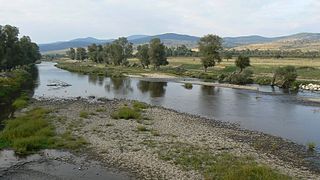
WThe Struma or Strymónas is a river in Bulgaria and Greece. Its ancient name was Strymṓn. Its drainage area is 17,330 km2 (6,690 sq mi), of which 10,797 km2 (4,169 sq mi) in Bulgaria, 6,295 km2 (2,431 sq mi) in Greece and the rest in North Macedonia. It takes its source from the Vitosha Mountain in Bulgaria, runs first westward, then southward, forming a number of gorges, enters Greek territory at the Kula village. In Greece it is the main waterway feeding and exiting from Lake Kerkini, a significant centre for migratory wildfowl. The river flows into the Strymonian Gulf in Aegean Sea, near Amphipolis in the Serres regional unit. The river's length is 415 kilometres (of which 290 kilometres in Bulgaria, making it the country's fifth-longest and one of the longest rivers that run solely in the interior of the Balkans.
 W
WThe Strumica or Strumeshnitsa is a river in North Macedonia and Bulgaria. It runs through the town of Strumica and flows into the river Struma.
 W
WThe Stryama is a river in southern Bulgaria, an important left tributary of the Maritsa. The river is 98.7 km long and has a drainage basin of 1,490 km².
 W
WThe Timok, sometimes also known as Great Timok, is a river in eastern Serbia, a right tributary of the Danube. For the last 15 km of its run it forms a border between eastern Serbia and western Bulgaria.
 W
WThe Topolnitsa (Bulgarian: Тополница [toˈpɔɫnit͡ʃɐ]) is a river in southern Bulgaria, an important left tributary of the Maritsa. It takes its source from Bich Peak in Sredna Gora close to Koprivshtitsa; it is known as the Shirineyska in its upper course. Its average discharge is 55 m³/s and it is 135.6 kilometres (84.3 mi) long; its drainage basin covers 1,780 square kilometres (690 sq mi). The Topolnitsa flows into the Maritsa near Pazardzhik after making a large turn under Trakiya motorway. The Topolnitsa Reservoir has a maximum volume of 120,000,000 cubic metres (4.2×10⁹ cu ft) and serves the area around Pazardzhik. Among the Topolnitsa's tributaries are the Mativir and the Bunovo River. The river's name is derived from the Bulgarian word топола, topola ("poplar").
 W
WThe Tundzha is a river in Bulgaria and Turkey and the most significant tributary of the Maritsa, emptying into it on Turkish territory near Edirne.
 W
WThe Vacha is a river in south Bulgaria, one of the main right tributaries of the Maritsa. It is 104 km long and is formed by the confluence of the rivers Chairdere and Buynovska reka. Shirokolashka is another tributary.
 W
WVarbitsa is a river in the Eastern Rhodope mountains in Bulgaria. The Varbitsa river, a tributary to the Arda, the main river of the Rhodope Mountains, runs through 8 municipalities, 6 of them within the region of Kardzhali and 2 in the region of Smolyan. It is the lifeline of the area, with industrial, drinking and irrigation water coming out, and refuse, raw sewage and industrial waste going in. That the Varbitsa starts below an officially “safe” tailings reservoir above the town of Zlatograd has been of concern, as has the fact that Zlatograd's rubbish dump is next to the river, and begins to enter into its waters as it expands. The Varbitsa is Bulgaria's most temperamental river, with up to 5,000 times difference in water volume between spring highs and autumn lows, with frequent massive flooding and erosion as a result.
 W
WThe Veleka is a river in the very southeast of Bulgaria, as well as the very northeast of European Turkey. It is 147 km long, of which 108 km in Bulgaria and 25 km in Turkey, and takes it sources from a number of Karst springs in the Turkish part of the Strandzha (İstranca) mountain to flow into the Black Sea at the Bulgarian village of Sinemorets. Veleka is situated in Strandzha Nature Park.
 W
WVisočica or Visochitsa is a river that passes through easternmost Serbia and westernmost Bulgaria, a right tributary of the Temštica. It belongs to the Black Sea drainage basin. The name is a derivative of the Visok mountain in Serbia through which it passes; the word is Slavic, derived from visoko ("high"), in the feminine form.
 W
WThe Vit also Vid is a river in central northern Bulgaria with a length of 188 km. It is a tributary of Danube. The source of the Vit is in Stara Planina, below Vezhen Peak at an altitude of 2,030 m, and it empties into the Danube close to Somovit. The river has a watershed area of 3,228 km², its main tributaries being Kamenska reka, Kalnik and Tuchenitsa.
 W
WBistritsa or Vitoshka Bistritsa, is a river in western Bulgaria, tributary of Iskar River. Flows from the eastern slopes of Golyam Rezen Peak on Vitosha Mountain, crossing Bistrishko Branishte Nature Reserve, where it forms a small but beautiful waterfall Samokovishteto, then crossing villages of Bistritsa and Pancharevo to flow into Lake Pancharevo, near Sofia. Additional charm of the area offer several artificial waterfalls in the lower reaches of the river.
 W
WThe Vladayska is a river in western Bulgaria, a tributary of the Perlovska.
 W
WYadenitsa is a tributary of Maritsa, with a length of 26 km. It has its origin near Chakaritsa, between the Rila Mountains and Rhodope Mountains, in western Bulgaria. It enters into Maritsa near Belovo.
 W
WThe Yantra is a river in northern Bulgaria, a right tributary of the Danube. It is 285 km (177 mi) long, and has a watershed of 7,862 km2 (3,036 sq mi).
 W
WZlatna Panega is a river in central northern Bulgaria, originating from a karst source at the village of Zlatna Panega, Yablanitsa municipality, Lovech Province. During the Ottoman rule in Bulgaria it was known as "Altǎn Paneg". Zlatna Panega's source is the largest Karst source in Bulgaria and the water temperature is relatively constant throughout the year. Although the Zlatna Panega is only several dozen kilometres in length, it runs through the villages of Zlatna Panega, Rumyantsevo, Petrevene and the town of Lukovit before emptying into Iskar River. It is also very popular among Bulgaria's fishing community, as it is a great place to fish brown trout, rainbow trout, chub, mountain barbel and even ide and perch.