 W
WThis is a list of the ceremonial counties of England by their highest point.
 W
WList of counties of England and Wales in 1964 by highest point. In 1964 they are more or less the ancient counties, with the addition of the County of London and a number of historic divisions in place as administrative counties: Cambridgeshire into the Isle of Ely and Cambridgeshire; Hampshire into the Isle of Wight and Hampshire; Lincolnshire into the Parts of Holland, Kesteven and Lindsey; Northamptonshire into Soke of Peterborough and Northamptonshire; Suffolk into East and West; Sussex into East and West; and Yorkshire into the East, North and West Ridings.
 W
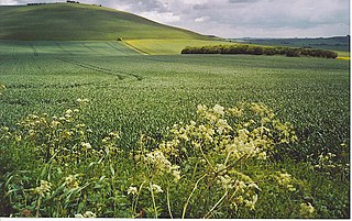
WArbury Hill, at 225 m (738 ft), is the joint highest point in the English county of Northamptonshire. It is 9 km (5.6 mi) southwest of the town of Daventry.
 W
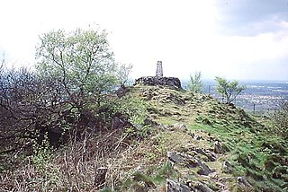
WBardon Hill is the highest Hill in Leicestershire and on a clear day the Malvern and Shropshire Hills, summits in Derbyshire and Lincoln Cathedral can be seen. However, the Sugar Loaf in South Wales, sometimes cited as visible from Bardon, cannot be seen, being over 90 miles (140 km) away.
Beacon Hill is the highest point in the English county of Norfolk. The hill is located 0.75 miles (1.2 km) south of the village of West Runton on the North Norfolk coast. At its summit the hill is 103 metres (338 ft) above sea level. The hill is also known as Roman Camp. The summit and surrounding woodlands are now in the care of the National Trust. A track, named Calves Well Lane, running west from Sandy Lane leads to a car park which is maintained by donations made to the National Trust collection box provide on the edge of the car park. Litter bins and benches make Beacon Hill an ideal location for picnics. There are several footpaths to follow across the area.
 W
WBetsom's Hill is a hill on the North Downs, and the highest point in the county of Kent at 251 metres (823 ft). Situated between Westerham and Tatsfield, at the western edge of the county, it lies close to where the A233 crosses the Downs en route to Biggin Hill. This is the highest part of the North Downs, with Botley Hill the highest point, nearby to the west. The hill lies at the western end of the Kent Downs, an area of outstanding natural beauty.
 W
WBillinge Hill, also known as Billinge Lump, is the highest point in the Metropolitan Borough of St Helens in North West England. It is also the highest point of Merseyside. It lies in Billinge, within the historic county boundaries of Lancashire. It is one of the 176 hills graded as a Marilyn in England.
 W
WBishop Wilton Wold is the highest point of the Yorkshire Wolds in the East Riding of Yorkshire, England. The summit, known as Garrowby Hill, lies about 5 miles (8 km) north of Pocklington.
 W
WBlack Chew Head in Saddleworth in the Metropolitan Borough of Oldham is the highest point or county top of Greater Manchester in northern England. It stands on moorland on the edge of the Peak District at a height of 542 metres (1,778 ft) above sea level, close to the border with the High Peak district of Derbyshire.
 W
WBlack Hill is a hill in the Peak District, England.
 W
WTwyn Llech, also known as Black Mountain, is a mountain in the Black Mountains. It is the only Marilyn to fall exactly on the Welsh–English border, straddling Brecknockshire and Herefordshire. Its parent peak, Waun Fach, lies to the west.
 W
WBlackdown, or Black Down, is the highest hill in Sussex, at 279.7 metres (918 ft); in southeastern England, exceeded by Walbury Hill and Leith Hill and is in the far north of West Sussex connected by footpaths to railway town Haslemere.
 W
WBrown Clee Hill is the highest hill in the rural English county of Shropshire, at 540 metres (1,770 ft) above sea level. It is one of the Clee Hills, and is in the Shropshire Hills Area of Outstanding Natural Beauty.
 W
WBrown Willy is a hill in Cornwall, England, United Kingdom. The summit, at 1,378 feet above sea level, is the highest point of Bodmin Moor and of Cornwall as a whole. It is about 2 1⁄2 miles northwest of Bolventor and 4 miles southeast of Camelford. The hill has a variable appearance that depends on the vantage point from which it is seen. It bears the conical appearance of a sugarloaf from the north but widens into a long multi-peaked crest from closer range.
 W
WBurnhope Seat is a high moorland fell in the North Pennines Area of Outstanding Natural Beauty (AONB) in northern England. It lies between the heads of the Rivers Tees, South Tyne and Wear. The summit is crossed by the boundary between County Durham and Cumbria. The trig point is the highest point in historic County Durham. However, this is not quite the summit of the mountain. Mickle Fell, south of Teesdale is higher than Burnhope Seat and is sometimes quoted as being the highest top of County Durham, but this is historically not correct. Mickle Fell, although it lies within the unitary council area of Durham County Council for administrative purposes, is historically a part of the North Riding of Yorkshire, and is the highest point in that county.
 W
WBushey is a town in the Hertsmere borough of Hertfordshire in the East of England. It has a population of over 25,000 inhabitants. Bushey Heath is a large neighbourhood south east of Bushey on the boundary with the London Borough of Harrow reaching elevations of 165 metres (541 ft) above sea level.
 W
WCheeks Hill is a hill on Axe Edge Moor in the Peak District, England. It lies just south of the Cat and Fiddle Road near Buxton, and forms part of the border between Derbyshire and Staffordshire. The highest and most northerly point in Staffordshire, at 520 metres (1,710 ft) above sea level, is just south-west of its summit.
 W
WThe Cheviot is the highest summit in the Cheviot Hills in the far north of England, only 1 1⁄4 miles from the Scottish border. It is the last major peak on the Pennine Way, if travelling from south to north, before the descent into Kirk Yetholm.
 W
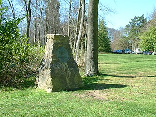
WChrishall is a small village in the English county of Essex. It is located 12 miles (20 km) south of Cambridge and lies equidistant [6 miles (10 km)] between the two medieval market towns of Saffron Walden and Royston. Although in Essex, Chrishall lies close to its borders with Hertfordshire and Cambridgeshire and has a 'Hertfordshire' postcode (SG8).
 W
WCleeve Hill is the highest point both of the Cotswolds hill range and of the county of Gloucestershire, at 1,083 feet (330 m). It is located on Cleeve Common which is a Site of Special Scientific Interest (SSSI) looked after by a small charity called Cleeve Common Trust. It commands a clear view to the west, over Cheltenham and the racecourse, over the River Severn and into Wales; and to the north over Winchcombe. It is a conspicuous outcrop on the edge of the limestone escarpment,. It is crossed by the Cotswold Way footpath.
 W
WA hill with a trig point pillar to the east of Cold Overton Park Wood is, at 197m, the highest point in the county of Rutland, England. The summit is southwest of the Glebe Farm radio relay mast on the road between Oakham and Knossington, and adjacent to the county boundary with Leicestershire. From the peak, there are views of Rutland Water.
 W
WCurrock Hill is a hill in Tyne and Wear, England, which at 259 m (850 ft) is the highest point in the county, and in the metropolitan borough of Gateshead.
Ditchling Beacon is the third-highest point on the South Downs in south-east England, behind Butser Hill and Crown Tegleaze. It consists of a large chalk hill with a particularly steep northern face, covered with open grassland and sheep-grazing areas. Situated just south of the East Sussex village of Ditchling and to the north-east of the city of Brighton, it is the highest point in the county of East Sussex. A road runs from Ditchling up and across the northern face and down into the northern suburbs of Brighton, and there are car parks at the summit and the northern base. Various charity, sporting and other events which are run regularly between London and Brighton incorporate this steep road as a challenging part of their route. It was also featured as a climb on the first of two days' racing in Britain in the 1994 Tour de France. The Tour organisers gave Ditchling Beacon a climb category of 4. 20 years later it was included as part of the route of the seventh stage of the 2014 Tour of Britain from Camberley to Brighton.
 W
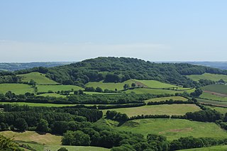
WDundry Hill is immediately south of Bristol, England: it includes farmland, a small number of houses and a church. It stretches east–west for some two miles. Most of the hill is within the district of North Somerset. At the hill's eastern end the southern slopes are within Bath and North East Somerset, and the northern slopes are within the city and county of Bristol, including the highest point in that county.
Dunkery Beacon at the summit of Dunkery Hill is the highest point on Exmoor and in Somerset, England. It is also the highest point in southern England outside of Dartmoor.
 W
WDunstable Downs are part of the Chiltern Hills, in southern Bedfordshire in England. They are a chalk escarpment forming the north-eastern reaches of the Chilterns. At 797 ft (243 m), Dunstable Downs are the highest point of the county of Bedfordshire.
 W
WEbrington Hill is a hill in Warwickshire, England, which at 261 m (856 ft) is the highest in the county. It is situated between the villages of Ebrington, Mickleton and Ilmington on the Warwickshire and Gloucestershire border in the Cotswolds.
 W
WGragareth is a mountain straddling the border between Lancashire and North Yorkshire in England. At 628 metres (2,060 ft) its summit is the highest point in the post-1974 county of Lancashire, while the Old Man of Coniston in the Furness Fells of the Lake District at 803 metres (2,635 ft) is the county top of the traditional county of Lancashire. The summit of Gragareth lies about 200 m west of the county boundary, but inside the 2016 border of Yorkshire Dales National Park. The western slopes are known as Leck Fell and the southern slopes form Ireby Fell.
 W
WGreat Chishill is a village in the civil parish of Great and Little Chishill, South Cambridgeshire, England. The village is about 1 mile (1.6 km) east of the county boundary with Hertfordshire and about 4 miles (6 km) east of Royston. The 2011 Census recorded the parish's population as 678.
 W
WAt 136 metres (446 ft), Great Wood Hill is the highest point in the Newmarket Ridge and in the English county of Suffolk. The top is in the middle of a wood, near the village of Rede.
 W
WHaddington Hill is a hill in The Chilterns, and the highest point in the English county of Buckinghamshire. On the north-eastern flank is Coombe Hill, not to be confused with another Coombe Hill 4 kilometres (2.5 mi) to the south-west.
 W
WHampstead Heath is a large, ancient London heath, covering 320 hectares. This grassy public space sits astride a sandy ridge, one of the highest points in London, running from Hampstead to Highgate, which rests on a band of London Clay. The heath is rambling and hilly, embracing ponds, recent and ancient woodlands, a lido, playgrounds, and a training track, and it adjoins the former stately home of Kenwood House and its estate. The south-east part of the heath is Parliament Hill, from which the view over London is protected by law.
 W
WHelvellyn is a mountain in the English Lake District, the highest point of the Helvellyn range, a north–south line of mountains to the north of Ambleside, between the lakes of Thirlmere and Ullswater.
 W
WHigh Stones, at 550 metres (1,804 ft), is the highest point within the boundaries of both Sheffield and South Yorkshire, England. It lies on the Howden Moors towards the northern boundary of the Peak District National Park, between Langsett Reservoir to the north east and Howden Reservoir to the south west. The area is managed by the National Trust, as part of the Nether Hey area of their High Peak Estate.
 W
WHigh Willhays, or according to some authorities High Willes, is the highest point on Dartmoor, Devon, at 621 metres above sea level, and the highest point in the United Kingdom south of the Brecon Beacons.
 W
WKinder Scout is a moorland plateau and national nature reserve in the Dark Peak of the Derbyshire Peak District in England. Part of the moor, at 636 metres (2,087 ft) above sea level, is the highest point in the Peak District, the highest point in Derbyshire, and the highest point in the East Midlands. In excellent weather conditions the city of Manchester and the Greater Manchester conurbation can be seen, as well as Winter Hill near Bolton, and the mountains of Snowdonia in North Wales.
 W
WLeith Hill in southern England is the highest summit of the Greensand Ridge, approximately 6.7 km (4 mi) southwest of Dorking, Surrey and 40.5 km (30 mi) southwest of central London. It reaches 294 m (965 ft) above sea level, and is the second highest point in southeast England, after Walbury Hill in southwest Berkshire,. Leith Hill is the highest ground for 79 km (49 mi).
 W
WLewesdon Hill is a hill, 279 metres (915 ft) high, in west Dorset, England. It is the highest point in Dorset.
 W
WMickle Fell is a mountain in the Pennines, the range of hills and moors running down the middle of Northern England. It is 2,585 feet (788 m) high and lies slightly off the main watershed of the Pennines, about ten miles south of Cross Fell. After Cross Fell, Mickle Fell is the highest Marilyn within the North Pennines designated Area of Outstanding Natural Beauty (AONB).
 W
WMilk Hill, located near Alton Priors east of Devizes, is the highest point in the county of Wiltshire, southwest England, at some 295 m / 968 ft above sea level. It is the location of the Alton Barnes white horse.
 W
WThe Old Man of Coniston is a fell in the Furness Fells in the English Lake District and the highest point of the traditional County Palatine of Lancashire. It is at least 2,632.61 feet (802.42 m) high, and lies to the west of the village of Coniston and the lake, Coniston Water. The fell is sometimes known by the alternative name of Coniston Old Man, or simply The Old Man. The mountain is popular with tourists and fell-walkers with a number of well-marked paths to the summit. The mountain has also seen extensive copper and slate mining activity for eight hundred years and the remains of abandoned mines and spoil tips are a significant feature of the north-east slopes. There are also several flocks of sheep that are grazed on the mountain.
 W
WPavis Wood is an area of woodland on a hill located near Hastoe in Tring, north-western Hertfordshire, England. A point on its eastern slopes is the highest point in the county of Hertfordshire at 244 metres (801 ft). The area is often considered as ancient woodland containing a wide variety of plants such as the yellow pimpernel and wood melick. A bridleway crosses the woodland which can be accessed throughout the year as well as the Ridgeway National Trail which is dominated mainly by beech, oak and ash.
 W
WPilot Hill is a hill in Hampshire, UK, which at 286 m (938 ft) has been the highest in the modern administrative county council area since border changes in 1895. However, it is not the historic county top of Hampshire, which is Walbury Hill, 297 metres (974 ft) high, which lies about 2 miles (3.2 km) to the northwest.
 W
WSt Boniface Down is a chalk down on the Isle of Wight, England. It is located close to the town of Ventnor, in the southeast of the Island, and rises to 241 metres (791 ft), the Island's highest point with views stretching from Beachy Head to the east, Portsmouth to the north and the Isle of Portland to the west. It is 1 kilometre (0.6 mi) north of the town. There is reputed to be a wishing well on its southern slope, which requires the wisher to climb up from the south without looking back. In 1545, a French invasion force attempted this against a force of the Isle of Wight Militia commanded by Sir John Fyssher – which allegedly included several women archers- and were routed. In 1940, the radar station was bombed by Ju 87 Stuka dive bombers, which is reconstructed in the film "The Battle of Britain". The top is surmounted by a round barrow.
 W
WScafell Pike is the highest and the most prominent mountain in England, at an elevation of 978 metres (3,209 ft) above sea level. It is located in the Lake District National Park, in Cumbria, and is part of the Southern Fells.
 W
WShining Tor is a hill with a height of 559 metres (1,834 ft) above sea level in the Peak District of England, between the towns of Buxton and Macclesfield, lying on the modern administrative border between Derbyshire and Cheshire East. Its summit is the highest point in the unitary council area of Cheshire East and in the former administrative county of Cheshire (1974–2009). However, it is not as often stated the (historic) county top of Cheshire, as this title belongs to Black Hill near Crowden. The word tor means a high rock, and is a loan word from Old Brythonic. The hill forms a long moorland ridge running north–south between Whaley Bridge and the A537 road to the west of the Cat and Fiddle Inn, which also includes Cats Tor to the north.
 W
WSilverhill is an artificial hill near Teversal in Nottinghamshire, and is one of the highest points in the county at 204.3 metres (670 ft). Originally it was a mine spoil heap on the site of the former Silverhill colliery which closed in the 1990s. It was subsequently landscaped in 2005 by Nottinghamshire County Council, with tree planting, numerous footpaths, and a viewpoint. It is now known as Silverhill Woods, and is one of a number of recreation sites in the area. These are linked together by multi-user trails, many of which incorporate the track beds of disused railway lines which once served the various local collieries.
 W
WTurners Hill or Turner's Hill is the highest hill in the county of West Midlands, United Kingdom at 269 metres (883 ft) above sea level. The hill is in the Rowley Hills range, situated in Rowley Regis, near the boundary with Dudley.
 W
WWalbury Hill is a summit of the North Wessex Downs in the ceremonial county of Berkshire, England. At 297 metres (974 ft) above sea level, it is the highest natural point in South East England.
WBetsom's Hill is a hill on the North Downs, and the highest point in the county of Kent at 251 metres (823 ft). Situated between Westerham and Tatsfield, at the western edge of the county, it lies close to where the A233 crosses the Downs en route to Biggin Hill. This is the highest part of the North Downs, with Botley Hill the highest point, nearby to the west. The hill lies at the western end of the Kent Downs, an area of outstanding natural beauty.
 W
WWhernside is a mountain in the Yorkshire Dales in Northern England. It is the tallest of the Yorkshire Three Peaks, the other two being Ingleborough and Pen-y-ghent. It is the highest point in the ceremonial county of North Yorkshire and the historic West Riding of Yorkshire with the summit lying on the county boundary with Cumbria. It is the fifteenth most prominent hill in England.
 W
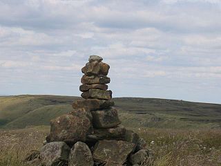
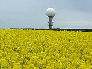
WWolds Top is the name sometimes given to the highest point of the Lincolnshire Wolds. It lies some distance to the north of the village of Normanby le Wold in Lincolnshire. The Viking Way passes close by, on a minor road, and there is a radio mast near the summit. The summit is marked with an Ordnance Survey triangulation station, which was erected in 1936, and is now used as part of the Ordnance Survey National GPS System.
Worcestershire Beacon, also popularly known as Worcester Beacon, or locally simply as The Beacon, is a hill whose summit at 425 metres (1,394 ft) is the highest point of the range of Malvern Hills that runs about 13 kilometres (8.1 mi) north-south along the Herefordshire-Worcestershire border, although Worcestershire Beacon itself lies entirely within Worcestershire.