 W
WNidderdale, historically also known as Netherdale, is one of the Yorkshire Dales in North Yorkshire, England. It is the upper valley of the River Nidd, which flows south underground and then along the dale, forming several reservoirs including the Gouthwaite Reservoir, before turning east and eventually joining the River Ouse.
 W
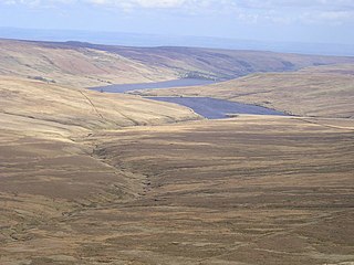
WAngram Reservoir is the first of three reservoirs on the River Nidd in Upper Nidderdale, North Yorkshire, England, the others being Scar House Reservoir and finally the compensation reservoir Gouthwaite Reservoir. It is located at OS map reference SE040759. Between them they attract around 150,000 visitors a year.
 W
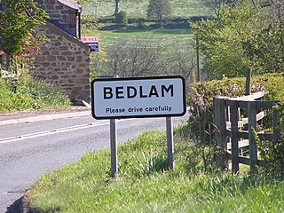
WBedlam is a small village in the Harrogate district of North Yorkshire, England situated north of Harrogate.
 W
WBirstwith is a village and civil parish in the Harrogate district of North Yorkshire, England. It is part of the Nidderdale, and is situated on the River Nidd. According to the 2001 census, the parish had a population of 756 and increased to 868 based on the 2011 Census.
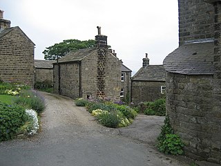
WBouthwaite is a hamlet in the Harrogate district of North Yorkshire, England. It is situated in Nidderdale, to the north of Pateley Bridge, close to the village of Ramsgill. The Nidderdale Way and Six Dales Trail both pass through the hamlet.
 W
WBrimham Rocks, once known as Brimham Crags, is a 183.9-hectare (454-acre) biological Site of Special Scientific Interest (SSSI) and Geological Conservation Review (GCR) site, 8 miles (13 km) north west of Harrogate, North Yorkshire, England, on Brimham Moor in the Nidderdale Area of Outstanding Natural Beauty. The site, notified as SSSI in 1958, is an outcrop of Millstone Grit, with small areas of birch woodland and a large area of wet and dry heath.
 W
WBurnt Yates is a village in the Borough of Harrogate in North Yorkshire, England.
 W
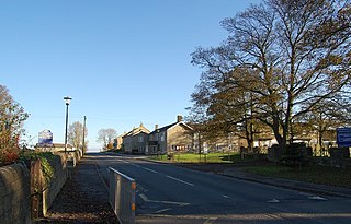
WClint is a village in Nidderdale in North Yorkshire, England. It lies on the north bank of the River Nidd, 4 miles north-west of Harrogate. Clint is the largest village in the civil parish of Clint cum Hamlets, which also includes the settlements of Burnt Yates and Bedlam.
WDacre is a village and civil parish in the Harrogate district of North Yorkshire, England, it is 5 miles south of Pateley Bridge. In the 2001 census the parish had a population of 658, increasing to 764 at the 2011 Census. The village is situated on the crest of a hill overlooking the River Nidd. Infrastructure of the village includes a small chapel and an old single-room schoolhouse which is currently used for community events.
 W
WDarley is a linear village in Nidderdale in the Harrogate district of North Yorkshire, England. The population as at the 2011 Census is 1,332 and is included in the civil parish of Darley and Menwith. The village extends for 1 mile east from a junction with the B6451 road. The western end of the village is known as Darley Head and the eastern end as The Holme. Darley has won many local and national 'Britain in Bloom' awards.
 W
WFelliscliffe is a civil parish in North Yorkshire, England, in Nidderdale, Harrogate borough. The population of the civil parish at the 2011 census was 283. The principal settlement in the parish is the village of Kettlesing, and the parish also includes the hamlet of Swincliffe. Felliscliffe was historically a township in the ancient parish of Hampsthwaite in the West Riding of Yorkshire, first mentioned in the Domesday Book as Felgesclif, apparently from an Old Danish personal name Felagh.
 W
WHMS Forest Moor was a Royal Navy land base located in Nidderdale in the borough of Harrogate, North Yorkshire, England.
 W
WGlasshouses is a small village in Nidderdale, North Yorkshire, England. It lies 1 mile (1.6 km) south-east of Pateley Bridge on the east side of Nidderdale and has a recently rebuilt river bridge across the River Nidd.
 W
WGouthwaite Reservoir is a reservoir in Nidderdale, North Yorkshire, England. It is one of many in the area, others include Roundhill Reservoir and Angram Reservoir.
 W
WGreat Whernside is a fell in the Yorkshire Dales, England, not to be confused with Whernside, some 17 miles (27 km) to the west. Its summit is the highest point of the eastern flank of Wharfedale above Kettlewell. Great Whernside forms the watershed between Wharfedale and Nidderdale, and is on the boundary between the Yorkshire Dales National Park and Nidderdale Area of Outstanding Natural Beauty. The River Nidd rises on the eastern slopes of Great Whernside, above Angram Reservoir.
WGreenhow is a village in North Yorkshire, England, often referred to as Greenhow Hill. The term how derives from the Old Norse word haugr meaning a hill and a mound, so Greenhow literally means 'Green's hill or mound'.
 W
WHampsthwaite is a large village and civil parish in Nidderdale in the Harrogate district of North Yorkshire, England. It lies on the south bank of the River Nidd 5 miles (8 km) north west of Harrogate. In the 2011 census the parish had a population of 1,083.
 W
WHeathfield is a hamlet in the civil parish of Stonebeck Down in upper Nidderdale, in North Yorkshire, England. It lies on a broad terrace on the west side of the dale, overlooking a steep slope down to the River Nidd.
 W
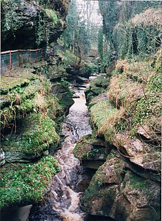
WHow Stean Gorge is a limestone gorge in Nidderdale in North Yorkshire, England. It forms a unit of the Upper Nidderdale Site of Special Scientific Interest. The gorge lies between the villages of Stean and Lofthouse and extends for about a kilometre along the course of How Stean Beck, a tributary of the River Nidd.
 W
WKnaresborough is a market and spa town and civil parish in the Borough of Harrogate, North Yorkshire, England, on the River Nidd 4 miles (6.4 km) east of Harrogate.
 W
WLittle Whernside is a hill in the Yorkshire Dales, North Yorkshire, England, 2.82 miles (4.54 km) north east of Great Whernside. It is on the boundary between the Yorkshire Dales National Park and Nidderdale Area of Outstanding Natural Beauty, and forms part of the watershed between Coverdale and Nidderdale. The highest point is marked by a cairn, a few metres inside the National Park.
 W
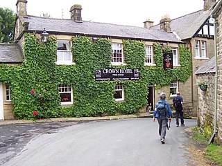
WLofthouse is a small village in Nidderdale in the Harrogate district of North Yorkshire, England about a mile south of Middlesmoor. It is the principal settlement in the civil parish of Fountains Earth. Lofthouse has a primary school, memorial village hall and public house, the Crown Hotel. The post office in the village closed in August 2014, and was replaced by a post office in the cafe at nearby How Stean Gorge, also now closed.
 W
WMeugher (/ˈmuː.fər/) is a hill in the Yorkshire Dales, England. It lies in remote country between Wharfedale and Nidderdale, in the parish of Stonebeck Down less than 1 kilometre (0.6 mi) outside the Yorkshire Dales National Park but within the Nidderdale Area of Outstanding Beauty. The hill has a conical peak topped by an Ordnance Survey triangulation pillar, and has been described as "perhaps the remotest and least inviting summit in the Yorkshire Dales". No public rights of way approach the summit, but since the Countryside and Rights of Way Act 2000 it has been on open access land. It can be accessed by a shooting track from near Lofthouse, which now approaches within 430 metres of the summit, or from a public footpath a mile north west of the summit, leading from Middlesmoor to Conistone.
 W
WMiddlesmoor is a small hill village at the head of Nidderdale in the Harrogate district of North Yorkshire, England. Middlesmoor is the principal settlement in the civil parish of Stonebeck Up, historically a township in the ancient parish of Kirkby Malzeard in the West Riding of Yorkshire.
 W
WNew York is a settlement in Nidderdale in the Harrogate district of North Yorkshire, England. It is on the River Nidd, near Summerbridge, and about 2.5 miles (4 km) south-east of Pateley Bridge.
 W
WThe River Nidd is a tributary of the River Ouse in the English county of North Yorkshire. In its first few miles it is dammed three times to create Angram Reservoir, Scar House Reservoir and Gouthwaite Reservoir, which attract a total of around 150,000 visitors a year. The Nidd can overflow the reservoirs, flooding the caves in the valley. In such cases the river overflows into the normally dry river bed past Lofthouse through to Gouthwaite Reservoir. The Yorkshire Dales Rivers Trust YDRT has a remit to conserve the ecological condition of the River Nidd from its headwaters to the Humber estuary.
 W
WThe Nidd Aqueduct is an aqueduct or man-made watercourse in North Yorkshire, England. It feeds water from Angram and Scar House reservoirs in upper Nidderdale, North Yorkshire 32 mi (51 km) to Bradford in West Yorkshire. The aqueduct supplies 21,000,000 imp gal (95,000 m3) of water per day to Chellow Heights water treatment works. The aqueduct and the reservoirs it connects to are all maintained by Yorkshire Water.
 W
WNidd Valley Light Railway, was a light railway in upper Nidderdale in the West Riding of Yorkshire, England. It was owned by Bradford Corporation Waterworks Department and the Corporation also operated its public passenger services. Power & Traction Ltd of London obtained a Light Railway Order for the 6.5-mile (10.5 km) railway from Pateley Bridge to Lofthouse in 1900, but these powers were taken over by Bradford Corporation. A contract to build Angram Reservoir was awarded to John Best & Son in 1903, and he also won the contract to build the public railway and a 6.5-mile (10.5 km) private extension to the reservoir site. This was initially built to 3 ft gauge but was converted to standard gauge by 1907, when the public railway opened. Best had his own locomotives, and Bradford Corporation equipped the public railway with second hand locomotives and carriages from the Metropolitan Railway.
 W
WThe Nidderdale Greenway is a 4-mile (6.4 km) path that runs between Harrogate and Ripley in North Yorkshire, England. It uses a former railway line that ran between Harrogate and Pateley Bridge as its course. The route connects to other cycle paths including the Way of the Roses.
 W
WThe Nidderdale Way is a 54 miles (87 km) circular long distance footpath in Nidderdale in North Yorkshire, England.
 W
WPateley Bridge is a small market town in Nidderdale in the Borough of Harrogate, North Yorkshire, England. Historically part of the West Riding of Yorkshire, it lies on the River Nidd.
 W
WRoyal Air Force Menwith Hill is a Royal Air Force station near Harrogate, North Yorkshire, England, which provides communications and intelligence support services to the United Kingdom and the United States. The site contains an extensive satellite ground station and is a communications intercept and missile warning site. It has been described as the largest electronic monitoring station in the world.
 W
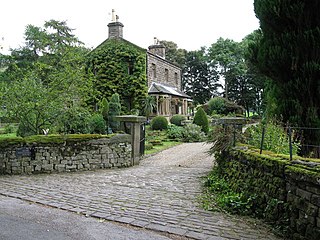
WRamsgill is a small village in Nidderdale, North Yorkshire, England, about 2 miles (3.2 km) south-east of Lofthouse. It lies near Gouthwaite Reservoir. It is chiefly known for the Yorke Arms, a Michelin-starred restaurant on the village green which takes its name from the lords of the manor, the Yorke family, who once lived in nearby Gouthwaite Hall.
 W
WRamsgill railway station was a station on the Nidd Valley Light Railway in Nidderdale in Yorkshire, England. It opened in 1907 and closed in 1930. It was located in Bouthwaite, 0.3 miles (0.5 km) from the village of Ramsgill, then in the West Riding of Yorkshire but now in North Yorkshire. The station is now a private residence, though the platform can still be seen.
 W
WScar House Reservoir is the second of the three reservoirs in Upper Nidderdale, England, the others being Angram Reservoir and Gouthwaite Reservoir. Between them they attract around 150,000 visitors a year.
 W
WScotgate Ash Quarry or Scot Gate Ash Quarry, was the collective name for extensive quarry workings that were on the northern edge of Pateley Bridge, North Yorkshire, England. When the quarry was last in use, the area was in the West Riding of Yorkshire, and was described as being the largest quarry in West Yorkshire.
 W
WShaw Mills is a hamlet in the civil parish of Bishop Thornton, Shaw Mills and Warsill, in Nidderdale in the Harrogate district, North Yorkshire, England. It lies in the valley of Thornton Beck, a tributary of the River Nidd, 6 miles (10 km) north west of Harrogate.
WStean is a small village in upper Nidderdale in North Yorkshire, England. It is 8 miles (13 km) north of Pateley Bridge.
 W
WStonebeck Down is a civil parish in Harrogate district, North Yorkshire, England. The main settlements in the parish are the village of Ramsgill and the hamlets of Stean and Heathfield. The population of the parish in the 2011 census was 192.
 W
WStonebeck Up is a civil parish in Harrogate district, North Yorkshire, England. The only village in the parish is Middlesmoor. The population of the parish in the 2011 census was 119.
 W
WStump Cross Caverns is a limestone cave system between Wharfedale and Nidderdale in North Yorkshire, England.
 W
WSummerbridge is a village in Nidderdale in Harrogate district, North Yorkshire, England. It is on the River Nidd, adjacent to Dacre Banks on the opposite bank of the river, and lies about 2.5 miles (4 km) south east of Pateley Bridge. The village is part of the historic West Riding of Yorkshire.
 W
WThornthwaite is a small village in the Harrogate district of North Yorkshire, England. It lies in the valley of Padside Beck, a side valley on the south side of Nidderdale, 9 miles (14 km) west of Harrogate.
 W
WWath, sometimes known as Wath-in-Nidderdale to distinguish it from other places named Wath, is a village in the Harrogate district of North Yorkshire, England. It is near Gouthwaite Reservoir and about 3 miles (4.8 km) north of Pateley Bridge.
 W
WWilsill is a village in Nidderdale in the Harrogate district of North Yorkshire, England. It is about 2 miles (3 km) east of Pateley Bridge on the B6165 road between Pateley Bridge and Ripley. In 2016, Harrogate Borough Council estimated the population as being 176.
 W
WThe Yorke Arms is a luxurious country house for hire in the stunning Yorkshire Dales.