 W
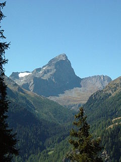
WThe Albis is a chain of hills in the Canton of Zürich, Switzerland, stretching for some 19 km from Sihlbrugg in the south to Waldegg near Zürich in the north. The chain forms, among others, the border between the Affoltern and Horgen districts. The best known point is Uetliberg at 870 m, overlooking the city of Zürich. Other points of interest include the Albishorn (909m.) the Bürglen, the Schnabelburg, an observation tower, the Albis Pass, the small town of Buechenegg, and the extensive woods on both sides of the river Sihl. The Sihl Valley borders the Albis chain on its entire east side. On the west side, the Albis is bordered by various streams and one lake, the Türlersee.
 W
WThe Albula Alps are a mountain range in the Alps of eastern Switzerland. They are considered to be part of the Central Eastern Alps, more specifically the Western Rhaetian Alps. They are named after the river Albula. The Albula Alps are separated from the Oberhalbstein Alps in the west by the Septimer Pass and the valley of the Sursés; from the Plessur Alps in the north-west by the Landwasser valley; from the Silvretta group in the north-east by the Flüela Pass; from the Bernina Range in the south-east by the Maloja Pass and the Inn valley.
 W
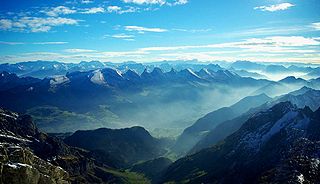
WThe Alps are the highest and most extensive mountain range system that lies entirely in Europe, and stretch approximately 1,200 km (750 mi) across eight Alpine countries : France, Switzerland, Monaco, Italy, Liechtenstein, Austria, Germany, and Slovenia. The Alpine arch generally extends from Nice on the western Mediterranean to Trieste on the Adriatic and Vienna at the beginning of the Pannonian basin. The mountains were formed over tens of millions of years as the African and Eurasian tectonic plates collided. Extreme shortening caused by the event resulted in marine sedimentary rocks rising by thrusting and folding into high mountain peaks such as Mont Blanc and the Matterhorn. Mont Blanc spans the French–Italian border, and at 4,809 m (15,778 ft) is the highest mountain in the Alps. The Alpine region area contains about a hundred peaks higher than 4,000 m (13,000 ft).
 W
WThe Alpstein are a subgroup of the Appenzell Alps in Switzerland. The Alpstein massif is in Appenzell Innerrhoden, Appenzell Ausserrhoden and St. Gallen.
 W
WThe Appenzell Alps are a mountain range in Switzerland on the northern edge of the Alps. They extend into the cantons of Appenzell Ausserrhoden, Appenzell Innerrhoden and St. Gallen and are bordered by the Glarus Alps to the west and the Rätikon to the south-east.
 W
WThe Bernese Alps are a mountain range of the Alps, located in western Switzerland. Although the name suggests that they are located in the Berner Oberland region of the canton of Bern, portions of the Bernese Alps are in the adjacent cantons of Valais, Fribourg and Vaud, the latter being usually named Fribourg Alps and Vaud Alps respectively. The highest mountain in the range, the Finsteraarhorn, is also the highest point in the canton of Bern.
 W
WThe Bernese Alps in the wide meaning are a mountain range in the northwestern part of the Alps. They are located in Switzerland.
 W
WThe Central Eastern Alps, also referred to as Austrian Central Alps or just Central Alps comprise the main chain of the Eastern Alps in Austria and the adjacent regions of Switzerland, Liechtenstein, Italy and Slovenia.
 W
WThe Chablais Alps are a mountain range in the western Alps. They are situated between Lake Geneva and the Mont Blanc Massif. The Col des Montets separates them from the Mont Blanc Massif in the south, and the Rhône valley separates them from the Bernese Alps in the east.
 W
WThe Dinkelberg is a partially forested hill range, up to 536.2 m above sea level (NHN), about 145 km² in area, in the High Rhine region of Germany. It lies within the counties of Lörrach and Waldshut in the German state of Baden-Württemberg and the Swiss canton of Basel-Stadt. It is on the southwestern edge of the Southern Black Forest, from which it is geologically distinct.
 W
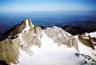
WThe Dufourspitze is the highest peak of Monte Rosa, a huge ice-covered mountain massif in the Alps. Dufourspitze is the highest mountain peak of both Switzerland and the Pennine Alps and is also the second-highest mountain of the Alps and Western Europe, after Mont Blanc. It is located between Switzerland and Italy.
 W
WEastern Alps is the name given to the eastern half of the Alps, usually defined as the area east of a line from Lake Constance and the Alpine Rhine valley up to the Splügen Pass at the Alpine divide and down the Liro River to Lake Como in the south. The peaks and mountain passes are lower than the Western Alps, while the range itself is broader and less arched.
 W
WThe Emmental Alps are a mountain range in the western part of the Alps, in Switzerland. They are located north-west of the Brünig Pass, mainly in the cantons of Lucerne, Bern, and Obwalden, with a small portion in the canton of Nidwalden. The highest summit of the range is the Brienzer Rothorn, which is also the highest point in the canton of Lucerne. The range is named after the Emme valley. In the north-west corner one finds the relatively low, but widespread, and very furrowed Napf.
 W
WThe Gastlosen are a mountain range of the Swiss Prealps, lying between the cantons of Fribourg, Bern and Vaud. They form a 12 km (7.5 mi) chain stretching from Jaun to Rougemont, culminating at the Dent de Savigny, elevation 2,252 m (7,388 ft), just south-west of the Dent de Ruth, where the three cantonal borders meet.
 W
WThe Glarus Alps are a mountain range in central Switzerland. They are bordered by the Uri Alps and the Schwyz Alps to the west, the Lepontine Alps to the south, the Appenzell Alps to the northeast. The eastern part of the Glarus Alps contains a major thrust fault which was declared a geologic UNESCO world heritage site.
 W
WThe Graian Alps are a mountain range in the western part of the Alps.
 W
WThe Jura Mountains are a sub-alpine mountain range a short distance north of the Western Alps and mainly demarcate a long part of the French-Swiss border.
 W
WThe Lepontine Alps are a mountain range in the north-western part of the Alps. They are located in Switzerland and Italy.
 W
WThe Livigno Alps are a mountain range in the Alps of eastern Switzerland and northern Italy, around the Italian village Livigno. They are considered to be part of the Central Eastern Alps.
 W
WThe Lugano Prealps are a mountain range in the western part of the Alps. They are located in Canton Ticino and in Lombardy.
 W
WThe Mont Blanc massif is a mountain range in the Alps, located mostly in France and Italy, but also straddling Switzerland at its northeastern end. It contains eleven major independent summits, each over 4,000 metres (13,123 ft) in height. It is named after Mont Blanc, the highest point in western Europe and the European Union. Because of its considerable overall altitude, a large proportion of the massif is covered by glaciers, which include the Mer de Glace and the Miage Glacier – the longest glaciers in France and Italy, respectively.
 W
WThe Oberhalbstein Alps or Platta Group are a mountain range in the Alps of eastern Switzerland and northern Italy. They are considered to be part of the Central Eastern Alps. The Oberhalbstein Alps are separated from the Lepontine Alps in the west by the Splügen Pass; from the Plessur Range in the north by the river Albula; from the Albula Alps in the east by the Septimer Pass and the river Gelgia; from the Bernina Range in the south by the Val Bregaglia.
 W
WThe Ortler Alps are a mountain range of the Southern Limestone Alps mountain group in the Central Eastern Alps, in Italy and Switzerland.
 W
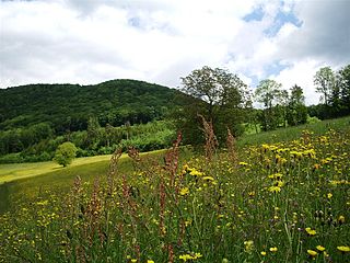
WPfannenstiel is a wooded mountain respectively a region overlooking the Lake Zürich and Zürcher Oberland in the canton of Zürich in Switzerland.
 W
WThe Plessur Alps are a mountain range in the Alps of eastern Switzerland. They are considered to be part of the Western Rhaetian Alps. They are named after the river Plessur, which originates from the center of the ranges. The Plessur Alps are separated from the Glarus Alps in the west by the Rhine valley; from the Rätikon range in the north by the Landquart river valley (Prättigau); from the Albula Alps in the south-east by the Landwasser river valley; from the Oberhalbstein Alps in the south by the Albula river valley.
 W
WThe Randen is a small mountain range located between the Jura and the Swabian Jura, north of the Rhine. Predominantly located in the Swiss canton of Schaffhausen, they culminate in the German state of Baden-Württemberg. The Randen are situated north of Schaffhausen and south of Blumberg.
 W
WThe Rätikon is a mountain range of the Central Eastern Alps, located at the border between Vorarlberg, Liechtenstein and Graubünden. It is the geological border between the Eastern and Western Alps and stretches from the Montafon as far as the Rhine. In the south, the Prättigau is its limit, and in the north, it is the Walgau. In the east, it borders the Silvretta groups. The Rätikon mountain range derives its name from Raetia, a province of the Roman Empire, named after the Rhaetian people.
 W
WThe Rhaetian Alps are a mountain range of the Eastern Alps. The SOIUSA classification system divides them into the Western and Eastern Rhaetian Alps, while the Alpine Club classification of the Eastern Alps places most of the Rhaetion subranges within the Western Limestone Alps.
 W
WMonte Rosa is a mountain massif in the eastern part of the Pennine Alps. It is between Italy's and Switzerland's (Valais). Monte Rosa is the second highest mountain in the Alps and western Europe, after Mont Blanc.
 W
WThe Saint-Gotthard Massif is a mountain range in the Alps in Switzerland, located at the border of four cantons: Valais, Ticino, Uri and Graubünden. It is delimited by the Nufenen Pass on the west, by the Furka Pass and the Oberalp Pass on the north and by the Lukmanier Pass on the east. The homonymous Gotthard Pass, lying at the heart of the massif, is the main route from north to south.
 W
WThe Savoy Prealps are a mountain range in the north-western part of the Alps. They are located in Rhône-Alpes and, marginally, in Valais. Savoy Prealps encompass northernmost area of the French Prealps.
 W
WThe Schwyz Alps are a mountain range in Switzerland. They form part of the North-Eastern Swiss Alps and are bordered by the Glarus Alps to the east, the Appenzell Alps to the north-east, the Emmental Alps in the west, and the Uri Alps to the south-west. The Klausen Pass is the highest point between the Schwyz Alps and the Glarus Alps.
 W
WThe Sesvenna Alps are a mountain range located in the Alps of eastern Switzerland, northern Italy and western Austria. They are considered to be part of the Central Eastern Alps.
 W
WThe Silvretta Alps are a mountain range of the Central Eastern Alps shared by Tirol, Vorarlberg and Graubünden (Switzerland). The Austrian states of Tirol and Vorarlberg are connected by a pass road. The majority of the peaks are elevated above three thousand metres and are surrounded by glaciers. Thus, the area is also known as the "Blue Silvretta".
 W
WThe Southern Limestone Alps are the ranges of the Eastern Alps south of the Central Eastern Alps mainly located in northern Italy and the adjacent lands of Austria and Slovenia. The distinction from the Central Alps, where the higher peaks are located, is based on differences in geological composition. The Southern Limestone Alps extend from the Sobretta-Gavia range in Lombardy in the west to the Pohorje in Slovenia in the east.
 W
WThe Uri Alps are a mountain range in Central Switzerland and part of the Western Alps. They extend into the cantons of Obwalden, Valais, Bern, Uri and Nidwalden and are bordered by the Bernese Alps and the Emmental Alps to the west, the Schwyzer Alps to the north, the Lepontine Alps to the south and the Glarus Alps to the east (Reuss).
 W
WThe Western Alps are the western part of the Alpine range including the southeastern part of France, the whole of Monaco, the northwestern part of Italy and the southwestern part of Switzerland. In the southeast the range is bounded by the Italian Padan Plain. In the west, the valley of the Rhone river separates it from the Massif Central. The northernmost part of the Western Alps - in the wide meaning of the term - is formed by the Swiss Prealps sub-range.