 W
WBannock Creek is a 67-mile (110 km) long tributary of the Snake River in the U.S. state of Idaho. Beginning at an elevation of 5,953 feet (1,814 m) north of Holbrook in northern Oneida County, it flows north into Power County and through the Arbon Valley, the town of Pauline, and the Fort Hall Indian Reservation. It then reaches its mouth at American Falls Reservoir, and impoundment of the Snake River, midway between the towns of American Falls and Pocatello, at an elevation of 4,357 feet (1,328 m). Bannock Creek has a 475-square-mile (1,230 km2) watershed.
 W
WThe Big Wood River is a 137-mile-long (220 km) river in central Idaho, United States, that is a tributary of the Malad River.
 W
WThe Blackfoot River is a tributary of the Snake River in the U.S. state of Idaho. Formed by the confluence of Diamond Creek and Lanes Creek, it flows 135 miles (217 km) to its mouth at the Snake River. The river is part of the Columbia River Basin.
 W
WThe Boise River is a 102-mile-long (164 km) tributary of the Snake River in the northwestern United States. It drains a rugged portion of the Sawtooth Range in southwestern Idaho northeast of Boise, as well as part of the western Snake River Plain. The watershed encompasses approximately 4,100 square miles (11,000 km2) of highly diverse habitats, including alpine canyons, forest, rangeland, agricultural lands, and urban areas.
 W
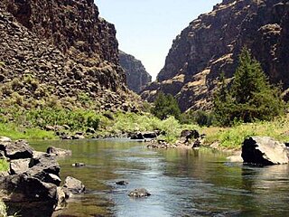
WThe Bruneau River is a 153-mile-long (246 km) tributary of the Snake River, in the U.S. states of Idaho and Nevada. It runs through a narrow canyon cut into ancient lava flows in southwestern Idaho. The Bruneau Canyon, which is up to 1,200 feet (370 m) deep and 40 miles (64 km) long, features rapids and hot springs, making it a popular whitewater trip.
 W
WThe Burnt River is a 98-mile-long (158 km) tributary of the Snake River in eastern Oregon, United States. It enters the Snake near Huntington, Oregon, at a point upstream of the Powder River and downstream of the Malheur River, slightly more than 327 miles (526 km) from the Snake's confluence with the Columbia River. Draining 1,090 square miles (2,800 km2), it flows predominantly west to east.
 W
WThe Clearwater River is in the northwestern United States, in north central Idaho. Its length is 74.8 miles (120.4 km), it flows westward from the Bitterroot Mountains along the Idaho-Montana border, and joins the Snake River at Lewiston. In October 1805, the Lewis and Clark Expedition descended the Clearwater River in dugout canoes, putting in at "Canoe Camp," five miles (8 km) downstream from Orofino; they reached the Columbia Bar and the Pacific Ocean about six weeks later.
 W
WGoose Creek is a 123-mile (198 km) long tributary of the Snake River. Beginning at an elevation of 7,239 feet (2,206 m) in the Cassia Division of the Sawtooth National Forest in southwestern Cassia County, Idaho, it flows south into Elko County, Nevada, and loops back around into Cassia County, briefly crossing Box Elder County, Utah, in the process. It is impounded by Oakley Dam several miles south of Oakley, Idaho, forming Lower Goose Creek Reservoir. All of the creek's water is stored for irrigation, so its channel from the reservoir to its mouth near Burley, Idaho, is dry and largely obliterated by agriculture. Goose Creek has a 1,120-square-mile (2,901 km2) watershed. The California Trail followed Goose Creek from a point just north of the Idaho/Utah border southwest across northwestern Utah to Little Goose Creek in northeastern Elko County, Nevada.
 W
WThe Grande Ronde River is a tributary of the Snake River, 182 miles (293 km) long, in northeastern Oregon and southeastern Washington in the United States. It drains an area southeast of the Blue Mountains and northwest of the Wallowa Mountains, on the Columbia Plateau. It flows through the agricultural Grande Ronde Valley in its middle course and through a series of scenic canyons in its lower course.
 W
WThe Greys River is a tributary of the Snake River, flowing through western Wyoming in the United States. The river is about 62 miles (100 km) long, starting high up in the Wyoming Range, 45 miles (72 km) south of the town of Alpine in Lincoln County. The river eventually flows into the Snake River in the Snake River Canyon, joining it just east of Alpine. The Greys River is generally a rushing mountain stream that separates the high Wyoming Range (east) from the Salt River Range (west). It joins the Snake River just above the intersection of U.S. highways 89 and 26. Just a short distance downriver from the confluence of the two rivers, the Snake widens quickly and passes through Alpine and enters the Palisades Reservoir. The largest tributary of the Greys River is the Little Greys River. At Alpine, Wyoming, the Greys River measures 654 cubic feet per second average. With a 180 cuft/s min. and a 3,004 max.
 W
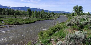
WThe Gros Ventre River is a 74.6-mile-long (120.1 km) tributary of the Snake River in the state of Wyoming, USA. During its short course, the river flows to the east, north, west, then southwest. It rises in the Gros Ventre Wilderness in western Wyoming, and joins the Snake River in the Jackson Hole valley. In 1925, the massive Gros Ventre landslide dammed the river and formed Lower Slide Lake. The natural dam collapsed in 1927, flooding the downstream town of Kelly, Wyoming. The river is noted for the excellent trout fishing along its length, where native Snake River Fine-spotted Cutthroat Trout average 12 to 16 inches, with some to 20 inches (510 mm).
 W
WThe Heart River is a 4.8-mile-long (7.7 km) river in the U.S. state of Wyoming, tributary to the Snake River. Its entire course is contained inside Yellowstone National Park. The river rises on the Continental Divide, in the Rocky Mountains, a few miles southeast of Yellowstone Lake. Its headwater streams flow into Heart Lake, from whose southeastern end the main Heart River issues, receiving two tributary streams from the northeast and flowing southwest into a short but steep gorge. It then continues generally south for roughly 4 miles (6 km) before emptying into the Snake near the boundary with the Teton National Forest.
 W
WHenrys Fork is a tributary river of the Snake River, approximately 127 miles (204 km) long, in southeastern Idaho in the United States. It is also referred to as the North Fork of the Snake River. Its drainage basin is 3,212 square miles (8,320 km2), including its main tributary, the Teton River. Its mean annual discharge, as measured at river mile 9.2 by the United States Geological Survey (USGS), is 2,096 cubic feet per second (59.4 m3/s), with a maximum daily recorded flow of 79,000 cubic feet per second (2,240 m3/s), and a minimum of 183 cubic feet per second (5.18 m3/s).
 W
WThe Hoback River, once called the Fall River, is an approximately 55-mile (89 km)-long tributary of the Snake River in the U.S. state of Wyoming. It heads in the northern Wyoming Range of Wyoming and flows north and then east through the Bridger-Teton National Forest. Its largest tributary is its South Fork, which joins the Hoback about nine miles downstream of its head as it turns northeast and continues to U.S. Route 191. It then turns northwest, where it spreads onto a large marshy flat in a braided floodplain once known as Jackson's Little Hole, but now referred to as the "Hoback Basin" in which lies the town of Bondurant. It then enters the steep, narrow Hoback Canyon from which it emerges to join the Snake about 11 miles (18 km) south of Jackson Hole, just upstream of head of the Snake River Canyon near the town of Hoback. The entire length of the Hoback is free flowing and unobstructed by dams. About 30 miles (48 km) downstream from the confluence with the Hoback River, the Snake River crosses into the state of Idaho and is impounded by Palisades Dam.
 W
WThe Imnaha River is a 73.3-mile-long (118.0 km) tributary of the Snake River in the U.S. state of Oregon. Flowing generally east near the headwaters and then north through Wallowa County, the entire river is designated Wild and Scenic. It follows a geologic fault to the Snake River, and in addition to land in the Wallowa–Whitman National Forest and private land, its corridor includes parts of three special management areas: the Eagle Cap Wilderness, Hells Canyon National Recreation Area, and Hells Canyon Scenic Byway. The Imnaha flows by the unincorporated community of Imnaha, the only settlement along its course, and enters the Snake River roughly 4 miles (6 km) from the larger river's confluence with the Salmon River of Idaho and 192 miles (309 km) from its confluence with the Columbia River.
 W
WThe Lewis River is an 18.1-mile-long (29.1 km) tributary of the Snake River. The entire course of the river is located within the boundaries of Yellowstone National Park in Wyoming, US. The river is named for Meriwether Lewis, commander of the Lewis and Clark Expedition.
 W
WLittle Wood River is a 130-mile-long (210 km) river in south-central Idaho in the United States. It is a tributary of the Malad River, which in turn is tributary to the Snake River and Columbia River.
 W
WThere are two rivers in Idaho named "Lost", the Big Lost River and the Little Lost River. They are often considered separate streams, but both flow into the same depression and become subterranean, feeding the Snake River Aquifer. The rivers are located in Custer County and Butte County, in Idaho in the United States. Via the aquifer and numerous springs, they are tributaries of the Snake River.
 W
WThe Malad River is river located entirely within Gooding County, Idaho, United States, and is a tributary of the Snake River.
 W
WThe Malheur River is a 190-mile-long (306 km) tributary of the Snake River in eastern Oregon in the United States. It drains a high desert area, between the Harney Basin and the Blue Mountains and the Snake.
 W
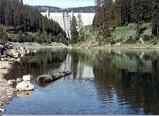
WThe North Fork Clearwater River is a major tributary of the Clearwater River in the U.S. state of Idaho. From its headwaters in the Bitterroot Mountains of eastern Idaho, it flows 135 miles (217 km) westward and is dammed by the Dworshak Dam just above its mouth in north-central Idaho. Draining a rugged watershed of 2,462 square miles (6,380 km2), the river has an average flow of over 5,600 cubic feet per second (160 m3/s), accounting for a third of the discharge from the Clearwater basin. The river drains parts of Clearwater, Shoshone, Latah, and Idaho counties. Most of the watershed is managed by the U.S. Forest Service. Some of the fish of the river include westslope cutthroat trout, rainbow trout, mountain whitefish, and the threatened bull trout. It also has smallmouth bass and a kokanee salmon run, both from Dworshak Reservoir. The North Fork drainage is home to grizzly bears, cougars, deer, moose, black bear, elk, grey wolves, and osprey. The river used to have a large steelhead run before the implementation of Dworshak Dam. The North Fork of the Clearwater is located within the Clearwater National Forest
 W
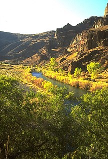
WThe Owyhee River is a tributary of the Snake River located in northern Nevada, southwestern Idaho and southeastern Oregon in the United States. It is 280 miles (450 km) long. The river's drainage basin is 11,049 square miles (28,620 km2) in area, one of the largest subbasins of the Columbia Basin. The mean annual discharge is 995 cubic feet per second (28.2 m3/s), with a maximum of 50,000 cu ft/s (1,400 m3/s) recorded in 1993 and a minimum of 42 cu ft/s (1.2 m3/s) in 1954.
 W
WThe Palouse River is a tributary of the Snake River in Washington and Idaho, in the northwest United States. It flows for 167 miles (269 km) southwestwards, primarily through the Palouse region of southeastern Washington. It is part of the Columbia River Basin, as the Snake River is a tributary of the Columbia River.
 W
WThe Payette River is an 82.7-mile-long (133.1 km) river in southwestern Idaho and is a major tributary of the Snake River.
 W
WThe Portneuf River is a 124-mile-long (200 km) tributary of the Snake River in southeastern Idaho, United States. It drains a ranching and farming valley in the mountains southeast of the Snake River Plain. The city of Pocatello sits along the river near its emergence from the mountains onto the Snake River Plain.
 W
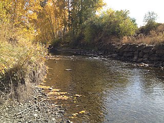
WThe Potlatch River is in the state of Idaho in the United States. About 56 miles (90 km) long, it is the lowermost major tributary to the Clearwater River, a tributary of the Snake River that is in turn a tributary of the Columbia River. Once surrounded by arid grasslands of the Columbia Plateau adjacent to the western foothills of the Rocky Mountains, the Potlatch today is used mainly for agriculture and irrigation purposes.
 W
WThe Powder River is a tributary of the Snake River, approximately 153 miles (246 km) long, in northeast Oregon in the United States. It drains an area of the Columbia Plateau on the eastern side of the Blue Mountains. It flows almost entirely within Baker County but downstream of the city of North Powder forms part of the border between Baker County and Union County.
 W
WThe Raft River is a 108-mile-long (174 km) tributary of the Snake River located in northern Utah and southern Idaho in the United States. It is part of the Columbia River Basin.
 W
WSailor Creek is a 64-mile (103 km) long tributary of the Snake River in the U.S. state of Idaho. Beginning at an elevation of 4,879 feet (1,487 m) southwest of Castleford in southeastern Owyhee County, it flows north through the Bruneau Desert, briefly crossing into Elmore County in the process. It then flows northwest to its mouth near Hammett, at an elevation of 2,467 feet (751.9 m).
 W
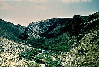
WSalmon Falls Creek is a tributary of the Snake River, flowing from northern Nevada into Idaho in the United States. Formed in high mountains at the northern edge of the Great Basin, Salmon Falls Creek flows northwards 121 miles (195 km), draining an arid and mountainous basin of 2,103 square miles (5,450 km2). The Salmon Falls Creek valley served as a trade route between the Native American groups of the Snake River Plain and Great Basin. Today, most of its water is used for irrigation.
 W
WThe Salmon River is located in Idaho in the western United States, also known as "The River of No Return." It flows for 425 miles (685 km) through central Idaho, draining a rugged, thinly populated watershed of 14,000 square miles (36,000 km2). The river drops more than 7,000 feet (2,100 m) from its headwaters, near Galena Summit above the Sawtooth Valley in the Sawtooth National Recreation Area, to its confluence with the Snake River. Measured at White Bird, its average discharge is 11,060 cubic feet per second. It is one of the largest rivers in the continental United States without a single dam on its mainstem.
 W
WThe Salt River is an 84-mile-long (135 km) river draining a valley in Lincoln County in western Wyoming. It is named for several exposed beds of salt and briny salt springs of up 60% pure salt in Idaho that drains into the Salt River via Stump Creek. The Salt River valley was a popular destination for Indians and later pioneers seeking salt and game. The headwaters of the river are below 10,472-foot (3,192 m) Mount Wagner in the Salt River Range. The river flows west out of the mountains and then northward along the border of Wyoming and Idaho. It passes 6,600-foot (2,000 m) Smoot, Wyoming and then meanders through the mostly agricultural Star Valley, being joined by numerous creeks along the way, to its confluence with the Snake River near the town of Alpine.
 W
WSuccor Creek is a 69.4-mile-long (111.7 km) tributary of the Snake River in the U.S. states of Idaho and Oregon. The creek begins in the Owyhee Mountains in Owyhee County, Idaho. After flowing for about 23 miles (37 km) in Idaho, Succor Creek enters Malheur County, Oregon, where it flows for 39 miles (63 km) before re-entering Idaho for its final 5 miles (8.0 km). It joins the Snake near Homedale, about 413 river miles (665 km) from the larger river's confluence with the Columbia River.
 W
WThe Tucannon River is a tributary of the Snake River in the U.S. state of Washington. It flows generally northwest from headwaters in the Blue Mountains of southeastern Washington to meet the Snake 4 miles (6 km) upstream from Lyons Ferry Park and the mouth of the Palouse River. The Tucannon is about 62 miles (100 km) long. Part of the upper river flows through the Wenaha–Tucannon Wilderness.
 W
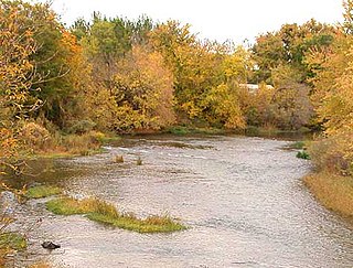
WThe Weiser River is a 103-mile-long (166 km) tributary of the Snake River in western Idaho in the United States. It drains a mountainous area of 1,660 square miles (4,300 km2) consisting primarily of low rolling foothills intersected by small streams south and east of Hells Canyon along the Idaho-Oregon border.
 W
WThe Wenaha River is a tributary of the Grande Ronde River, about 22 miles (35 km) long, in the U.S. state of Oregon. The river begins at the confluence of its north and south forks in the Blue Mountains and flows east through the Wenaha–Tucannon Wilderness to meet the larger river at the small settlement of Troy. A designated Wild and Scenic River for its entire length, the stream flows wholly within Wallowa County.