 W
WMountains constitute a significant part of Bulgaria and are dominant in the southwest and central parts. Bulgaria's highest mountains are Rila and Pirin. The large mountain chain of Stara planina runs west-east across the entire country, bisecting it and giving the name to the entire Balkan peninsula. Other extensive mountains are the massifs Rhodopes and Strandzha in the south.
 W
WBohovska planina is a mountain on the border of Serbia and Bulgaria, near the town of Bosilegrad. Its highest peak Ogorelica has an elevation of 1318 meters above sea level.
 W
WBotev Peak is, at 2,376 metres (7,795 ft) above sea level, the highest peak of the Balkan Mountains. It is located close to the geographic centre of Bulgaria, and is part of the Central Balkan National Park.
 W
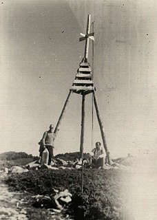
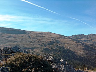
WBuzludzha is a historical peak in the Central Balkan Mountains, Bulgaria. The mountain is located to the east of the Shipka Pass near the town of Kazanlak and is a site of historical importance. The peak is 1,432 metres high. It was renamed to Hadzhi Dimitar in 1942 but remains popularly known as Buzludzha. The summit is limestone and granite. Its slopes are covered with grassy vegetation; its foothills and the neighbouring peaks sustain beech forests. The peak's name derives from Turkish: buzlu 'icy'.
 W
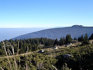
WCherni Vrah is the summit of Vitosha Mountain in Bulgaria. Rising to 2290 m, the peak is the fourth highest mountain summit in the country after Musala, Vihren, and Botev Vrah.
WČudinska planina or Chudinska planina, is a mountain on the border of Serbia and Bulgaria, near the town of Bosilegrad. Its highest peak Aramlija has an elevation of 1496 meters above sea level.
 W
WDzhendema or Djendema is an area in the Balkan mountain range in Bulgaria. The Southern Dzhendem, or just Dzhendema, occupies the southern slopes of Mount Botev 42°41′41″N 24°54′41″E. It was established as reserve on March 28, 1953. Djendema encompasses 42.2 km2, and is the largest reserve in the mountain and the second largest reserve in Bulgaria. It is centred on a granite extrusion combined with limestone outcroppings to form a labyrinth of steep slopes; deep, narrow gorges, massive rock cliffs, and huge waterfalls. Djendema Reserve shelters beech and fir forests and large meadows with unique sub-alpine grassy species and communities. Because of its specific geological and climatic conditions, the area is rich in endemic species and rare plants. One could take several days to cross Djendema. The name is derived from Ottoman Turkish cehennem 'hell'.
 W
WFalakro Oros is a mountain in the Drama regional unit, eastern Greek Macedonia, northern Greece. The elevation of its highest summit, Profitis Ilias, is 2232 meters above the sea level. There is a ski resort on the mountain.
 W
WGolyam Kupen is a peak rising to 1,930 m in Vitosha Mountain, Bulgaria. The peak is situated on the southern border of Bistrishko Branishte Biosphere Reserve, on the watershed between Vitoshka Bistritsa to the north and Selska Reka to the south, rivers flowing eastwards to the villages of Bistritsa and Zheleznitsa respectively, and eventually to Iskar River.
 W
WGolyam Perelik is the highest peak in the Rhodope Mountains, situated 19 km to the west of Smolyan. It makes the Rhodopes the seventh highest Bulgarian mountain range after Rila, Pirin, Stara Planina, Vitosha, Osogovo and Slavyanka. The peak is easily accessible, but currently cannot be climbed because a unit of the Bulgarian Army is stationed in its vicinity.
 W
WGolyam Rezen is a peak on Vitosha Mountain in Bulgaria. Rising to 2,277 m, the peak is second to the mountain's summit Cherni Vrah situated 900 m to the west. Golyam Rezen hosts an Air Traffic Services facility, as well as military communications installations. The precipitous east slopes of the peak are a popular rock climbing site, overlooking Bistritsa River Valley in Bistrishko Branishte Biosphere Reserve.
 W
WGreben is a mountain in southeastern Serbia, with a small section of the southwestern ridge in Bulgaria. It is named after a large karst ridge that runs along its spine. Greben rises near the village of Poganovo in Serbia, in the municipality of Dimitrovgrad, and extends southeast towards the Bulgarian village of Vrabcha. Prior to the Treaty of Neuilly of 1919, after the First World War, the area was part of Bulgaria.
 W
WKamen Del is a peak on Vitosha Mountain in Bulgaria. Rising to 1,862 metres (6,109 ft), and surmounting the city of Sofia, it is the most conspicuous peak seen from the Bulgarian capital. Its northern slope is partly covered by an extensive one by one km stone sea. A flat col links Kamen Del to Ushite Peak 1,960 metres (6,430 ft) to the south, hosting a small refuge on the track between Aleko and Zlatnite Mostove, the two most popular tourist sites on Vitosha.
 W
WKom Peak or Golyam Kom is a peak in the western Balkan Mountains, located in western Bulgaria, not far from the Serbian border. The peak is 2,016 metres high and lies south of the town of Berkovitsa, of which it is a traditional symbol. Kom, along with the lower peaks Sreden Kom and Malak Kom to the east, form a west-east elevation with a round grassy ridge, a steep rocky northern slope and a slant grassy southern slope. Looking north, one can see Berkovitsa and the surrounding fields, as well as Montana and the Ogosta Reservoir some 30 kilometres away.
 W
WKominite are several minor andesite peaks in the Vitosha Mountains near Sofia, Bulgaria. The peaks are in the upper valley of the Dragalevska River near the Bay Krastyo tourist site. The peaks are the nearest to and most easily accessible from a climbing area near Sofia, with climbing routes of UIAA categories II to VIII and 50 to 100 m high. The Kominite peaks can be reached easily from Dragalevtsi via the Bay Krastyo or the Goli Vrah chair lift stations.
 W
WLevski Peak is a peak in the central Balkan Mountains, in Lovech Province, Bulgaria. It is named after the famous Bulgarian revolutionary Vasil Levski. The peak is 2,166 metres (7,106 ft) high and is situated on the main ridge of the mountain range to the west of Golyam Kupen Peak.
 W
WLozen Mountain is a small mountain in Bulgaria. It is at the westernmost end of the Sredna Gora range. To the west, it is separated by the Pancharevo Gorge from the Vitosha and Plana mountains. To the north, its foothills descend into the Sofia Valley. The mountain extends for 15 kilometres (9.3 mi) in an east–west direction, while its width varies between 5 kilometres (3.1 mi) and 10 kilometres (6.2 mi). Its highest point is Popov Dyal, 1,190.2 metres (3,905 ft). It is named after the village of Lozen.
 W
WLyulin is a range of hills in western Bulgaria, located several kilometres west of Sofia. The highest point is Dupevitsa Peak. The Buchino Pass divides the hills into two, a western and an eastern part. Bonsovi Polyani are a popular tourist attraction.
 W
WMalak Rezen is a peak rising to 2,191 m in northeastern Vitosha Mountain in Bulgaria. The peak is situated 1.5 km northeast of the summit Cherni Vrah, and 1.3 km north by east of Golyam Rezen Peak, surmounting Stenata ski run and Aleko site to the north.
 W
WThe Maleshevo Mountain or Maleševo Mountain, is situated in southwestern Bulgaria and eastern North Macedonia. It is the third of the five mountains of the Osogovo-Belasitsa mountain group, known also as the Western Border Mountains. The highest point is Ilyov Vrah.
 W
WMilevska planina is a mountain in western Bulgaria and southeastern Serbia, near the town of Bosilegrad. Its highest peak Milevets or Krvavi kamik has an elevation of 1,738 meters above sea level. It is located at the border of Bulgaria and Serbia.
WMiloslavska planina is a mountain on the border of Serbia and Bulgaria, near the town of Dimitrovgrad. Its highest peak Golema rudina has an elevation of 1486 meters above sea level.
 W
WOgrazhden is a mountain shared by southeastern North Macedonia and southwestern Bulgaria, part of the Belasitsa-Osogovo group. It is located north of Belasitsa, northeast of the Macedonian town of Strumitsa and northwest of the Bulgarian town of Petrich. The highest peak of the mountain is located in North Macedonia, Ograzhdenets (Огражденец) at 1,744 m, while the highest in Bulgaria is Bilska Chuka at 1,644 m.
 W
WPlana is a mountain in western Bulgaria, bounded by Sofia Valley to the north, Iskar River to the east, Samokov Valley to the south and southwest, and Vitosha Mountain to the northwest. The summit Manastirishte rises to 1338m.
 W
WRadomir or Kerkini, is a mountain on the Bulgarian–Greek border. At 2,031 metres (6,663 ft) it is the highest peak in the Belasica range. It is also known by its earlier Greek name Kalabáka.
 W
WRuy or Ruj, is a mountain on the border of western Bulgaria and southeastern Serbia. Its eponymous highest peak rises 1,706 meters above sea level. The mountain is located west of Tran and is part of the Ruy-Verila range. On a clear day one can see Rila and Vitosha in Bulgaria and Veliki Strešer in Serbia.
 W
WSakar is a mountain in southeastern Bulgaria, between the rivers Maritsa, Tundzha, Sokolitsa and Sazliyka and close to the borders with Greece and Turkey. The mountain's highest peak is Vishegrad at 856 m.
 W
WSelimitsa is a peak rising to 2,041 m west of Torfeno Branishte Nature Reserve in northwestern Vitosha Mountain in Bulgaria. The northern slopes of the peak are occupied by the ski runs of Konyarnika Ski Centre. Linked by tracks to Kumata Chalet and Zlatnite Mostove Tourist Centre to the north, Selimitsa Chalet, Kladnitsa Monastery and Kladnitsa Village to the west, Matnitsa River valley and Chuypetlovo Village to the south, and the mountain's summit Cherni Vrah to the east.
 W
WSkoparnik is the third highest peak of Vitosha Mountain in Bulgaria. Rising to 2,226 m, the peak is situated 1.5 km south of Golyam Rezen Peak (2,277 m), and 2 km southeast of the summit Cherni Vrah (2,290 m). The peak is bounded by the Bistrishko Branishte Biosphere Reserve to the east, and a prohibited drinking water catchment area to the west, and is part of the divide between the Black Sea and the Mediterranean, with the Vitoshka Bistritsa draining its eastern slopes to flow into the Iskar River and eventually to the Danube River, and the Struma River draining the western slopes to flow into the Aegean Sea.
 W
WSredna Gora is a mountain range in central Bulgaria, situated south of and parallel to the Balkan mountain range and extending from the Iskar River to the west and the elbow of Tundzha north of Yambol to the east. Sredna Gora is 285 km long, reaching 50 km at its greatest width. Its highest peak is Golyam Bogdan at 1,604 m (5,262 ft). It is part of the Srednogorie mountain chain system, together with Vitosha, Plana (mountain), Lyulin Mountain, Greben (mountain), Viskyar Mountain, etc.
 W
WStargach is a border mountain, situated between Bulgaria and Greece. It is located east of the Slavyanka Mountain, west of the Beslen hill, south of the Pirin Mountains and north of the Kato Novrokopi valley.
 W
WTumba is a peak in the Belasica mountains in the region of Macedonia. The peak, 1,880 metres (6,170 ft) in height, lies on Belasica's main ridge, west of Lozen Peak and east of Sechena Skala Peak. A dome-shaped mountain with steep southern and northern slopes, Tumba is covered with low subalpine vegetation and is made of metamorphic rock. Tumba is notable as the point where the national borders of Bulgaria, Greece and North Macedonia meet (tripoint). It is one of the southwesternmost point of Bulgaria and one of the southeasternmost point of North Macedonia.
 W
WUshite Peak is a peak rising to 1,860 metres (6,100 ft) in northern Vitosha Mountain, Bulgaria. The peak is situated on the northern border of Torfeno Branishte Nature Reserve, and 650 m south of Kamen Del Peak. A small refuge is situated on the northeastern slopes Ushite, off track between Aleko and Zlatnite Mostove, the two most popular tourist sites on Vitosha.
 W
WVezhen is a peak in the western Balkan Mountains, located in western Bulgaria. At 2,198 metres (7,211 ft) Vezhen is the 77th highest mountain in Bulgaria. It is situated in the Teteven mountain. Its slopes mark the border of the Tsarichina Reserve. Around the peak's area is located the largest forests of Pinus peuce in the Balkan Mountains.
 W
WVidlič or Vidlich is a mountain on the border of Serbia and Bulgaria, near the town of Pirot. Its highest peak Golemi vrh has an elevation of 1,413 meters above sea level.
WVrashka Chuka or Vrška čuka is a peak in the Balkan Mountains, situated on the border between Bulgaria and Serbia. The peak is 692 metres (2,270 ft) high. Vrashka Chuka is the most northwestern peak in the Balkan mountains and part of Babin Nos mountain. Vrashka Chuka Pass is located to the north of the peak. There is a border checkpoint between Bulgaria and Serbia in the pass. The closest towns to the peak are Kula to the northeast and Zaječar to the northwest.