 W
WAnsongo is a rural commune and small town in the Gao Region of eastern Mali. The town lies on the left bank of the Niger River 90 km south of Gao. It is the administrative center for the surrounding Ansongo Cercle. The commune covers an area of 445 square kilometers and in the 2009 census had a population of 32,709.
WBaguinéda-Camp is a small town and rural commune in the Cercle of Kati in the Koulikoro Region of southern Mali. The commune contains 32 villages and in the 2009 census had a population of 58,661. The town lies to the south of the Niger River.
 W
WBamako is the capital and largest city of Mali, with a 2009 population of 1,810,366. In 2006, it was estimated to be the fastest-growing city in Africa and sixth-fastest in the world. It is located on the Niger River, near the rapids that divide the upper and middle Niger valleys in the southwestern part of the country.
 W
WBamba is a small town and rural commune in the Bourem Cercle of the Gao Region of Mali. The town is located on the left (north) bank of the Niger River, 190 km east of Timbuktu and 230 km northwest of the town of Gao. In the 2009 census the commune had a population of 28,524.
WBoky Wéré is a village and rural commune in the Cercle of Macina in the Ségou Region of southern-central Mali. The commune covers an area of approximately 220 square kilometers and includes 14 villages. The commune is bordered to the north by the commune of Monimpébougou, to the east by the commune of Kokry, to the west by the commune of Pogo and to the south by the commune of Kolongo. In the 2009 census the commune had a population of 16,934. The village lies to the north of the Fala de Boky-Wéré, an ancient riverbed that forms part of the Office du Niger irrigation system, and to the south of a large irrigation canal dug in 2009 as part of the Libyan financed Malibya project.
WBourem is a commune and small town in the Gao Region of northeastern Mali. The town sits on the left bank of the River Niger.
 W
WCité Niger, also called "Cité du Niger" is a Bamako neighborhood and an island on the Niger river. The Cité du Niger is located in the Commune 2 of the Bamako district.
 W
WDiafarabé is a village and rural commune of the Cercle of Ténenkou in the Mopti Region of Mali. The commune is at the southern boundary of the cercle. It covers an area of approximately 980 square kilometers and extends on both sides of the Niger River. The commune includes 10 villages and in the 2009 census had a population of 15,748. The main village of Diafarabé, the chef-lieu, is situated on the north bank of the river next to the junction with the Diaka Channel, a distributary that only flows when the Niger is in flood.
 W
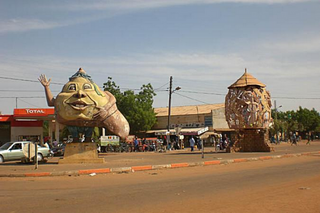
WGao, or Gawgaw/Kawkaw, is a city in Mali and the capital of the Gao Region. The city is located on the River Niger, 320 km (200 mi) east-southeast of Timbuktu on the left bank at the junction with the Tilemsi valley.
 W
WGourma-Rharous is a rural commune and small town in the Tombouctou Region of Mali. The town is the administrative center (Chef-lieu) of the Gourma-Rharous Cercle and lies on the right bank of the Niger River 110 km east of Timbuktu. The commune has an area of approximately 7,000 km2 and contains 29 villages. In the census of 2009 it had a population of 26,115. French singer Daniel Balavoine died in a helicopter crash in Gourma-Rharous as he was leading a fund-raising effort in Africa during the 1986 Dakar Rally.
 W
WJebba is a Nupe, city situated in Mokwa local Government Area of Niger State, Nigeria. It has views of the River Niger and as of 2007 had an estimated population of 22,411. The town has the benefit of being split into North and South Jebba. South Jebba falling in Kwara State and North in Niger State. It is home to the largest paper mill in West Africa, as well as being the home of one of Nigeria's three hydro-electric dams. Powering the whole of Nigeria, every day. It has also a monument to Mungo Park, in remembrance of the shipwreck which took place there, while he tried to trace the source of the Niger. More recently it has taken in 16 new residents in the form of volunteers from Nigeria and the UK. Jebba's main quality is its Islamic culture.
 W
WKabara is a small town in Mali on the Niger River, the port for Timbuktu. It is 8 km (5 mi) to the south of Timbuktu and is connected to an arm of the Niger River by a 3 km (2 mi) canal. The town has at times in the past been linked to Timbuktu by an extension of the canal. However, silting and lower water levels in recent years have made the extension canal unusable and the Kabara port usable only during the high water seasons.
 W
WKalabougou is a Bambara village on the left bank of the Niger River in the Ségou Region of Mali.
 W
WKarimama is a town, arrondissement and commune in the Alibori Department of northeastern Benin. The commune covers an area of 6102 square kilometres and as of 2013 had a population of 66,675 people. The town lies on the border with Niger.
 W
WKoïma is a village in the Commune of Gao in the Cercle of Gao in the Gao Region of south-eastern Mali. It lies on the Niger River.
 W
WKokry is a village and rural commune in the Cercle of Macina in the Ségou Region of southern-central Mali. The commune covers an area of approximately 160 square kilometers and includes 17 villages. The farmland is irrigated by the Office du Niger irrigation scheme. The main crop is rice. In the 2009 census the commune had a population of 13,393. The main village, (chef-lieu), is called Kokry Centre to distinguish it from Kokry Bozo which lies 3 km to the east on a strip of land between the Niger River and the Distributeur Kokry, an irrigation canal.
WKolongo or Kolongo Tomo is a village and rural commune in the Cercle of Macina in the Ségou Region of southern-central Mali. The commune covers an area of approximately 484 square kilometers and includes 37 villages. In the 2009 census the commune had a population of 37,648. The village lies on the Fala de Boky-Wéré, an ancient branch of the Niger River that now forms part of the irrigation system of the Office du Niger.
 W
WKoulikoro is a town and urban commune in Mali. The capital of the Koulikoro Region, Koulikoro is located on banks of the Niger River, 59 kilometres (37 mi) downstream from Mali's capital Bamako.
 W
WLokoja is a city in Nigeria. It lies at the confluence of the Niger and Benue rivers and is the capital of Kogi State. While the Oworo, Bassa Nge and Nupe are indigenous to the area, other ethnic groups of Nigeria, including the Hausa, Ebira, Igala, Igbo, Bini/Edo, and Tiv have recently established themselves.
 W
WMacina is a small town and rural commune in the Cercle of Macina in the Ségou Region of southern-central Mali. The commune covers an area of 1,100 square kilometers and contains the main town and 20 villages. In the 2009 census the commune had a population of 36,170.
 W
WMarkala is a commune in Mali's Ségou Region on the Niger River 35 km down stream from the town of Ségou. The commune contains 30 villages in an area of 318 square kilometers and in 2009 had a population of 45,961. Mali's primary irrigation dam, the Markala dam, lies in the commune. The main village of the commune, Diamarabougou, is on the right bank adjacent to the dam which also serves as an important road bridge.
WMeguetan is a commune in the Cercle of Koulikoro in the Koulikoro Region of south-western Mali. The principal town lies at Gouni on the Niger River. As of 1998 the commune had a population of 15,136.
 W
WMopti is a town and an urban commune in the Inner Niger Delta region of Mali. The town is the capital of the Mopti Cercle and the Mopti Region. Situated 630 km northeast of Bamako, the town lies at the confluence of the Niger and the Bani Rivers and is linked by an elevated causeway to the town of Sévaré. The urban commune, which includes both Mopti and Sévaré, had a population of 114,296 in the 2009 census.
WNiagadina is a village and rural commune in the Cercle of Kati in the Koulikoro Region of south-western Mali. The commune has an area of 87 square kilometers and includes five villages. The administrative center is the village of Niagadina which lies on the right bank of the Niger River, 72 km southwest of Bamako, the Malian capital. In the 2009 census the commune had a population of 11,961.
 W
WNiamey is the capital and largest city of Niger. Niamey lies on the Niger River, primarily situated on the east bank. Niamey's population was counted as 978,029 as of the 2012 census; the Niamey Capital District, covering 670 km2, had 1,026,848 people. As of 2017, population projections show the capital district growing at a slower rate than the country as a whole, which has the world's highest fertility rate.
 W
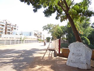
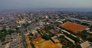
WOnitsha is a city located on the eastern bank of the Niger River, in Nigeria's Anambra State. A metropolitan city, Onitsha is known for its river port and as an economic hub for commerce, industry, and education. It hosts the Onitsha Main Market, the largest market in Africa in terms of geographical size and volume of goods.
WPategi or Patigi is a town and Local government in Kwara State, Nigeria with the headquarters located at the town. The town is the headquarters of Pategi Emirate. It is inhabited by the Nupe people who also exhibit a linguistic repertoire of the Yoruba dialect. They are farmers, aquatic sellers/fishers and traders. They are known to be governed by a monarch.
WSanankoro Djitoumou is a village and rural commune in the Cercle of Kati in the Koulikoro Region of southern Mali. The commune covers an area of approximately 630 square kilometers and includes 27 villages. In the 2009 census it had a population of 13,382. The village lies 75 km south of the Malian capital, Bamako.
WSanankoroba is a small town and rural commune in the Cercle of Kati in the Koulikoro Region of southern Mali. The commune covers an area of approximately 617 square kilometers and includes the town and 25 villages. In the 2009 census the commune had a population of 37,294. The town lies 34 km south of the Malian capital, Bamako, on the Route Nationale 7 (RN7).
 W
WSégou is a town and an urban commune in south-central Mali that lies 235 kilometres (146 mi) northeast of Bamako on the right bank of the River Niger. The town is the capital of the Ségou Cercle and the Ségou Region. With 130,690 inhabitants in 2009, it is the fifth-largest town in Mali.
 W
WSiguiri is a city in northeastern Guinea on the River Niger. It is a sub-prefecture and capital of Siguiri Prefecture in the Kankan Region. Its population was estimated at 28,319 in 2008.
WTaboye is a rural commune and village in the Cercle of Bourem in the Gao Region of south-eastern Mali. The commune is crossed by the River Niger and includes the villages of Bia, Dagha, Ha, Moudakane, Ouani, Tondibi and Taboye. In the 2009 census the commune had a population of 20,503.
WTarkint is a village and commune in the Cercle of Bourem in the Gao Region of north-eastern Mali. The village is 70 km (43 mi) northeast of Bourem and 123 km (76 mi) from Gao. Tarkint extends for 23,000 km2 and includes part of the Tilemsi Valley. In the 2009 census Tarkint had a population of 19,082.
WTemera is a small town and commune on the north bank of the Niger River in the Cercle of Bourem in the Gao Region of south-eastern Mali. In the 2009 census the commune had a population of 20,363.
WTienfala is a small town and commune on the Niger River in the Cercle of Koulikoro in the Koulikoro Region of south-western Mali. As of 1998 the commune had a population of 4128. It is located 30 kilometres from Bamako.
 W
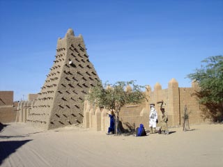
WTimbuktu is a city in Mali, situated 20 km (12 mi) north of the Niger River. The town is the capital of the Timbuktu Region, one of the eight administrative regions of Mali. It had a population of 54,453 in the 2009 census.