 W
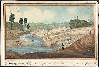
WThe Black River is a 125-mile-long (201 km) blackwater river that empties into the eastern end of Lake Ontario on the shore of Jefferson County, New York in the United States. The origin of the name is not clear, but it may stem from the natural tannic acid that darkens the water in places. The river flows in a generally northwest direction, with its valley dividing the Adirondack Mountains on the east from the Tug Hill region to the west.
 W
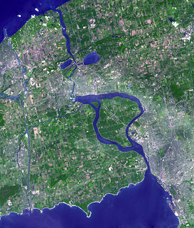
WThe Cataraqui River forms the lower portion of the Rideau Canal and drains into Lake Ontario at Kingston, Ontario. The name is taken from the original name for Kingston, Ontario; its exact meaning, however, is undetermined. Early maps showed several name variations including the Great Cataraqui River and Grand River Cataraquay. The river was once called Riviere de Frontenac, or Frontenac River. The alternate spelling "Cadaraqui" also appears in some historic texts.
 W
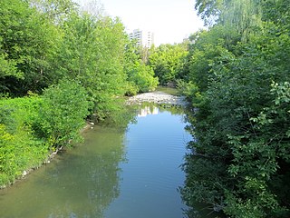
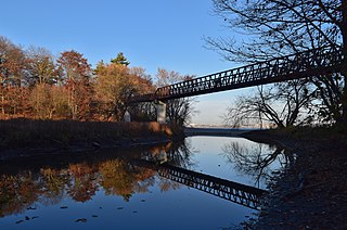
WCooksville Creek is a short stream in Mississauga, Regional Municipality of Peel in the Greater Toronto Area of Ontario, Canada. It begins near Bristol Road West and Hurontario Street and flows south to Lake Ontario at R.K McMilian Park near Lakeshore Road and Cawthra Road. The community of Cooksville is located on the west bank of the creek near Hurontario Street and Dundas Street East. The creek is surrounded mostly by residential homes and a few parks:R.K. McMilian Park Camilla Park Cooksville Park R. Jones Park Mississauga Valley Park Stonebrook Park Woodington Green Kingsbridge Common
 W
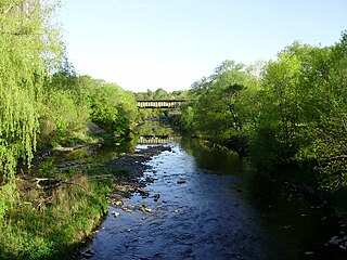
WThe Credit River is a river in southern Ontario, which flows from headwaters above the Niagara Escarpment near Orangeville and Caledon East to empty into Lake Ontario at Port Credit, Mississauga. It drains an area of approximately 1,000 square kilometres (390 sq mi). The total length of the river and its tributary streams is over 1,500 kilometres (930 mi).
 W
WThe Don River is a watercourse in southern Ontario, that empties into Lake Ontario, at Toronto Harbour. Its mouth was just east of the street grid of the town of York, Upper Canada, the municipality that evolved into Toronto, Ontario. The Don is one of the major watercourses draining Toronto that have headwaters in the Oak Ridges Moraine.
 W
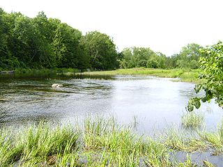
WDuffins Creek is a waterway that runs within York Region and Durham Region in the eastern end of the Greater Toronto Area.
 W
WEighteen Mile Creek, or Eighteenmile Creek, is a tributary of Lake Ontario located entirely in Niagara County, New York in the United States. The name of "Eighteen Mile" Creek refers not to the length of the creek, but to its distance from the Niagara River to the west.
 W
WEtobicoke Creek is a river in the Greater Toronto Area of Ontario, Canada. It is a tributary of Lake Ontario and runs from Caledon to southern Etobicoke, part of the City of Toronto. The creek is within the jurisdiction of the Toronto and Region Conservation Authority.
 W
WThe Ganaraska River is a river in Northumberland County and the Regional Municipality of Durham in Southern Ontario, Canada. It is part of the Great Lakes Basin, and is a tributary of Lake Ontario, which it reaches at the central community of the municipality of Port Hope. The river's name is thought to originate from Ganaraske, the name for the Cayuga village which was located at the current site of Port Hope.
 W
WThe Genesee River is a tributary of Lake Ontario flowing northward through the Twin Tiers of Pennsylvania and New York in the United States.
 W
WGrindstone Creek is a stream in the Greater Toronto and Hamilton Area, Ontario, Canada. It is in the Great Lakes Basin and is a tributary of Lake Ontario at the western end of the lake.
 W
WHighland Creek is a river in the Scarborough district of Toronto, Ontario, emptying into Lake Ontario at the eastern end of the Scarborough Bluffs. It is home to several species of fish including trout, carp, bass and salmon. It is a meandering river which, like most rivers in Toronto, travels through a glacial ravine formed after the last Ice Age. The Highland Creek watershed, including tributaries, is almost entirely contained within Scarborough.
 W
WThe Humber River is a river in Southern Ontario, Canada. It is in the Great Lakes Basin, is a tributary of Lake Ontario and is one of two major rivers on either side of the city of Toronto, the other being the Don River to the east. It was designated a Canadian Heritage River on September 24, 1999.
 W
WThe Southern Laurentian Channel is an ancient underground river in southern Ontario, Canada. The river predates the recent ice ages. The river valley was filled with glacial debris. Water still flows down this old valley—underground. The source of the aquifer is the Georgian Bay, approximately 200 kilometres (120 mi) away.
 W
WThe Little Cataraqui Creek is a watercourse, much of which is a semi-urban wetland, that empties into Lake Ontario within the municipality of Kingston, Ontario, Canada. Further inland, just north of Highway 401, the creek has been dammed to form a reservoir that is part of the Little Cataraqui Creek Conservation Area.
WThe Little Salmon River is a tributary of Lake Ontario located in Oswego County, New York. The river enters Lake Ontario approximately four miles (6.4 km) southwest from the mouth of the Salmon River.
 W
WLynde Creek is a stream in the municipalities of Whitby and Scugog, Regional Municipality of Durham, in the Greater Toronto Area of Ontario, Canada. It is in the Great Lakes Basin, is a tributary of Lake Ontario, and is under the auspices of the Central Lake Ontario Conservation Authority. The creek begins on the Oak Ridges Moraine in geographic Reach Township in the municipality of Scugog, and flows south to its mouth in the southwest of the town of Whitby. Portions of the 132.19-square-kilometre (51.04 sq mi) watershed also extend into the town of Ajax, the city of Pickering and the municipality of Uxbridge.
 W
WMimico Creek is a stream that flows through Brampton, Mississauga and Toronto in the Greater Toronto Area of Ontario, Canada. It is 33 kilometres (21 mi) long, is in the Great Lakes Basin, and is a tributary of Lake Ontario.
 W
WThe Moira River is a river in Hastings County in eastern Ontario, Canada. It travels from its source in the centre of the county to the Bay of Quinte at the county seat Belleville.
 W
WThe Napanee River is a river in Lennox and Addington County and Frontenac County in Eastern Ontario, Canada. It is in the Great Lakes Basin and flows from its source at Camden Lake to its mouth at the Bay of Quinte on Lake Ontario at Napanee. It flows through a valley of preglacial origin. The valley of the Napanee is lined with settlements such as Greater Napanee, Newburgh, Camden East, Yarker, and Petworth.
 W
WThe Niagara River is a river that flows north from Lake Erie to Lake Ontario. It forms part of the border between the province of Ontario in Canada and the state of New York in the United States. There are differing theories as to the origin of the river's name. According to Iroquoian scholar Bruce Trigger, Niagara is derived from the name given to a branch of the locally residing native Neutral Confederacy, who are described as being called the Niagagarega people on several late-17th-century French maps of the area. According to George R. Stewart, it comes from the name of an Iroquois town called Ongniaahra, meaning "point of land cut in two".
 W
WOak Orchard Creek is a tributary of Lake Ontario in Orleans County, New York in the United States.
 W
WThe Oswego River is a river in upstate New York in the United States. It is the second-largest river flowing into Lake Ontario. James Fenimore Cooper’s novel The Pathfinder, or The Inland Sea is set in the Oswego River valley.
 W
WPetticoat Creek is a stream in the cities of Pickering, Toronto and Markham in the Greater Toronto Area of Ontario, Canada. The creek is in the Great Lakes Basin, is a tributary of Lake Ontario, and falls under the auspices of the Toronto and Region Conservation Authority. Its watershed covers 26.77 square kilometres (10.34 sq mi), and the cumulative length of all its branches is 49 kilometres (30 mi). Land use in the watershed consists of 52% agricultural, 27% protected greenspace and 21% urban.
 W
WThe Rouge River is a river in Markham, Pickering, Richmond Hill and Toronto in the Greater Toronto Area of Ontario, Canada. The river flows from the Oak Ridges Moraine to Lake Ontario at the eastern border of Toronto, and is the location of Rouge Park, the only national park in Canada within a municipality. At its southern end, the Rouge River is the boundary between Toronto and southwestern Pickering in the Regional Municipality of Durham.
WSalem Creek is a stream in the municipal township of Cramahe, Northhumberland County in Central Ontario, Canada. It is in the Great Lakes Basin and is a tributary of Lake Ontario. The creek takes its name from the community of Salem which it flows past.
 W
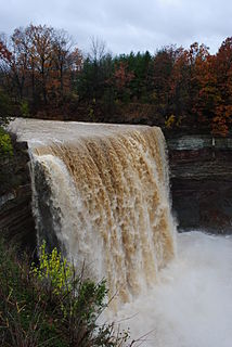
WThe Salmon River is a small river north of Syracuse in Upstate New York, the United States. It is a popular and economically important sportfishing destination, and the most heavily fished of New York's Lake Ontario tributaries. From its headwaters in the Tug Hill region of New York, it flows 44 miles (71 km) westward through two hydroelectric dams and over the 110-foot (34 m) Salmon River Falls before it empties into eastern Lake Ontario at Port Ontario in Oswego County. The Salmon River watershed drains approximately 280 square miles (730 km2).
 W
WThe Salmon River is a river in Ontario, Canada. The river flows 135 kilometres (84 mi) south from about 200 metres south of Mazinaw Lake into Kennebec Lake near the community of Arden, part of Central Frontenac, Frontenac County, through a chain of small lakes and through part of Lennox and Addington County to the Bay of Quinte on Lake Ontario near the community of Shannonville, part of Tyendinaga, Hastings County. The watershed is about 227,579 acres of which 65,524 acres is forested.
 W
WSixteen Mile Creek is a river in Halton Region in the Greater Toronto Area of Ontario, Canada. It is in the Great Lakes Basin, and flows from the Niagara Escarpment through the towns of Milton and Oakville to Lake Ontario.
WSixteen Mile Creek is a stream in the municipalities of Lincoln, Pelham and West Lincoln, Regional Municipality of Niagara in Southern Ontario, Canada. It is part of the Great Lakes Basin and flows from the top of the Niagara Escarpment to Sixteen Mile Pond on Lake Ontario. The stream falls within the remit of the Niagara Peninsula Conservation Authority, whose 2012 watershed report card gave the stream watershed grades of D for both water quality and forest cover.
 W
WSouth Sandy Creek is a small tributary to Lake Ontario in Jefferson and Lewis counties in the U.S. state of New York. South Sandy Creek flows from its source in the Tug Hill region westward through the village of Ellisburg before emptying into Lake Ontario.
 W
WThe Trent River is a river in southeastern Ontario which flows from Rice Lake to empty into the Bay of Quinte on Lake Ontario. This river is part of the Trent-Severn Waterway which leads to Georgian Bay. The river is 90 kilometres (56 mi) long. The Trent drains a large portion of south-central Ontario, including most of the Kawartha Lakes and their supplying watersheds.
 W
WThe Twenty Mile Creek is a minor waterway, located in the Niagara Peninsula, Ontario, Canada. The creek is named for the location of its mouth, twenty miles (32 km) west of the Niagara River along the Lake Ontario shoreline. The Indian name for the Twenty Mile Creek was the Kenachdaw, which translates to Lead River.