 W
WThe ACF River Basin is the drainage basin, or watershed, of the Apalachicola River, Chattahoochee River, and Flint River, in the Southeastern United States.
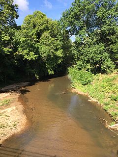
WThe Apalachicola River is a river, approximately 160 mi (180 km) long in the state of Florida. The river's large watershed, known as the ACF River Basin, drains an area of approximately 19,500 square miles (50,505 km2) into the Gulf of Mexico. The distance to its farthest head waters in northeast Georgia is approximately 500 miles (800 km). Its name comes from the Apalachicola people, who used to live along the river.
 W
WThe Chattahoochee River forms the southern half of the Alabama and Georgia border, as well as a portion of the Florida - Georgia border. It is a tributary of the Apalachicola River, a relatively short river formed by the confluence of the Chattahoochee and Flint rivers and emptying from Florida into Apalachicola Bay in the Gulf of Mexico. The Chattahoochee River is about 430 miles (690 km) long. The Chattahoochee, Flint, and Apalachicola rivers together make up the Apalachicola–Chattahoochee–Flint River Basin. The Chattahoochee makes up the largest part of the ACF's drainage basin.
 W
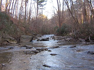
WThe Chipola River is a tributary of the Apalachicola River in western Florida. It is part of the ACF River Basin watershed.
 W
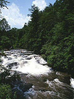
WThe Flint River is a 344-mile-long (554 km) river in the U.S. state of Georgia. The river drains 8,460 square miles (21,900 km2) of western Georgia, flowing south from the upper Piedmont region south of Atlanta to the wetlands of the Gulf Coastal Plain in the southwestern corner of the state. Along with the Apalachicola and the Chattahoochee rivers, it forms part of the ACF basin. In its upper course through the red hills of the Piedmont, it is considered especially scenic, flowing unimpeded for over 200 miles (320 km). Historically, it was also called the Thronateeska River.
 W
WJohns Creek is an 8.0-mile-long (12.9 km) stream which begins in southern Forsyth County, Georgia and runs south-southwestward through the eastern part of northern Fulton County, Georgia. It is a tributary of the Chattahoochee River and has no official stream gauges.
 W
WPeachtree Creek is a major stream in Atlanta. It flows for 7.5 miles (12.1 km) almost due west into the Chattahoochee River just south of Vinings.
 W
WSope Creek is an 11.6-mile-long (18.7 km) stream located in Cobb County, Georgia, United States. It is a significant tributary of the Chattahoochee River. It was known as Soap Creek during the 19th century. A section of Sope Creek runs through the Chattahoochee River National Recreation Area.
 W
WThe Soque River and its watershed are located entirely within the county boundaries of Habersham County in northeast Georgia. The Soque is a tributary of the Chattahoochee River. Portions of the river run along State Route 197.
 W
WSweetwater Creek is a 45.6-mile-long (73.4 km) stream in the U.S. state of Georgia, west of Atlanta. It begins in southwestern Paulding County, flowing generally eastward into southwestern Cobb County, then turning south into eastern Douglas County. It is a tributary of the Chattahoochee River, and near its end it is the centerpiece of Sweetwater Creek State Park.
 W
WVickery Creek or Big Creek is a 26.5-mile-long (42.6 km) stream in Forsyth and Fulton counties in Georgia. The creek mouth into the Chattahoochee River is located at the southern border of Roswell where State Route 9 crosses the river. Its source is located just north of the intersection of Georgia State Route 9 and Georgia State Route 20, in Forsyth County, about 1 mile directly south of downtown Cumming.
 W
WWilleo Creek is a 6.7-mile-long (10.8 km) stream in the U.S. state of Georgia, and is located in the north-northwestern part of metro Atlanta. It is a significant tributary of the Chattahoochee River, into which it flows at Bull Sluice Lake, just upstream from Morgan Falls Dam and downstream from the Chattahoochee Nature Center. Together, the two streams form nearly all of the county line between Fulton to the east and Cobb to the west.
 W
WNancy Creek is a 16.3-mile-long (26.2 km) stream in northern Atlanta, Georgia, United States. It begins in far northern DeKalb County, just north of Chamblee, and flows southwestward into Fulton County, through the far southeast corner of Sandy Springs, then through the Buckhead area of Atlanta. It empties into Peachtree Creek, which then flows into the Chattahoochee River, south of Vinings and Paces. The Chattahoochee eventually joins with the Flint River to create the Apalachicola River, which flows into the Gulf of Mexico. The North Fork Nancy Creek is a major tributary, while Little Nancy Creek tends to run low or dry. Other tributaries include Bubbling Creek which originates in Chamblee, Perimeter Creek which originates in Dunwoody and Silver Creek which includes the 38-acre Silver Lake and Little Silver Lake.
 W
WApalachicola Bay is an estuary and lagoon located on the northwest coast of the U.S. state of Florida. The Apalachicola Bay system also includes St. George Sound, St. Vincent Sound and East Bay, covering an area of about 208 square miles (540 km2). Four islands, St. Vincent Island to the west, Cape St. George Island and St. George Island to the south, and Dog Island to the east, separate the system from the Gulf of Mexico. Water exchange occurs through Indian Pass, West Pass, East Pass and the Duer Channel. The lagoon has been designated as a National Estuarine Research Reserve and the Apalachicola River is the largest source of freshwater to the estuary. Combined with the Chattahoochee River, Flint River, and Ochlockonee River they drain a watershed of over 20,000 square miles (50,000 km2) at a rate of 19,599 cubic feet (550 m3) per second according to the United States Geological Survey in 2002.
 W
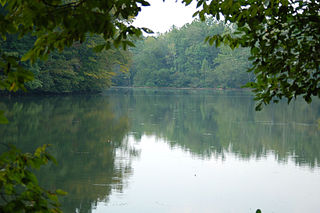
WBull Sluice Lake is a small reservoir located along the Chattahoochee River in northern Georgia, in the northern suburbs of metro Atlanta. It is 673 acres (272 ha), and is impounded by the Morgan Falls Dam. Besides the hydroelectric power produced by the dam, the lake's primary use is recreation, including fishing and rowing.
 W
WCity Mills Dam was a dam on the Chattahoochee River, between Downtown Columbus, Georgia and Phenix City, Alabama. The dam was built in 1907 to power the City Mills grist mill. Previously, a wooden dam dating to 1828 had existed at the site. The dam impounded a 1.3-mile (2.1 km) run of the river reservoir of approximately 110 acres (0.45 km2).
 W
WCrow Hop Dam is a lowhead dam on the Chattahoochee River. The dam was built to channel the river westward around the west side of Hills Island to increase generation capacity at Riverview Dam slightly downstream. It is very close to, but does not touch, the Alabama state line, which here lies along the river's western bank, in Chambers County, Alabama, west of Hills Island.
 W
WDead Lakes State Recreation Area is a Florida protected area located 1 mile (1.6 km) north of Wewahitchka off Florida State Road 71 and southwest of Tallahassee. It was formerly a Florida State Park and originally a fish hatchery operated by the Florida Fish and Wildlife Conservation Commission from 1936 until 1951. Activities include hiking, fishing, boating, camping, and wildlife viewing. Among the wildlife of the park are foxes, cotton rats, raccoons, opossums, white-tailed deer, rabbits, skunk, beavers, turtles, snakes and alligators. A variety of trees can be found in the park, including longleaf pine, magnolia and bald cypress trees. Amenities include a boat ramp, fresh water trails, nature trails, and a camping area. The recreation area is open from 8:00 am until sunset year-round.
 W
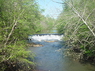
WThe Eagle and Phenix Dam is a dam on the Chattahoochee River, in downtown Columbus, Georgia. The dam was built in 1882 to power the defunct Eagle and Phenix textile Mill. It is located just south of the 13th Street Bridge which connects Columbus to Phenix City, Alabama. The dam produces a 45-acre (18 ha) run of the river reservoir that extends approximately 1-mile (1.6 km) upstream.
 W
WNora Mill Dam is a log dam about one mile or 1.5km south of Helen, Georgia on the Chattahoochee River. The dam was built in 1824, and there is still a working grist mill at the site. The historic Nora Mill Granary was established in 1876, and is operated a business open to the public, selling grits, cornmeal, and other products which it mills in front of customers.
 W
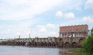
WNorth Highlands Dam is a structure on the Chattahoochee River at the northern edge of the Columbus, Georgia, United States. It is approximately 4.2 miles north of 9th Avenue in downtown Columbus. The dam was built in 1899 to provide power for the former Bibb City Mill. It was one of the first large dams constructed in the South. The North Highlands Dam was owned by the Columbus Electric and Power Company, until that utility was purchased by Georgia Power in 1930.
WRiverview Dam is a lowhead dam on the Chattahoochee River. The dam was built in 1918 to provide power for Riverview Textile Mill. The dam is currently owned by Georgia Power.
 W
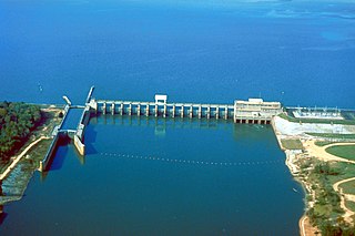
WLake Seminole is a reservoir located in the southwest corner of Georgia along its border with Florida, maintained by the U.S. Army Corps of Engineers. The Chattahoochee and Flint rivers join in the lake, before flowing from the Jim Woodruff Lock and Dam, which impounds the lake, as the Apalachicola River. The lake contains 37,500 acres (152 km2) of water, and has a shoreline of 376 mi (605 km). The fish in Lake Seminole include largemouth bass, crappie, chain pickerel, catfish, striped bass and other species. American alligators, snakes and various waterfowl are also present in the lake, which is known for its goose hunting.
 W
WLangdale Dam is a lowhead dam on the Chattahoochee River just south of Langdale, Alabama.
 W
WLake Blackshear is a man-made lake on the Flint River in Georgia created by a dam that was constructed from 1925 to 1930. The lake was named after General David Blackshear.
WGeorge W. Andrews Lake is a U.S. Army Corps of Engineers lake 29 miles south of Walter F. George Lake and north of Lake Seminole. The lake is very riverine in nature but is noted for good fishing. The purpose of the dam is for river navigation via the lock at George W. Andrews Dam. There is no hydroelectric generation at this location. The lake is named for George W. Andrews.
 W
WGoat Rock Lake is a 940-acre (3.8 km2) reservoir on the Chattahoochee River, which lies directly south of Bartlett's Ferry Dam and north of Lake Oliver. The lake is created by the Goat Rock Dam and Generating Plant. The name of the dam and lake date to the construction of the dam in 1912. Reportedly, construction workers saw goats jumping onto rocks in the river.
WLake Harding, also known as Bartlett's Ferry Lake, is a 5,850-acre (23.7 km2) reservoir on the Chattahoochee River.
 W
WLake Lanier is a reservoir in the northern portion of the U.S. state of Georgia. It was created by the completion of Buford Dam on the Chattahoochee River in 1956, and is also fed by the waters of the Chestatee River. The lake encompasses 38,000 acres (150 km2) or 59 square miles (150 km2) of water, and 692 miles (1,114 km) of shoreline at normal level, a "full pool" of 1,071 feet (326 m) above mean sea level and the exact shoreline varies by resolution according to the coastline paradox. Named for American poet Sidney Lanier, it was built and is operated by the U.S. Army Corps of Engineers for flood control and water supplies. It is patrolled by the Georgia Department of Natural Resources (GDNR), as well as local law enforcement.
WLake Oliver is a 2,150-acre (8.7 km2) reservoir on the Chattahoochee River, which lies south of Goat Rock Dam. The lake is created by the Oliver Dam and Generating Plant, which was completed in 1959 by Georgia Power.
 W
WThe Walter F. George Lake, named for Walter F. George (1878–1957), a United States Senator from Georgia, is formed on the Chattahoochee River along the state line between Alabama and Georgia. It is also widely known by the name, Lake Eufaula – particularly in Alabama, where the state legislature passed a resolution on June 25, 1963, to give the lake that name. The 46,000-acre lake extends north about 85 miles (140 km) from the Walter F. George Lock and Dam and has approximately 640 miles (1,030 km) of shoreline. Popular activities along the lake include camping and trophy fishing.
 W
WWest Point Lake is a man-made reservoir located mostly in west-central Georgia on the Chattahoochee River and maintained by the U.S. Army Corps of Engineers (USACE). The Chattahoochee river flows in from the north, before flowing through the West Point Dam, which impounds the lake, and continuing to Columbus, Georgia. Of the four major USACE lakes in the ACF River Basin, West Point Lake is the smallest by area containing 25,864 acres (10,467 ha) of water, and has the second shortest shoreline at 604 mi (972 km). The purposes of the reservoir are to provide flood control, hydroelectric power, and water storage to aid the navigation of the lower Chattahoochee.
WThe tri-state water dispute is a 21st-century water-use conflict among the states of Georgia, Alabama, and Florida over flows in the Apalachicola-Chattahoochee-Flint River Basin and the Alabama-Coosa-Tallapoosa River Basin. The U.S. Army Corps of Engineers has regulated water flow for the entire Chattahoochee River, from Lake Lanier in Forsyth County, Georgia, to Alabama and Florida.