 W
WThe Sacramento Valley is the area of the Central Valley of the U.S. state of California that lies north of the Sacramento–San Joaquin River Delta and is drained by the Sacramento River. It encompasses all or parts of ten Northern California counties. Although many areas of the Sacramento Valley are rural, it contains several urban areas, including the state capital, Sacramento.
 W
WBattus philenor hirsuta, the California pipevine swallowtail or hairy pipevine swallowtail, is a subspecies of the pipevine swallowtail that is endemic to Northern California in the United States. The butterfly is black with hindwings that have iridescent green-blue coloring above and a row of red spots below; the caterpillars are black with fleshy protrusions and orange spots. The subspecies' butterflies are smaller in size and hairier than the species, and they lay eggs in larger clutch sizes than the species. The egg clutches are deposited on the shoot tips of the California pipevine, a perennial vine native to riparian, chaparral, and woodland ecosystems of the California Coast Ranges, Sacramento Valley, and Sierra Nevada foothills. The larvae feed exclusively on the foliage and shoot tips of the pipevine, although adults eat floral nectar from a variety of plants. The plant contains a toxic substance, aristolochic acid. The larvae sequester the toxin, and both the juvenile and adult butterflies have high and toxic concentrations of the aristolochic acid in their tissues. Throughout the range of the species, Battus philenor, other butterflies and moths mimic the distinctive coloration of the swallowtail to avoid predators. However, there are no known mimics of the Californian subspecies.
 W
WNeostapfia is a genus of endemic Californian bunchgrasses, in the subfamily Chloridoideae of the grass family, Poaceae. The only known species is Neostapfia colusana, with the common name Colusa grass.
 W
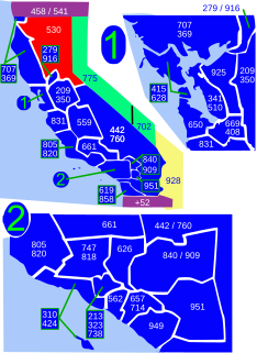
WArea code 530 is a California telephone area code in northeastern and Northern California.
 W
WButte County is a county in northern California. In the 2010 census, the population was 220,000. The county seat is Oroville.
 W
WCalifornia's 1st congressional district is a U.S. congressional district in California.
 W
WCalifornia's 3rd congressional district is a U.S. congressional district in California.
 W
WCalifornia's 3rd State Assembly district is one of 80 California State Assembly districts. It is currently represented by Republican James Gallagher of Yuba City.
 W
WCalifornia's 4th State Assembly district is one of 80 California State Assembly districts. It is currently represented by Democrat Cecilia Aguiar-Curry of Winters.
 W
WCalifornia's 4th State Senate district is one of 40 California State Senate districts. It is currently represented by Republican Jim Nielsen of Gerber.
 W
WColusa County is a county located in the U.S. state of California. As of the 2010 census, the population was 21,419. The county seat is Colusa. It is in the Central Valley of California, northwest of the state capital, Sacramento.
 W
WGlenn County is a county located in the U.S. state of California. As of the 2010 census, the population was 28,122. The county seat is Willows. It is located in the Sacramento Valley, in the northern part of the California Central Valley.
 W
WThe North Table Mountain Ecological Reserve is a nature reserve of 3,315 acres (13.42 km2) located three miles (5 km) north of Oroville, in Butte County, northern California. The land was acquired by the state in October, 1993.
 W
WThe Patwin are a band of Wintun people native to the area of Northern California. The Patwin comprise the southern branch of the Wintun group, native inhabitants of California since approximately 500 AD.
 W
WPlacer County, officially the County of Placer, is a county located in the U.S. state of California. As of the 2010 census, the population was 348,432. The county seat is Auburn.
 W
WThe Plains and Sierra Miwok were once the largest group of California Indian Miwok people, indigenous to California. Their homeland included regions of the Sacramento Valley, San Joaquin Valley, and the Sierra Nevada.
 W
WSacramento County is a county located in the U.S. state of California. As of the 2010 census, the population was 1,418,788. Its county seat is Sacramento, which has been the state capital of California since 1854.
 W
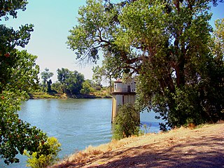
WThe Sacramento River is the principal river of Northern California in the United States and is the largest river in California. Rising in the Klamath Mountains, the river flows south for 400 miles (640 km) before reaching the Sacramento–San Joaquin River Delta and San Francisco Bay. The river drains about 26,500 square miles (69,000 km2) in 19 California counties, mostly within the fertile agricultural region bounded by the Coast Ranges and Sierra Nevada known as the Sacramento Valley, but also extending as far as the volcanic plateaus of Northeastern California. Historically, its watershed has reached as far north as south-central Oregon where the now, primarily, endorheic (closed) Goose Lake rarely experiences southerly outflow into the Pit River, the most northerly tributary of the Sacramento.
 W
WThe Sacramento Valley Museum is located at 1491 E Street Williams, in Williams, Colusa County, northern California in the heart of the Sacramento Valley. Sacramento Valley history is promoted through displays of historical photographs, artifacts, textiles and quilts, manuscripts and documents, and vintage newspapers from the Sacramento Valley region in the northern California Central Valley.
 W
WThe Shasta Cascade region of California is located in the northeastern and north-central sections of the state bordering Oregon and Nevada, including far northern parts of the Central Valley and the Sierra Nevada mountain range.
 W
WShasta County, officially the County of Shasta, is a county in the northern portion of the U.S. state of California. As of the 2010 census, the population was 177,223. The county seat is Redding.
 W
WSutter County is a county in the U.S. state of California. As of the 2010 census, the population was 94,737. The county seat is Yuba City.
 W
WTehama County is a county located in the northern part of the U.S. state of California. As of the 2010 census, the population was 63,463. The county seat and largest city is Red Bluff.
 W
WWest Sacramento is a city in Yolo County, California. The city is separated from Sacramento by the Sacramento River which also separates Sacramento and Yolo counties. It is a fast-growing community; the population was 48,744 at the 2010 census, up from 31,615 at the 2000 census. The traditional industrial center of the region since the Gold Rush era, West Sacramento is home to a diverse economy and is one of the area's top four employment centers.
 W
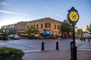
WWinters is a city in rural Yolo County, and the western Sacramento Valley, in northern California.
 W
WWintuan is a family of languages spoken in the Sacramento Valley of central Northern California.
 W
WThe Wintun are members of several related Native American peoples of Northern California, including the Wintu (northern), Nomlaki (central), and Patwin (southern). Their range is from approximately present-day Lake Shasta to San Francisco Bay, along the western side of the Sacramento River to the Coast Range. Each of these tribes speak one of the Wintuan languages. Linguistic and archaeological evidence suggests that the Wintun people probably entered the California area around 500 AD from what is now southern Oregon, introducing bow and arrow technology to the region.
 W
WWoodland is a city in and the county seat of Yolo County, California, located approximately 15 miles (24 km) northwest of Sacramento, and is a part of the Sacramento - Arden-Arcade - Roseville Metropolitan Statistical Area. The population was 55,468 at the 2010 census.
 W
WYolo County, officially the County of Yolo, is a county located in the northern portion of the U.S. state of California. As of the 2010 census, the population was 200,849. Its county seat is Woodland.
 W
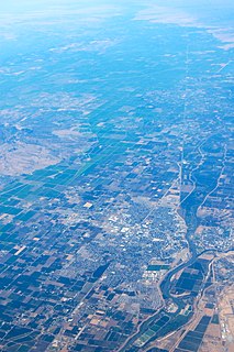
WYuba City is a city in Northern California and the county seat of Sutter County, California, United States. The population was 64,925 at the 2010 census. Yuba City is the principal city of the Yuba City Metropolitan Statistical Area which encompasses all of Sutter County and Yuba County. The metro area's population is 164,138. It is the 21st largest metropolitan area in California ranked behind Redding and Chico. Its metropolitan statistical area is part of the Greater Sacramento CSA.
 W
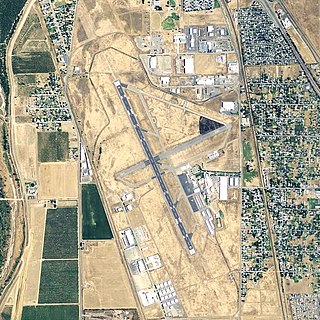
WYuba County Airport is in Yuba County, California, United States, three miles southeast of Marysville. The National Plan of Integrated Airport Systems for 2011–2015 categorized it as a general aviation facility.
 W
WYuba County is a county located in the U.S. state of California. As of the 2010 U.S. Census, the population was 72,155. The county seat is Marysville. Yuba County is included in the Yuba City, California Metropolitan Statistical Area, which is also included in the Sacramento–Roseville, California Combined Statistical Area. The county is located in the state's Central Valley region along the Feather River.