 W
WAtaran River is a river of Burma and Thailand. In Thailand, it is usually known as the Kasat River. It merges into the larger Gyaing River and Salween River near the city of Mawlamyine. A main tributary of the Ataran River is the Zami River. The Ataran and its tributaries begin near the Thai-Burmese border and flow in a general north-north-west direction.
 W
WBago River is a river of southern Myanmar. It flows through Bago and Yangon. It arises in the hills of the Pegu Range and flows into the Myitmaka River which below that point is called the Yangon River.
 W
WThe Chindwin River is a river flowing entirely in Myanmar, and the largest tributary of the country's main river, the Ayeyarwady.Its official name is also spelled Chindwinn.
 W
WThe Dawei River or Tavoy River is a river of the Tanintharyi Region, Burma.
 W
WThe Great Tenasserim River or the Tanintharyi River is a major river of southeastern Burma. It flows through the Tanintharyi Region, past the town of Tanintharyi, and enters the sea at Myeik (Mergui). The river rises from the Tenasserim Range at an altitude of 2,074 m (6,804 ft), and flows into the Andaman Sea. The region formed by this river is also known as Tenasserim, or Tanintharyi in Burmese. It is in a constricted coastal region in southeastern Myanmar, which borders Thailand on the east and the Andaman Sea on the west.
 W
WGyaing River is a river of Kayin State and Mon State, in southeastern Burma (Myanmar). Its two major tributaries, the Hlaingbwe River and the Haungtharaw River, flow together to form the Gyaing at 16°36′12″N 98°00′25″E. It is about 45 miles (72 km) long and flows into the Salween River immediately above Moulmein, at 16°30′55″N 97°37′36″E.
 W
WHaungtharaw River is a river of Kayin State, in southeastern Burma (Myanmar). It has its source in the Dawna Range and flows into the Gyaing River.
 W
WThe Heinze River is a river of Burma. It has its source in the Tenasserim Hills and ends in the Andaman Sea in the Tanintharyi Region coast. The Heinze Islands is a small island group located 25 km to the SSW of the mouth of the Heinze River.
 W
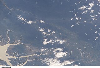
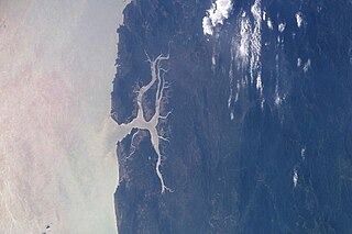
WThe Irrawaddy or, officially, Ayeyarwady River is a river that flows from north to south through Burma. It is the country's largest river and most important commercial waterway. Originating from the confluence of the N'mai and Mali rivers, it flows relatively straight North-South before emptying through the Irrawaddy Delta in the Ayeyarwady Region into the Andaman Sea. Its drainage basin of about 404,200 square kilometres (156,100 sq mi) covers a large part of Burma. After Rudyard Kipling's poem, it is sometimes referred to as 'The Road to Mandalay'.
 W
WThe Kaladan River is a river in eastern Mizoram State of India, and in Chin State and Rakhine State of western Myanmar. The Kaladan River is called the Chhimtuipui River in India. It forms the international border between India and Burma between 22° 47′ 10" N and 22° 11′ 06" N.
 W
WThe Kok River flows in Southeast Asia.
 W
WThe Kraburi River, also Kra or Pak Chan River is the boundary river between Thailand and Myanmar at the Kra Isthmus of the Malay Peninsula. The river has its source in the Tenasserim Hills and flows into the Andaman Sea near the Thai town of Ranong and Kawthaung, Myanmar.
 W
WThe Lemro is a river of Burma flowing through Chin State and Rakhine State. It flows into the Bay of Bengal east of Sittwe. The name of the river was given after establishment of four kingdom cities of Arakanese people between the eight and thirteen centuries along the river bank. The Lemro valley is noted for its rock art from these settlers.
 W
WThe Mali River is a river that originates in the hills of Kachin State, in the northern border of Myanmar. It flows approximately 320 km, when it meets with the N'Mai River and forms the Ayeyarwady River.
 W
WManipur River, also called Kathe Khyoung, is a river in India's Manipur state that flows into Myanmar, where it merges with the Myittha River, a tributary of the Chindwin river.
 W
WThe Mayu is a river in Rakhine State, Myanmar (Burma). The river and its surrounding region, known as the Mayu region or Mayu peninsula, is named after the nearby Mayu Mountain. It was formerly known as the Manlayuwaddy River. It is the third most used river in Rakhine State, and is 96 miles long and drains into the Bay of Bengal, near Sittwe. It passes through Buthidaung, Rathedaung and Sittwe Township.
 W
WThe Mekong, or Mekong River, is a trans-boundary river in East Asia and Southeast Asia. It is the world's twelfth longest river and the seventh longest in Asia. Its estimated length is 4,350 km (2,703 mi), and it drains an area of 795,000 km2 (307,000 sq mi), discharging 475 km3 (114 cu mi) of water annually. From the Tibetan Plateau the river runs through China, Myanmar, Laos, Thailand, Cambodia, and Vietnam. The extreme seasonal variations in flow and the presence of rapids and waterfalls in the Mekong make navigation difficult. Even so, the river is a major trade route between western China and Southeast Asia.
 W
WThe Moei River is a tributary of the Salween River. Unlike most rivers in Thailand, the Moei River flows north in a northwest direction. It originates in Phop Phra District, Tak Province, flowing then from south to north across Mae Sot, Mae Ramat, and Tha Song Yang Districts, finally entering the Salween River within the limits of Sop Moei District of Mae Hong Son Province. The river is 327 kilometres (203 mi) long.
 W
WMu River is a river in upper central Myanmar (Burma), and a tributary of the country's chief river the Ayeyarwady. It drains the Kabaw valley and part of the Dry Zone between the Ayeyarwady to the east and its largest tributary Chindwin River to the west, flows directly north to south for about 275 km (171 mi) and enters the Ayeyarwady west of Sagaing near Myinmu.
 W
WMyitnge River (Burmese: မြစ်ငယ် or Nam Tu, also known as Dokhtawaddy River, is a major tributary of Ayeyarwady River in Myanmar. The name Myitnge in Burmese and Dokhtawaddy in Pali both mean "little river", by contrast with the Ayeyarwady or "big river".
 W
WMyittha River is a river of western Burma, a tributary of the Chindwin River.
WThe N'Mai River or N'Mai Hka is a river in northern Myanmar (Burma).
 W
WThe Naf River is an international river marking the border of southeastern Bangladesh and western Myanmar.
 W
WThe Ruak River is a right hand tributary of the Mekong. The mouth of the Ruak river is at the Thai-Burma border opposite Laos, a spot known as the "Golden Triangle", a popular tourist destination.
 W
WSai River, formerly known as the River of Lawa, is a river that forms the natural border between Thailand and Myanmar at Tachileik and Mae Sai Districts. Mae Sai town, where the bridge crossing the international border is located, is named after this river. It is a tributary of the Ruak River, itself a tributary of the Mekong.
 W
WThe Salween, known in China as the Nu River, is a river about 2,815 kilometres (1,749 mi) long that flows from the Tibetan Plateau into the Andaman Sea in Southeast Asia.
 W
WShweli River is a river in Myanmar (Burma). Also known as Nam Mao in Shan and Ruili River or Long Chuan River(龙川江) in Chinese, it forms part of the boundary between Burma and China. It is one of the tributaries of the country's chief river, the Ayeyarwady, and arises in Yunnan Province of China. It flows through northern Shan state and Sagaing Division, and enters the Ayeyarwady at Inywa, 60 km north of Tagaung and south of Katha.
 W
WThe Sittaung River, is a river in south central Myanmar in Bago Division. The Pegu Range separates its basin from that of the Irrawaddy. The river originates at the edge of the Shan Hills southeast of Mandalay, and flows southward to the Gulf of Martaban. Its length is 420 km and its mean annual discharge is around 50 cubic kilometers per year.
 W
WThe Taping River, known as Ta Hkaw Hka in Kachin and Daying River in Chinese, is a river in Yunnan province, China and northern Myanmar (Burma). It is the first tributary of the country's chief river, the Irrawaddy, and the watersheds between it and the N'mai Hka river to the northwest and the rivers Shweli and Salween to the southeast form part of the boundary between China and Myanmar. Its source lies in Yingjiang County of Yunnan, and it enters the Irrawaddy near Bhamo, Kachin State.
 W
WThe Winyaw River is a river in southern part of Myanmar. It originates in Tenasserim Range and empties into the Ataran River at the village of Chaunghanakwa. Death Railway crosses the river near Anankwin village.
 W
WThe Yangon River is formed by the confluence of the Pegu and Myitmaka Rivers in Myanmar. It is a marine estuary that runs from Yangon to the Gulf of Martaban of the Andaman Sea. The channel is navigable by ocean-going vessels, thus plays a critical role in the economy of Myanmar.
 W
WZami River is a river of Myanmar, arising at 15°17′16″N 98°15′37″E in southern Kayin State. It flows north past Kyondaw, Phadaw, Apalon, Kanni, Kyungyaung, Danon, Kyain Seikgyi and Chaunghanakwa, where it flows into Mon State. The Zami River is a tributary of the Ataran River, which on a grander scale is part of the Salween River Basin.