 W
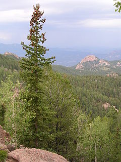
WThe Pike National Forest is located in the Front Range of Colorado, United States, west of Colorado Springs including Pikes Peak. The forest encompasses 1,106,604 acres (4,478 km2) within Clear Creek, Teller, Park, Jefferson, Douglas and El Paso counties. The major rivers draining the forest are the South Platte and Fountain Creek. Rampart Reservoir is a large artificial body of water located within the forest.
 W
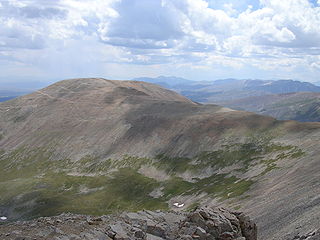
WBadger Mountain is a mountain summit in the South Park Hills of the Rocky Mountains of North America. The 11,295-foot (3,443 m) peak is located in Pike National Forest, 9.6 miles (15.5 km) northwest by west of the community of Lake George in Park County, Colorado, United States.
 W
WBison Peak is the highest summit of the Tarryall Mountains range in the Rocky Mountains of North America. Officially designated Bison Mountain, the prominent 12,432-foot (3,789 m) peak is located in the Lost Creek Wilderness of Pike National Forest, 8.1 miles (13.1 km) north by west of the community of Tarryall in Park County, Colorado, United States. The summit is the highest point in the Lost Creek Wilderness.
WBlack Mountain is a prominent mountain summit in the South Park Hills of the Rocky Mountains of North America. The 11,649-foot (3,551 m) peak is located in Pike National Forest, 21.7 miles (34.9 km) south by east of the community of Hartsel in Park County, Colorado, United States.
 W
WMount Bross is a high mountain summit in the Mosquito Range of the Rocky Mountains of North America. The 14,178-foot (4,321 m) fourteener is located in Pike National Forest, 4.1 miles (6.6 km) northwest by north of the Town of Alma in Park County, Colorado, United States. Mount Bross is named in honor of William Bross, who owned property in the area.
 W
WMount Buckskin is a high mountain summit in the Mosquito Range of the Rocky Mountains of North America. The 13,872-foot (4,228 m) thirteener is located in Pike National Forest, 4.9 miles (7.9 km) west-northwest of the Town of Alma in Park County, Colorado, United States.
 W
WBuffalo Peak is a mountain summit in the Kenosha Mountains range of the Rocky Mountains of North America. The 11,594-foot (3,534 m) peak is located in the Lost Creek Wilderness of Pike National Forest, 7.7 miles (12.4 km) west by north of the community of Deckers, Colorado, United States. Buffalo Peak is the highest point in Jefferson County, Colorado.
 W
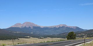
WThe Buffalo Peaks Wilderness is a U.S. Wilderness Area located in San Isabel and Pike National Forests in central Colorado. The 43,410-acre (175.7 km2) wilderness was named after two highly eroded volcanic mountains, East Buffalo Peak and West Buffalo Peak, in the Mosquito Range and was established in 1993. The wilderness contains Colorado's largest herd of bighorn sheep.
 W
WCheyenne Mountain is a triple-peaked mountain in El Paso County, Colorado, southwest of downtown Colorado Springs. The mountain serves as a host for military, communications, recreational, and residential functions. The underground operations center for the North American Aerospace Defense Command (NORAD) was built during the Cold War to monitor North American airspace for missile launches and Soviet military aircraft. Built deep within granite, it was designed to withstand the impact and fallout from a nuclear bomb. Its function broadened with the end of the Cold War, and then many of its functions were transferred to Peterson Air Force Base in 2006.
WClinton Peak is a high mountain summit in the Mosquito Range of the Rocky Mountains of North America. The 13,864-foot (4,226 m) thirteener is located 2.1 miles (3.3 km) east of Fremont Pass, Colorado, United States, on the Continental Divide separating San Isabel National Forest and Lake County from Pike National Forest and Park County.
 W
WMount Democrat is a high mountain summit in the Mosquito Range of the Rocky Mountains of North America. The 14,155-foot (4,314 m) fourteener is located 5.4 miles (8.7 km) northwest of the Town of Alma, Colorado, United States, on the Continental Divide separating San Isabel National Forest and Lake County from Pike National Forest and Park County.
 W
WDevil's Head Lookout is a U.S. Forest Service fire lookout tower at the summit of Devils Head in Douglas County, Colorado. Located on a large pinnacle of Pikes Peak granite, the fire lookout point lies within the Pike National Forest and is accessed by hiking the Devils Head National Recreation Trail.
 W
WDevils Head is a mountain summit in the Rampart Range of the Rocky Mountains of Colorado. The 9,749-foot (2,971 m) peak is located in Pike National Forest, 14.2 miles (22.9 km) southwest by south of the community of Sedalia in Douglas County, Colorado, United States.
 W
WMount Evans is the highest peak in the namesake Mount Evans Wilderness in the Front Range of the Rocky Mountains of North America. The prominent 14,271-foot fourteener is located 13.4 miles (21.6 km) southwest by south of Idaho Springs in Clear Creek County, Colorado, United States, on the drainage divide between Arapaho National Forest and Pike National Forest.
 W
WGreen Mountain is a prominent mountain summit in the Kenosha Mountains range of the Rocky Mountains of North America. The 10,427-foot (3,178 m) peak is located in Pike National Forest, 5.2 miles (8.4 km) northwest of the community of Deckers, Colorado, United States, in Jefferson County.
 W
WThe Greenhorn Mountain Wilderness is a U.S. Wilderness Area located northwest of Walsenburg, Colorado in the San Isabel and Pike National Forests. The wilderness area includes the summit of Greenhorn Mountain, the highest point in the Wet Mountains of Colorado. There are 11 miles (18 km) of trails, all in the northern half of the wilderness.
 W
WHorseshoe Mountain is a high mountain summit in the Mosquito Range of the Rocky Mountains of North America. The 13,905-foot (4,238 m) thirteener is located 7.1 miles (11.5 km) southeast by east of the City of Leadville, Colorado, United States, on the drainage divide separating San Isabel National Forest and Lake County from Pike National Forest and Park County.
 W
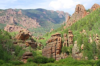
WThe Lost Creek Wilderness is a 119,790-acre (485 km2) wilderness area located in central Colorado in Jefferson and Park counties south of the town of Bailey. The area is situated entirely within the boundaries of the Pike National Forest.
WMcCurdy Mountain is a mountain summit in the Tarryall Mountains range of the Rocky Mountains of North America. The 12,172-foot (3,710 m) peak is located in the Lost Creek Wilderness of Pike National Forest, 28.2 miles (45.4 km) east of the Town of Fairplay in Park County, Colorado, United States. Like its neighbor, Bison Peak, McCurdy Mountain features a variety of unusual granite formations.
WThe Mount Evans Wilderness is a U.S. Wilderness Area in Arapaho National Forest and Pike National Forest about 30 miles (48 km) west of Denver, Colorado. The wilderness area is named after Mount Evans.
 W
WMount Lincoln is the eighth-highest summit of the Rocky Mountains of North America and the U.S. state of Colorado. The prominent 14,293-foot (4356.5 m) fourteener is the highest summit of the Mosquito Range and the eleventh-highest summit in the contiguous United States. Mount Lincoln is located in Pike National Forest, 5.2 miles (8.3 km) north-northwest of the Town of Alma in Park County, Colorado, United States. The summit of Mount Lincoln is the highest point in Park County and the entire drainage basin of the Missouri River. The mountain was named in honor of Abraham Lincoln, 16th President of the United States.
 W
WMount Silverheels is a high and prominent mountain summit in the Front Range of the Rocky Mountains of North America. The 13,829-foot (4,215 m) thirteener is located in Pike National Forest, 4.9 miles (7.9 km) northeast of the Town of Alma in Park County, Colorado, United States.
 W
WPikes Peak is the highest summit of the southern Front Range of the Rocky Mountains, in North America. The ultra-prominent 14,115-foot (4,302.31 m) fourteener is located in Pike National Forest, 12 miles (19 km) west of downtown Colorado Springs, Colorado. The mountain is named in honor of American explorer Zebulon Pike. The summit is higher than any point in the United States east of its longitude.
 W
WThe Purgatoire River track site, also called the Picketwire Canyonlands tracksite, is one of the largest dinosaur tracksites in North America. The site is located on public land of the Comanche National Grassland, along the Purgatoire ("Picketwire") River south of La Junta in Otero County, Colorado.
WThe Rampart Range is a mountain range located in Douglas, El Paso, and Teller counties, Colorado. It is part of the Front Range of the Rocky Mountains. The range is almost entirely public land within the Pike National Forest.
 W
WRampart Reservoir or Rampart Range Reservoir is a reservoir northwest of the city of Colorado Springs, Colorado in Pike National Forest. The reservoir is located on a granite plateau approximately 9,000 feet (2,700 m) above sea level, and consists of a body of water with a capacity of 13,000,000,000 US gallons (49,000,000 m3). This water supplies the domestic drinking water for the city of Colorado Springs, and because of this fact, access to the area was briefly limited after the September 11 attacks on the United States. The area today is a popular recreation area for boaters, mountain bikers, and hikers.
 W
WMount Rosa is a mountain summit of the Pikes Peak Massif in the southern Front Range of the Rocky Mountains of North America. The 11,504-foot (3,506 m) peak is located in Pike National Forest, 12.8 miles (20.6 km) southwest by west of downtown Colorado Springs in Teller County, Colorado, United States.
 W
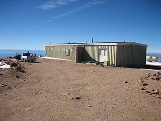
WThe U.S. Army Pikes Peak Research Laboratory, or simply the "Pikes Peak Lab", is a modern medical research laboratory for the assessment of the impact of high altitude on human physiological and medical parameters of military interest. It is a satellite facility of the U.S. Army Research Institute of Environmental Medicine (USARIEM), located in Natick, Massachusetts. The Pikes Peak Lab is at the summit of Pikes Peak 14,115 feet (4,302 m) in central Colorado, USA. The summit is approximately 5 acres (2.0 ha) of relatively flat, rocky terrain and is directly and easily accessible by automobile via the Pikes Peak Highway.