 W
WA' Bhuidheanach Bheag is a Scottish mountain situated on the eastern side of the Pass of Drumochter, some 24 km WNW of Blair Atholl. The mountain straddles the border between Highland and Perth and Kinross council areas although the actual summit is in the latter.
 W
WAn Socach is a Scottish mountain situated some three miles (5 km) west of the A93 road from Perth to Braemar. It is located at grid ref. 080800 on Ordnance Survey sheet 43. The summit altitude is 944 m (3,097 ft). The name may derive from the Gaelic Soc, meaning the snout or beak, leading to the projecting place by analogy with the shape of a snout. Other sources state that it in fact means 'the sow'.
 W
WBeinn a’ Ghlò is a Scottish mountain situated roughly 10 km (6 mi) north east of Blair Atholl in the Forest of Atholl in between Glen Tilt and Glen Loch, in Cairngorms National Park. It is a huge, complex hill with many ridges, summits and corries, covering approximately 40 km2 (15 sq mi) with three Munros. These are Càrn Liath at 976 metres (3,202 ft), Bràigh Coire Chruinn-bhalgain at 1,070 metres (3,510 ft) and Càrn nan Gabhar at 1,121.9 metres (3,681 ft). The mountain has patches of grey scree amongst grass, while heather grows quite profusely on the lower slopes and gives the hill a colourful skirt when in bloom in summer.
 W
WBen Aigan is a hill in Moray rising to a height of 471m (1546 feet) to the east of the River Spey, which flows along the foot of its western and northern slopes. It lies to the east of Rothes and north east of Craigellachie. The Speyside Way passes over the shoulder of the hill.
 W
WBen Rinnes is a mountain in Moray, in northern Scotland. The mountain is popular with hikers. The mountain is 20 km² in total and is located 8 km southwest of Dufftown. The mountain has one main path and can be easily accessed from the nearby car park. The Friends of Ben Rinnes program has been working on the paths to make it more accessible to the public and to prevent further erosion of the fragile ecosystem on the steep slopes and has been rather successful.
 W
WBennachie is a range of hills in Aberdeenshire, Scotland. It has several tops, the highest of which, Oxen Craig, has a height of 528 metres (1,732 ft). Though not particularly high, compared to other peaks within Scotland, the mountain is very prominent, owing to its isolation and the relative flatness of the surrounding terrain, and dominates the skyline from several viewpoints.
 W
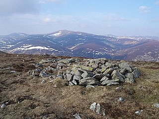
WBroad Cairn is a mountain in the Grampians of Scotland, located about sixteen miles south of the River Dee near Balmoral.
 W
WCairn Bannoch is a mountain in the Grampians of Scotland, located about seventeen miles south of the River Dee near Balmoral.
 W
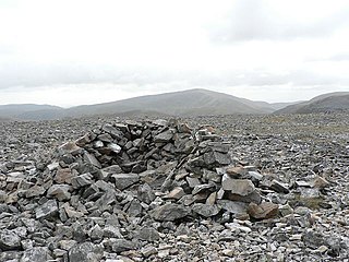
WCairn of Claise is a mountain in the Grampians of Scotland, located about three miles from the Glenshee Ski Center near Braemar.
 W
WThe Cairngorms are a mountain range in the eastern Highlands of Scotland closely associated with the mountain of the Cairn Gorm. The Cairngorms became part of Scotland's second national park on 1 September 2003. Although the Cairngorms give their name to, and are at the heart of, the Cairngorms National Park, they only form one part of the national park, alongside other hill ranges such as the Angus Glens and the Monadhliath, and lower areas like Strathspey.
 W
WThe Cairnwell is a mountain in the Eastern Highlands of Scotland, south of Braemar. It is often considered to be one of the most spoiled of the Munros, due to the Glenshee Ski Centre which covers the eastern slope of the mountain.
 W
WCàrn a' Chlamain is a Scottish mountain situated roughly 12 kilometres north of Blair Atholl in the Forest of Atholl. It is the highest point of an undulating plateau lying northeast of Glen Tilt. The River Tarf, a tributary of the Tilt, rises on the northwestern slopes before curving round the northern side of the plateau, whilst a further Tilt tributary marks the plateau's western boundary.
 W
WCàrn Aosda is a Scottish mountain situated 12.5 km south of the town of Braemar, in the county of Aberdeenshire. It stands near the summit of the Cairnwell Pass on the A93 road, in the midst of the Glenshee Ski Centre.
 W
WCat Law is a hill in the southern Mounth of Scotland, north of Kirriemuir in Angus.
 W
WClachnaben is a 589-metre hill in Glen Dye, Aberdeenshire, Scotland. It is a distinctive hill visible from many points on Lower Deeside and is topped with a large granite tor. Clachnaben is the war cry of Clan Strachan.
 W
WDriesh is a mountain located in the Grampians of Scotland. Apart from Mount Keen, it is the most easterly of the Munro peaks.
 W
WGlas Maol is the highest point in the Mounth hills, in the southeastern part of the Highlands of Scotland. The broad, flat summit is divided between the council area of Aberdeenshire, Angus and Perth and Kinross, though the highest point lies wholly within Angus; indeed Glas Maol is the highest point in that council area. Glas Maol is both a Munro and a Marilyn. The western slopes of Glas Maol form part of the Glenshee Ski Centre ski area. The most common route of ascent goes through the slopes, starting from the highest point of the A93 road, the Cairnwell pass. This is the highest public road in Scotland; hence only around 400m of ascent is involved. Glas Maol is often climbed in conjunction with Creag Leacach to the south or Cairn of Claise to the north. The broad ridge linking these peaks is topped by a dry-stone dyke, which approximately corresponds to the border of the Angus council area.
 W
WGlas Tulaichean is a large, complex Scottish mountain located approximately 18 kilometres (11 mi) south of Braemar in Perth and Kinross. It is the highest of a group of domed hills which lie in remote land between the head of Glen Tilt and Glen Shee to the east. It is most commonly climbed from the Spittal of Glenshee via Glen Lochsie to the south.
 W
WMount Keen is a 939 m high mountain in Scotland and the most easterly Munro. It can be accessed from several directions, South from Glen Mark, North from Glen Tanar, and East to Braid Cairn. It is a moderate walk which is most popularly started by mountain bike, riding through the native Caledonian pine forest of Glen Tanar from Aboyne. On a good day, the Cairngorms, especially Lochnagar, can be seen. The summit is marked by a trig point.
 W
WLochnagar or Beinn Chìochan is a mountain in the Grampians of Scotland, located about five miles south of the River Dee near Balmoral. It is a popular hill with hillwalkers, and is a noted venue for summer and winter climbing.
 W
WMayar is a mountain in the Grampians, in Angus, Scotland. It is usually climbed together with its near neighbour, Driesh. At an elevation of 928m, it is the 564th highest peak in the British Isles and the 534th tallest in Scotland.
 W
WMorrone is a Scottish hill immediately southwest of the village of Braemar in Aberdeenshire.
 W
WThe Mounth is the broad upland in northeast Scotland between the Highland Boundary and the River Dee.