 W
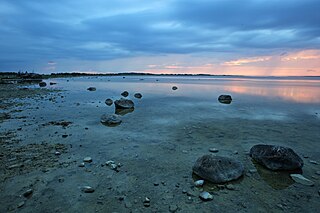
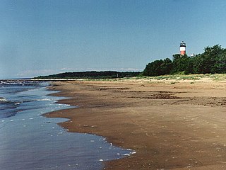
WThis is list of bays in Estonia. The list is incomplete.
 W
WEru Bay is bay in Kuusalu Parish and Haljala Parish, Lääne-Viru County in Estonia; the bay is part of Gulf of Finland. Area of the bay is 7656 ha.
 W
WHara Bay is a bay in Harju County, Estonia. The bay is located between Juminda and Pärispea Peninsula. The bay's area is 9859 ha.
WThis is list of bays in Estonia. The list is incomplete.
 W
WKäina Bay is almost isolated and very shallow approximately 9 km2 (3.5 sq mi) marine area between the Estonian islands Hiiumaa and Kassari, which is connected to the surrounding Väinameri and adjacent Vaemla Bay via three tiny channels - Orjaku channel, Orjaku sill and Vaemla channel. The maximum depth of Käina Bay is about 1 meter. Käina Bay is separated from the Väinameri Sea by Kassari Island, Õunaku Bay and Jausa Bay by a dyke road. There are many thickets of reeds and islets (23). In the southern part of the bay there is mineral curative mud.
WThis is list of bays in Estonia. The list is incomplete.
WKäsmu Bay is a bay in Lääne-Viru County, Estonia.
 W
WKolga Bay is a bay in Harju County, Estonia.
WThis is list of bays in Estonia. The list is incomplete.
WThis is list of bays in Estonia. The list is incomplete.
WThis is list of bays in Estonia. The list is incomplete.
 W
WMatsalu Bay is a bay in Lääne County, Estonia; the bay is part of Väinameri.
 W
WMuuga Bay is bay in Harju County, Estonia. Muuga Bay is part of Ihasalu Bay. Area of Muuga Bay is 3366 ha.
 W
WThe Narva Bay is a bay in the southern part of the Gulf of Finland divided between Estonia and Russia. The Kurgalsky Peninsula separates it from the Luga Bay to the east. The bay is about 40 kilometres (25 mi) long and 90 kilometres (56 mi) wide at its mouth. The eastern shore is low and sandy, while the south coast is rather steep. The bay is covered by ice from December to March. The Narva River flows into the bay near the town of Narva-Jõesuu.
WThis is list of bays in Estonia. The list is incomplete.
WThis is list of bays in Estonia. The list is incomplete.
 W
WPärnu Bay is a bay in the northeastern part of the Gulf of Livonia, in southern Estonia.
WThis is list of bays in Estonia. The list is incomplete.
WThis is list of bays in Estonia. The list is incomplete.
WThis is list of bays in Estonia. The list is incomplete.
 W
WTagalaht is a bay in the Baltic Sea, on the north-west coast of Saaremaa Island in Estonia, situated between the Tagamõisa Peninsula and Ninase. During World War I, the bay, guarded by Russian beach forts at Hundsort and Ninnast, was the main landing point for German troops during Operation Albion in October 1917, when Saaremaa was occupied.
 W
WThe Tallinn Bay is a bay in Estonia on the southern coast of the Gulf of Finland. The Estonian capital city Tallinn is located on the southern coast of the bay.
WThis is list of bays in Estonia. The list is incomplete.