 W
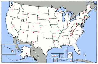
WBadwater Basin is an endorheic basin in Death Valley National Park, Death Valley, Inyo County, California, noted as the lowest point in North America and the United States, with a depth of 282 ft (86 m) below sea level. Mount Whitney, the highest point in the contiguous 48 United States, is only 84.6 miles (136 km) to the northwest.
 W
WLaguna del Carbón is a salt lake in Corpen Aike Department, Santa Cruz Province, Argentina. This salt lake is located 54 kilometres from Puerto San Julián, within the Gran Bajo de San Julián, an endorheic basin situated between the San Julian Bay and the Chico River. At 105 metres (344 ft) below sea level, Laguna del Carbón is the lowest point of Argentina and both the Western and Southern hemispheres, and the seventh-lowest point on Earth.
 W
WThe Caspian Depression or Pricaspian/Peri-Caspian Depression/Lowland is a low-lying flatland region encompassing the northern part of the Caspian Sea, the largest enclosed body of water on Earth. It is the larger northern part of the wider Aral-Caspian Depression around the Aral and Caspian seas.
 W
WThe Caspian Sea is the world's largest inland body of water, variously classed as the world's largest lake or a full-fledged sea. As an endorheic basin, it lies between Europe and Asia; east of the Caucasus, west of the broad steppe of Central Asia, south of the fertile plains of Southern Russia in Eastern Europe, and north of the mountainous Iranian Plateau of Western Asia. It covers 371,000 km2 (143,000 sq mi) and a volume of 78,200 km3 (19,000 cu mi). It has a salinity of approximately 1.2%, about a third that of average seawater. It is bounded by Kazakhstan from mid-north to mid-east, Russia from mid-north to mid-west, Azerbaijan to the southwest, Iran to the south and adjacent corners, and Turkmenistan along southern parts of its eastern coast.
 W
WChott Melrhir also known as Chott Melghir or Chott Melhir is an endorheic salt lake in northeastern Algeria. It the westernmost part of a series of depressions, which extend from the Gulf of Gabès into the Sahara. They were created between Miocene and Early Pleistocene as a result of compression accompanying the formation of the Atlas Mountains. With the maximum area of about 6,700 km2 (2,600 sq mi), Chott Melrhir is the largest lake in Algeria. It lies almost entirely below the sea level and contains the lowest point in Algeria, −40 meters. Its size varies over the year and is usually larger than 130 km (81 mi) from east to west. The nearby cities are Biskra, El Oued and Touggourt.
 W
WThe Dead Sea is a salt lake bordered by Jordan to the east and Israel and the West Bank to the west. It lies in the Jordan Rift Valley, and its main tributary is the Jordan River.
 W
WHachirōgata or Hachirō Lagoon is a lake in Akita Prefecture in northern Japan. Its formal name is Lake Hachirō , but it is also called Hachirōgata Regulating Pond . At 4 meters below sea level, Hachirōgata is the lowest natural point in Japan.
 W
WKaragiye is a 40 kilometres (25 mi) long karst trench close to the Caspian Sea. At its lowest point at Vpadina Kaundy, it is approximately 132 metres (433 ft) below sea level. It is the lowest point in Central Asia, Kazakhstan, and the former Soviet Union. It is also known as the Karagiye Depression and Karagiye Mountain Trench.
 W
WKristianstad is a city and the seat of Kristianstad Municipality, Skåne County, Sweden with 40,145 inhabitants in 2016. During the last 15 years, it has gone from a garrison town to a developed commercial city, today attracting visitors in the summertime mainly from Germany, Denmark and The Netherlands.
 W
WKuttanad is a region covering the Alappuzha, Kottayam and Pathanamthitta Districts, in the state of Kerala, India, well known for its vast paddy fields and geographical peculiarities. The region has the lowest altitude in India, and is one of the few places in the world where farming is carried on around 1.2 to 3.0 metres below sea level. Kuttanadu is historically important in the ancient history of South India and is the major rice producer in the state. Farmers of Kuttanad are famous for Biosaline Farming. Food and Agriculture Organization (FAO) has declared the Kuttanad Farming System as a Globally Important Agricultural Heritage System (GIAHS).
 W
WLake Assal (Arabic: بحيرة عسل Buḥayrah ʿAsal, ; is a crater lake in central-western Djibouti. It is located at the western end of Gulf of Tadjoura in the Tadjoura Region, touching Dikhil Region, at the top of the Great Rift Valley, some 120 km west of Djibouti city. Lake Assal is a saline lake that lies 155 m below sea level in the Afar Triangle, making it the lowest point on land in Africa and the third-lowest point on Earth after the Sea of Galilee and the Dead Sea. No outflow occurs from the lake, and due to high evaporation, the salinity level of its waters is 10 times that of the sea, making it the third most saline body of water in the world behind Don Juan Pond and Gaet'ale Pond. Lake Assal is the world's largest salt reserve, which is exploited under four concessions awarded in 2002 at the southeast end of the lake; the major share of production is held by Société d’Exploitation du Lac and Société d’Exploitation du Salt Investment S.A de Djibouti.
 W
WLake Enriquillo is a hypersaline lake in the Dominican Republic located in the southwestern region of the country. Its waters are shared between the provinces of Bahoruco and Independencia, the latter of which borders Haiti. Lake Enriquillo is the largest lake in both the Dominican Republic and Hispaniola, as well as the entire Caribbean. It is also the lowest point for an island country.
 W
WLake Eyre, officially known as Kati Thanda–Lake Eyre, is an endorheic lake in east-central Far North South Australia, some 700 km (435 mi) north of Adelaide. The shallow lake is the depocentre of the vast endorheic Lake Eyre basin, and contains the lowest natural point in Australia at approximately 15 m (49 ft) below sea level (AHD), and on the rare occasions that it fills completely, is the largest lake in Australia covering an area up to 9,500 km2 (3,668 sq mi). When the lake is full, it has the same salinity level as seawater, but becomes hypersaline as the lake dries up and the water evaporates.
 W
WThe following list is a comparison of elevation absolutes in Switzerland. Data includes interval measures of highest and lowest elevation for all 26 cantons, with coordinates of the highest. Location names, mean elevation, and the numeric differences between high and low elevations are also provided.
 W
WThe elevation of the U.S. states, the federal district, and the territories may be described in several ways. These include:the elevation of their highest point; the elevation of their lowest point; and the difference between their highest points and lowest points.
 W
WThe following sortable table lists land surface elevation extremes by country or dependent territory.
 W
WNeuendorf-Sachsenbande is a municipality in Wilstermarsch, in the district of Steinburg, in Schleswig-Holstein, Germany. The town is notable for containing the lowest accessible point in Germany, which is 3.54 m (11.61 ft) below sea level.
 W
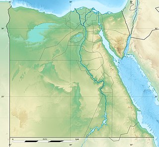
WThe Qattara Depression is a depression in northwestern Egypt, specifically in the Matruh Governorate. The depression is part of the Western Desert of Egypt. The Qattara Depression lies below sea level, and its bottom is covered with salt pans, sand dunes, and salt marshes. The depression extends between the latitudes of 28°35' and 30°25' north and the longitudes of 26°20' and 29°02' east.
 W
WSabkhat Ghuzayyil is Libya's lowest point at 47 meters below sea level, and is just southeast of the Gulf of Sidra. It is located in the Al Wahat District of the Cyrenaica region in northeastern Libya.
 W
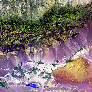
WThe Turpan Depression or Turfan Depression, is a fault-bounded trough located around and south of the city-oasis of Turpan, in the Xinjiang Autonomous Region in far Western China, about 150 kilometres (93 mi) southeast of the regional capital Ürümqi. It includes Lake Ayding, −154 metres (−505 ft), the second or third lowest depression on Earth. By some measures, it is also the hottest and driest area in China during the summer.
 W
WThis is a list of United States National Parks by elevation. Most of America's national parks are located in mountainous areas. Even among those located close to the ocean, not all are flat. Those few that are low-lying preserve important natural habitats that could never exist at high altitude. Several national parks protect deep canyons with great vertical relief. There are also three national parks whose primary features are caves, the depths of which are still being explored.
 W
WThe Zuidplaspolder is a polder in the western Netherlands, located northeast of Rotterdam. It reaches a depth of 6.76 metres below average sea level. This makes it, along with Lammefjord in Denmark, the lowest point of Western Europe and the European Union.