 W
WThe Mississippi River is the second-longest river and chief river of the second-largest drainage system on the North American continent, second only to the Hudson Bay drainage system. From its traditional source of Lake Itasca in northern Minnesota, it flows generally south for 2,320 miles (3,730 km) to the Mississippi River Delta in the Gulf of Mexico. With its many tributaries, the Mississippi's watershed drains all or parts of 32 U.S. states and two Canadian provinces between the Rocky and Appalachian mountains. The main stem is entirely within the United States; the total drainage basin is 1,151,000 sq mi (2,980,000 km2), of which only about one percent is in Canada. The Mississippi ranks as the fourth-longest river and fifteenth-largest river by discharge in the world. The river either borders or passes through the states of Minnesota, Wisconsin, Iowa, Illinois, Missouri, Kentucky, Tennessee, Arkansas, Mississippi, and Louisiana.
 W
WThe Arkansas River is a major tributary of the Mississippi River. It generally flows to the east and southeast as it traverses the U.S. states of Colorado, Kansas, Oklahoma, and Arkansas. The river's source basin lies in the western United States in Colorado, specifically the Arkansas River Valley, where the headwaters derive from the snowpack in the Sawatch and Mosquito mountain ranges. It then flows east into the Midwest via Kansas, and finally into the South through Oklahoma and Arkansas.
 W
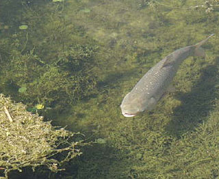
WIntroduced Asian carp in North America pose a major threat to the ecology, environment, economy, and way of life in the Upper Midwest and Great Lakes region of the United States and Canada. Asian carp are a group of fish species, which include several known to be invasive, and represent the most urgent potential danger to the ecology of the Great Lakes. The United States Department of the Interior and United States Fish and Wildlife Service presented their first annual report to Congress on the issue in December 2014.
 W
WThe Atchafalaya River is a 137-mile-long (220 km) distributary of the Mississippi River and Red River in south central Louisiana in the United States. It flows south, just west of the Mississippi River, and is the fifth largest river in North America, by discharge. The name Atchafalaya comes from Choctaw for 'long river', from hachcha, 'river', and falaya, 'long'.
 W
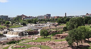
WThe Big Sioux River is a tributary of the Missouri River, 419 miles (674 km) long, in eastern South Dakota and northwestern Iowa in the United States. The United States Board on Geographic Names settled on "Big Sioux River" as the stream's name in 1931. The river was named after the Lakota people which was known by them as Tehankasandata, or Thick Wooded River. The correct spelling is Cankasdeca Wakpa [Can = wood; kasdeca = to split; Wakpa = River. Named so because this river flows through or splits the trees / forest along its banks. At Flandreau, SD this river has a large bend which is named Wakpaipaksan [Wakpa = river; ipaksan = bend] [16].
 W
WThe Canadian River is the longest tributary of the Arkansas River in the United States. It is about 906 miles (1,458 km) long, starting in Colorado and traveling through New Mexico, the Texas Panhandle, and Oklahoma. The drainage area is about 47,700 square miles (124,000 km2).
 W
WThe Grand River is a river that stretches from northernmost tributary origins between Creston and Winterset in Iowa approximately 226 miles (364 km) to its mouth on the Missouri River near Brunswick, Missouri.
 W
WThe Illinois River is a principal tributary of the Mississippi River and is approximately 273 miles (439 km) long. Located in the U.S. state of Illinois, the river drains a large section of central Illinois, with a drainage basin of 28,756.6 square miles (74,479 km2). The drainage basin extends into Wisconsin, Indiana, and a very small area of southwestern Michigan.
 W
WThe Iowa River is a tributary of the Mississippi River in the state of Iowa in the United States. It is about 323 miles (520 km) long and is open to small river craft to Iowa City, about 65 miles (105 km) from its mouth. Its major tributary is the Cedar River.
 W
WThe Kankakee River is a tributary of the Illinois River, approximately 133 miles (214 km) long, in the Central Corn Belt Plains of northwestern Indiana and northeastern Illinois in the United States. At one time, the river drained one of the largest wetlands in North America and furnished a significant portage between the Great Lakes and the Mississippi River. Significantly altered from its original channel, it flows through a primarily rural farming region of reclaimed cropland, south of Lake Michigan.
 W
WThe Kansas River, also known as the Kaw, is a river in northeastern Kansas in the United States. It is the southwesternmost part of the Missouri River drainage, which is in turn the northwesternmost portion of the extensive Mississippi River drainage. Its two names both come from the Kanza (Kaw) people who once inhabited the area; Kansas was one of the anglicizations of the French transcription Cansez of the original kką:ze. The city of Kansas City, Missouri, was named for the river, as was later the state of Kansas.
 W
WThe Kentucky River is a tributary of the Ohio River, 260 miles (418 km) long, in the U.S. Commonwealth of Kentucky. The river and its tributaries drain much of the central region of the state, with its upper course passing through the coal-mining regions of the Cumberland Mountains, and its lower course passing through the Bluegrass region in the north central part of the state. Its watershed encompasses about 7,000 square miles (18,000 km2). It supplies drinking water to about one-sixth of the population of the Commonwealth of Kentucky.
 W
WThe La Crosse River is a 61.3-mile-long (98.7 km) tributary of the Mississippi River in southwestern Wisconsin in the United States.
 W
WThe Mississippi River Basin Model Waterways Experiment Station, located near Clinton, Mississippi, was a large-scale hydraulic model of the entire Mississippi River basin, covering an area of 200 acres. The model was built from 1943 to 1966 and in operation from 1949 until 1973. By comparison, the better known San Francisco Bay Model covers 1.5 acres and the Chesapeake Bay Model covers 8 acres. The model is now derelict, but open to the public within Buddy Butts Park, Jackson.
 W
WConservation programs for the Mississippi River watershed have been designed to protect and preserve it by implementing practices that decrease the harmful effects of development on habitats and to overlook monitoring that helps future planning and management. A main focus is nutrient pollution from agricultural runoff of the nation's soybean, corn and food animal production, and problems relating to sediment and toxins. Conservation programs work with local farmers and producers to decrease excess nutrients because they cause major water quality problems along with hypoxia and loss of habitat. Organizations such as the Mississippi River/Gulf of Mexico Watershed Nutrient Task Force and USDA programs such as the Upper Mississippi River Forestry Partnership and the Mississippi River Basin Healthy Watersheds Initiative contribute to conserving what is left of the Mississippi River watershed.
 W
WThe Missouri River is the longest river in North America. Rising in the Rocky Mountains of western Montana, the Missouri flows east and south for 2,341 miles (3,767 km) before entering the Mississippi River north of St. Louis, Missouri. The river drains a sparsely populated, semi-arid watershed of more than 500,000 square miles (1,300,000 km2), which includes parts of ten U.S. states and two Canadian provinces. Although nominally considered a tributary of the Mississippi, the Missouri River above the confluence is much longer and carries a comparable volume of water. When combined with the lower Mississippi River, it forms the world's fourth longest river system.
 W
WThe Ohio River is a 981-mile (1,579 km) long river in the United States. It is located in the Midwestern United States, flowing southwesterly from western Pennsylvania south of Lake Erie to its mouth on the Mississippi River at the southern tip of Illinois. It is the third largest river by discharge volume in the United States and the largest tributary by volume of the north-south flowing Mississippi River that divides the eastern from western United States. The river flows through or along the border of six states, and its drainage basin includes parts of 14 states. Through its largest tributary, the Tennessee River, the basin includes several states of the southeastern U.S. It is the source of drinking water for three million people.
 W
WThe Platte River is a major river in the State of Nebraska. It is about 310 mi (500 km) long; measured to its farthest source via its tributary the North Platte River, it flows for over 1,050 miles (1,690 km). The Platte River is a tributary of the Missouri River, which itself is a tributary of the Mississippi River which flows to the Gulf of Mexico. The Platte over most of its length is a broad, shallow, meandering stream with a sandy bottom and many islands—a braided stream.
 W
WThe Tennessee River is the largest tributary of the Ohio River. It is approximately 652 miles (1,049 km) long and is located in the southeastern United States in the Tennessee Valley. The river was once popularly known as the Cherokee River, among other names, as many of the Cherokee had their territory along its banks, especially in eastern Tennessee and northern Alabama. Its current name is derived from the Cherokee village Tanasi.
 W
WThe Wabash River is a 503-mile-long (810 km) river that drains most of the state of Indiana in the United States. It flows from the headwaters in Ohio, near the Indiana border, then southwest across northern Indiana turning south near the Illinois border where the southern portion forms the Indiana-Illinois border before flowing into the Ohio River. It is the largest northern tributary of the Ohio River and third largest overall, right behind the Cumberland and Tennessee Rivers. From the dam near Huntington, Indiana, to its terminus at the Ohio River, the Wabash flows freely for 411 miles (661 km). Its watershed drains most of Indiana. The Tippecanoe River, White River, Embarras River and Little Wabash River are major tributaries. The river's name comes from a Miami Indian word meaning "water over white stones".
 W
WThe Wisconsin River is a tributary of the Mississippi River in the U.S. state of Wisconsin. At approximately 430 miles (692 km) long, it is the state's longest river. The river's name, first recorded in 1673 by Jacques Marquette as "Meskousing", is rooted in the Algonquian languages used by the area's American Indian tribes, but its original meaning is obscure. French explorers who followed in the wake of Marquette later modified the name to "Ouisconsin", and so it appears on Guillaume de L'Isle's map. This was simplified to "Wisconsin" in the early 19th century before being applied to Wisconsin Territory and finally the state of Wisconsin.