 W
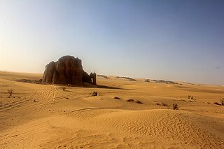
WThe Arak gorges are a series of desert gorges located in Tamanrasset Province, Algeria. The gorges are roughly 330 kilometres from the city of Tamanrasset. Carved by ancient river activity, the canyon walls vary in height from 250 to 500 m, and the canyon base is now a dry wadi.
 W
WThe Bou Sellam River is a river of the Maghreb region in Algeria, in Bordj Bou Arréridj Province.
 W
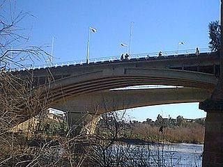
WChelif River is a 700-kilometre-long (430 mi) river in Algeria and also the longest one in the country. It rises in the Saharan Atlas near the city of Aflou, flows through the Tell Atlas and empties into the Mediterranean Sea north of the city of Mostaganem. The water level in the river often fluctuates. The river is being used for irrigation.
 W
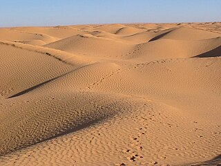
WThe Erg Admer is a large erg or field of sand dunes in the Sahara Desert. Situated in the Illizi Province west of the oasis town of Djanet in south-eastern Algeria, the erg covers an area some 20 km wide by some 100 km large north to south. It originates in the centre of Tassili n'Ajjer, towards Essendilène and extends southwards to reach Ténéré at the Niger border.
 W
WThe Erg Iguidi, is a large erg in the area of Tindouf in southwestern Algeria extending into northern Mali and Mauritania.
 W
WOued Fodda is a town and commune in Chlef Province, Algeria. According to the 1998 census it has a population of 36,187.
 W
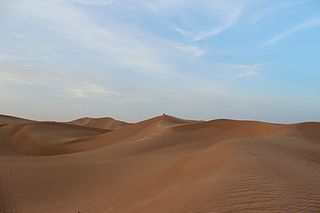
WThe Grand Erg Occidental, is the second largest erg in northern Algeria after the Grand Erg Oriental. It covers an area of approximately 78,000 square kilometres (30,000 sq mi). The sand dunes in the erg are formed by the wind, and can be up to 120 metres (390 ft) high. Certain crescent-shaped dunes, known as barchans, are actually mobile; the wind can push these dunes as much as 20 to 30 m in one year.
 W
WThe Grand Erg Oriental is a large erg or "field of sand dunes" in the Sahara Desert. Situated for the most part in Saharan lowlands of northeast Algeria, the Grand Erg Oriental covers an area some 600 km wide by 200 km north to south. The erg's northeastern edge spills over into neighbouring Tunisia.
 W
WThe Issaouane Erg is an approximately 38,000 km2 erg in Algeria's portion of the Sahara desert, located at 27.83°N 7.23°E.
 W
WThe Iullemmeden Basin is a major sub-Saharan inland basin in West Africa, extending about 1,000 kilometres (620 mi) north to south and 800 kilometres (500 mi) east to west. It covers western Niger and parts of Algeria, Mali and Nigeria. It is named after the Iullemmeden, a federation of Tuareg people who live in the central region of Niger. Its geographic range is largely coincident with the Azawagh region.
 W
WThe Mazafran River is a river, with an estuary, in Algeria, North Africa.
 W
WThe Wadi El Harrach is an Algerian river that originates in the Bliden, Atlas Mountains near Hammam Melouane. It is 67 kilometres (42 mi) long and flows into the Mediterranean, right in the middle of the bay of Algiers.
 W
WThe Oued Sebt is a small river in Algeria between the city of Gouraya, Tipaza and meselmoun. The post code for the area is 19542.
 W
WThe Sebaou River, or Oued Sebaou is the main river of the western Kabylie region of Algeria, which flows into the Mediterranean near the coastal town of Dellys in Boumerdès Province.
 W
WThe Sig River, also known as Mekerra, is a river of Algeria.
 W
WThe Soummam River is a river in northern Algeria, born from the confluence of the Oued Sahel and the Oued Bou Sellam near Akbou and flowing into the Mediterranean Sea at Béjaïa.
 W
WTademaït is a natural region in the Sahara Desert right in the centre of Algeria. It is located north of In Salah and south of the Grand Erg Occidental in the Adrar District of Adrar Province, El Ménia District of Ghardaïa Province and the northern end of Tamanrasset Province. It is one of the places of the Sahara Desert where the summer heat is most extreme.
 W
WThe Taoudeni Basin is a major geological formation in West Africa, named after the Taoudenni village in northern Mali. It covers large parts of the West African craton in Mauritania and Mali. It is of considerable interest due to its possible reserves of oil.
 W
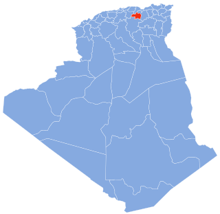
WChlef is the capital of Chlef Province, Algeria. Located in the north of Algeria, 200 kilometres (120 mi) west of the capital, Algiers, it was founded in 1843, as Orléansville, on the ruins of Roman Castellum Tingitanum. In 1962, it was renamed al-Asnam, but since 1980 it has borne its present name, Chlef, which is derived from the name of the longest river in Algeria.