 W
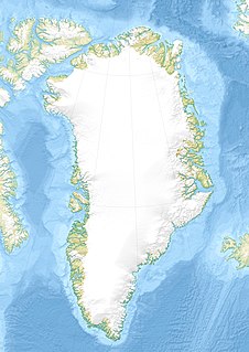
WGreenland is located between the Arctic Ocean and the North Atlantic Ocean, northeast of Canada and northwest of Iceland. The territory comprises the island of Greenland—the largest island in the world—and more than a hundred other smaller islands. As an island, Greenland has no land boundaries and 44,087 km of coastline. A sparse population is confined to small settlements along certain sectors of the coast. Greenland possesses the world's second largest ice sheet.
 W
WCharcot Land is a peninsula of Eastern Greenland, part of the Scoresby Sound system. It lies in the Northeast Greenland National Park zone.
 W
WThe Icelandic Low is a semi-permanent centre of low atmospheric pressure found between Iceland and southern Greenland and extending in the Northern Hemisphere winter into the Barents Sea. In summer it weakens and splits into two centres, one near Davis Strait and the other west of Iceland. It is a principal centre of action in the atmosphere circulation of the Northern Hemisphere, associated with frequent cyclone activity. It forms one pole of the North Atlantic oscillation, the other being the Azores High.
 W
WInglefield Land is an unglaciated region along the northwestern coast of Greenland, stretching from Cape Alexander in the southwest to Cape Agassiz in the northeast. It is bounded by Prudhoe Land in the south, Humboldt Glacier in the east, and Kane Basin in the north.
 W
WJohannes V. Jensen Land is an area in Peary Land, Northern Greenland. Administratively it lies in the Northeast Greenland National Park zone. The area is remote and currently uninhabited.
 W
WKing Christian IX Land is a coastal area of Southeastern Greenland in Sermersooq Municipality fronting the Denmark Strait and extending through the Arctic Circle from 65°N to 70°N.
 W
WKing Christian X Land is an area of northeastern Greenland.
 W
WKing Frederick VI Coast is a major geographic division of Greenland. It comprises the coastal area of Southeastern Greenland in Sermersooq and Kujalleq municipalities fronting the Irminger Sea of the North Atlantic Ocean. It is bordered by King Christian IX Land on the north and the Greenland Ice Sheet to the west.
 W
WKing Frederick VIII Land is a major geographic division of northeastern Greenland. It extends above the Arctic Circle from 76°N to 81°N in a N/S direction along the coast of the Greenland Sea.
 W
WKujataa is a sub-arctic farming landscape in the southern region of Greenland.
 W
WThis is a list of mountain ranges of Greenland.
 W
WLouise Boyd Land is an area in King Christian X Land, Eastern Greenland. Administratively it lies in the Northeast Greenland National Park zone. The area is remote and uninhabited.
 W
WThis article comprises three sortable tables of major mountain peaks of the nation of Greenland (Kalaallit Nunaat). Kalaallit Nunaat includes the Island of Greenland and surrounding islands.
 W
WNathorst Land is an area in King Christian X Land, Eastern Greenland. It lies in the Northeast Greenland National Park zone. The area is remote and uninhabited.
 W
WScoresby Land is an area of Eastern Greenland, which lies partly in Sermersooq and partly in the Northeast Greenland National Park zone. The area is uninhabited, except for Mestersvig, a military outpost.
 W
WTh. Sørensen Land is an area in King Christian X Land, Eastern Greenland, part of the inner Scoresby Sound system. Administratively it lies in the Northeast Greenland National Park zone. The area is remote and uninhabited.
 W
WThule is the farthest north location mentioned in ancient Greek and Roman literature and cartography. Modern interpretations have included Orkney, Shetland, northern Scotland, the island of Saaremaa (Ösel) in Estonia, and the Norwegian island of Smøla.
 W
WThe following sortable table comprises the 38 ultra-prominent summits of the nation of Greenland . Each of these peaks has at least 1500 meters of topographic prominence.
 W
WVatnahverfi was a district in the Norse Greenlanders’ Eastern Settlement (Eystribyggð) and is generally regarded by archaeologists and historians as having the best pastoral land in the colony. The Norse settled Vatnahverfi in the late 10th century and farmed there for nearly 500 years before mysteriously disappearing from the district and the entirety of Greenland, likely at some point in the latter 15th century. Its name is roughly translated as “Lake District."