 W
WThe Alid Volcano is a stratovolcano located in the Northern Red Sea region of Eritrea in the Danakil Depression. The peak elevation from its base is 904 metres (2,966 ft). The volcano's most recent activity was identified in 1928, when it emitted smoke. It is a large volcano located in the northern east coast.
 W
WArdoukôba is a fissure vents volcano in Djibouti. Located on the coast 100 kilometres (62 mi) from Djibouti City, its summit is situated at 298 metres (978 ft) above sea level. It last erupted in November 1978 following an earthquake, the area having been dormant for 3,000 years. The volcano's rift is 17 kilometres (11 mi) in width, and has a depth of 800 metres (2,600 ft).
 W
WCraters of the Moon National Monument and Preserve is a U.S. national monument and national preserve in the Snake River Plain in central Idaho. It is along US 20, between the small towns of Arco and Carey, at an average elevation of 5,900 feet (1,800 m) above sea level. The protected area's features are volcanic and represent one of the best-preserved flood basalt areas in the continental United States.
 W
WThe Dubbi Volcano is a stratovolcano located in the Southern Red Sea Region of Eritrea. Its peak elevation is 1625 m. There have been four known eruptions. In 1400 lava was determined to have reached the Red Sea while in 1861 ash was thrown over 250 km from the volcano. Two further events were suspected between 1861 and the 20th century.
 W
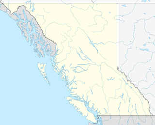
WThe Explorer Seamount is a seamount located in the Pacific Ocean off the coast of British Columbia, Canada. It is on the Explorer Ridge, a tectonic spreading centre that separates the Pacific and Explorer plates and so the volcanism is rift-related. It is the namesake of the Explorer Ridge.
 W
WCraters of the Moon National Monument and Preserve is a U.S. national monument and national preserve in the Snake River Plain in central Idaho. It is along US 20, between the small towns of Arco and Carey, at an average elevation of 5,900 feet (1,800 m) above sea level. The protected area's features are volcanic and represent one of the best-preserved flood basalt areas in the continental United States.
 W
WMount Haddington is a massive 1,630 m (5,350 ft) high shield volcano comprising much of James Ross Island in Graham Land, Antarctica. It is 60 km (37 mi) wide and has had numerous subglacial eruptions throughout its history, forming many tuyas. Some of its single eruptions were bigger in volume than a whole normal-sized volcano. Old eruption shorelines are widespread on the volcano's deeply eroded flanks.
 W
WHell's Half Acre Lava Field is a basaltic lava plain located on the Snake River Plain of Idaho in the United States. It is the easternmost of the basaltic lava fields on the Snake River Plain, located about 25 miles (40 km) west of Idaho Falls, Idaho and 30 miles (48 km) north of Pocatello, Idaho. In 1976, the National Park Service designated the northwestern portion of the site a National Natural Landmark. In 1986, the Bureau of Land Management recommended that 68,760 acres (27,830 ha) of the site, located just southeast of the National Natural Landmark, to be a wilderness study area.
 W
WThe Jalua Volcano is a volcano located in the Northern Red Sea region of Eritrea. It is a stratovolcano, with no eruption ever recorded.
 W
WLake Monoun is a lake in West Province, Cameroon, that lies in the Oku Volcanic Field 5.58°N 10.59°E. On August 15, 1984, the lake exploded in a limnic eruption, which resulted in the release of a large amount of carbon dioxide that killed 37 people. At first, the cause of the deaths was a mystery, and causes such as terrorism were suspected. Further investigation and a similar event two years later at Lake Nyos led to the currently accepted explanation.
 W
WMousa Ali is a 2,021 metres (6,631 ft) stratovolcano located on the tri-point of Ethiopia, Eritrea and Djibouti. The volcano is the highest point in Djibouti. The volcano's summit is truncated by a caldera, which contains rhyolitic lava domes and lava flows. The last known eruption occurred before the Holocene era.
 W
WThe Nabro Volcano is an active stratovolcano in the Southern Red Sea Region of Eritrea. It is located at the south-east end of the Danakil Alps in the Danakil Depression. Before its 2011 eruption, the volcano was widely believed to be extinct.
 W
WLake Nyos is a crater lake in the Northwest Region of Cameroon, located about 315 km (196 mi) northwest of Yaoundé, the capital. Nyos is a deep lake high on the flank of an inactive volcano in the Oku volcanic plain along the Cameroon line of volcanic activity. A volcanic dam impounds the lake waters.
 W
WThe O'a Caldera, also known as Shala, is a volcanic caldera in Ethiopia. It has two lakes: Lake Shala and a small maar called Lake Chitu. Sub-features include Mount Fike and Mount Billa.
 W
WThe Taos Plateau volcanic field is an area of extensive volcanism in Taos County, New Mexico, United States. It is the largest volcanic field in the Rio Grande Rift, spreading over 7,000 km2. The age of most of the vents and associated lava flows in the field is estimated to be between 1.8 and 4 million years, with a few 22-million-year-old vents. The composition of the lavas varies from tholeiitic basalt to rhyolite. Landforms include sheet flows, cinder cones, and shield volcanoes. The sheet flows of the Servilleta Basalt are well-exposed in the Rio Grande Gorge carved by the Rio Grande. The highest point of the field is San Antonio Mountain at 10,908 feet (3,325 m).
 W
WThe Tseax Cone, also called the Tseax River Cone or the Aiyansh Volcano, is a young and active cinder cone and adjacent lava flows associated with the Nass Ranges and the Northern Cordilleran Volcanic Province. It is located east of Crater Creek at outlet of Melita Lake, southeast of Gitlakdamix and 60 kilometres (37 mi) north of Terrace, British Columbia, Canada.
 W
WValles Caldera is a 13.7-mile (22.0 km) wide volcanic caldera in the Jemez Mountains of northern New Mexico. Hot springs, streams, fumaroles, natural gas seeps and volcanic domes dot the caldera floor landscape. The highest point in the caldera is Redondo Peak, an 11,253-foot (3,430 m) resurgent lava dome located entirely within the caldera. Also within the caldera are several grass valleys, or valles, the largest of which is Valle Grande, the only one accessible by a paved road. Much of the caldera is within the Valles Caldera National Preserve, a unit of the National Park System. In 1975, Valles Caldera was designated as a National Natural Landmark by the National Park Service.
 W
WThe Volcano, also known as Lava Fork volcano, is a small cinder cone in the Boundary Ranges of the Coast Mountains in northwestern British Columbia, Canada. It is located approximately 60 km (40 mi) northwest of the small community of Stewart near the head of Lava Fork. With a summit elevation of 1,656 m (5,433 ft) and a topographic prominence of 311 m (1,020 ft), it rises above the surrounding rugged landscape on a remote mountain ridge that represents the northern flank of a glaciated U-shaped valley.