 W
WThe Tropical Andes is northern of the three climate-delineated parts of the Andes, the others being the Dry Andes and the Wet Andes. The Tropical Andes' area spans 1,542,644 km2 (595,618 sq mi).
 W
WThe Andean natural region, located in central Colombia, is the most populated natural region of Colombia. With many mountains contains the majority of the country's urban centers. They were also the location of the most significant pre-Columbian indigenous settlements. Beyond the Colombian Massif in the south-western departments of Cauca and Nariño, the Colombian Andes divide into three branches known as "cordilleras" : the West Andes run adjacent to the Pacific coast and is home to the city of Cali. The Central Andes run up the center of the country between the Cauca and Magdalena river valleys and includes the cities of Medellín, Manizales and Pereira. The East Andes extend northeast towards the Guajira Peninsula, and includes the cities of Bogotá, Bucaramanga and Cúcuta.
 W
WThe Cauca Valley dry forests is a tropical dry broadleaf forest ecoregion in Colombia.
 W
WThe Central Andean dry puna (NT1001) is an ecoregion in the Montane grasslands and shrublands biome, located in the Andean high plateau, in South America. It is a part of the Puna grassland.
 W
WThe Central Andean puna is a montane grasslands and shrublands ecoregion in the Andes of southern Peru, Bolivia, and northern Argentina.
 W
WThe Central Andean wet puna is a montane grasslands and shrublands ecoregion in the Andes of Peru and Bolivia.
 W
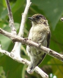
WThe following is a list of fishes present in the Colombian Magdalena River.
 W
WWhen the Spanish arrived, they divided Peru into three main regions: the coastal region, that is bounded by the Pacific Ocean; the highlands, that is located on the Andean Heights, and the jungle, that is located on the Amazonian Jungle. But Javier Pulgar Vidal (es), a geographer who studied the biogeographic reality of the Peruvian territory for a long time, proposed the creation of eight Natural Regions. In 1941, he presented his thesis "Las Ocho Regiones Naturales del Perú" at the III General Assembly of the Pan-American Institute of Geography and History.
 W
WThe Paramillo Massif is a mountain range of the Tropical Andes System, located at the northern end of the Cordillera Occidental range in Colombia.
 W
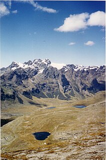
WThe puna grassland ecoregion, of the montane grasslands and shrublands biome, is found in the central Andes Mountains of South America. It is considered one of the eight Natural Regions in Peru, but extends south, across Bolivia, as far as northern Argentina and Chile. The term puna encompasses diverse ecosystems of the high Central Andes above 3200–3400 m.
 W
WQuechua is one of the eight Natural Regions of Peru and is between 2,300 and 3,500 m above sea level. It is composed of big valleys divided by rivers fed by estival rains.
 W
WRupa-Rupa or High Jungle is one of the eight natural regions of Peru. It is located between 400 and 1,000 m above the sea level. This region has many long, narrow valleys and fluvial mountain trails. The weather is warm, humid, and rainy.
 W
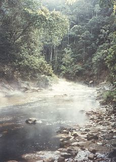
WSanta Lucia Cloud Forest is a cloud forest reserve, located about 80 km northwest of Quito, in the province of Pichincha, in Ecuador. This is at the far south of the southern phase of the Choco-Andean Rainforest Corridor. Rainforest Concern works with the Santa Lucia co-operative, a community-based conservation organisation dedicated to conservation and to sustainable development so that they can make a modest living whilst conserving their remaining cloud forest.
 W
WSuni or Jalca is one of the eight Natural Regions of Peru. It is located in the Andes at an altitude between 3,500 and 4,000 metres above sea level. Suni has a dry and cold weather and there are many glacial valleys.
 W
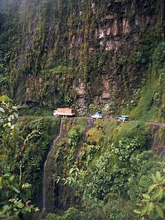
WThe Yungas is a narrow band of forest along the eastern slope of the Andes Mountains from Peru, Bolivia, and northern Argentina. It is a transitional zone between the Andean highlands and the eastern forests. Like the surrounding areas, the Yungas belong to the Neotropical realm; the climate is rainy, humid, and warm.