 W
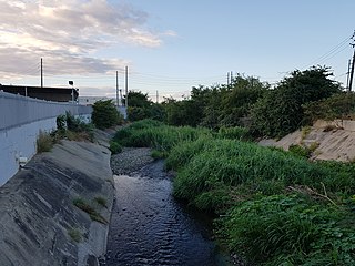
WThis list of rivers of Ponce consists of the 14 rivers in the municipality of Ponce, Puerto Rico. Rivers that either originate in the municipality or that run the bulk of their course through said municipality are listed. Except for two rivers, Río Portugués and Río Jacaguas, all other rivers originate and terminate within the boundaries of the municipality of Ponce. This list does not include quebradas. Only streams recognized as "rivers" by the United States Geological Survey and the Puerto Rico Department of Natural and Environmental Resources are included here.
WAnón River is a river in the municipality of Ponce, Puerto Rico. It is located in the northeastern area of the municipality. Río Anón is one of the 14 rivers in the municipality and, at 1,060 feet (320 m), it is also the third with the highest river mouth location, after Río Prieto and Río Blanco, both of which have their mouths at 1,381 feet (421 m). Río Anón is a tributary of Río Inabón. It has a length of approximately 4 kilometers (2.5 mi) and generally runs south. It has both its origin and its mouth in Barrio Anón.
 W
WRío Bayagán is a river in the municipality of Ponce, Puerto Rico. Bayagán is a tributary of Cerrillos River. It has a length of approximately six kilometers and runs in a southerly direction, mostly along PR-505. It originates in barrio Montes Llanos and runs south through barrio Machuelo Arriba for about nine kilometers until it meets Río Cerrillos. It is part of the Bucaná River watershed. This river is one of the 14 rivers in the municipality.
WRío Blanco is a river in the municipality of Ponce, Puerto Rico. It is located in the northeastern area of the municipality. It empties into the Río Prieto. Together with the Río Prieto, the Río Blanco is one of the two rivers in Ponce with their mouth at the highest elevation. This river is one of the 14 rivers in the municipality.
 W
WBucaná River is a river in the municipality of Ponce, Puerto Rico. Río Bucaná has its origin in barrio Machuelo Arriba where it forms at an altitude of 115 feet (35 m). It forms from the confluence of Río Cerrillos and Río Bayagán. It is also fed by Río Portugues during its southernly run. Río Bucaná used to run for some 29.5 kilometers (18.3 mi) prior to canalization and other diversion work by the U.S. Army Corps of Engineers. It now runs for 5.89 miles (9.48 km) to drain into the Caribbean Sea. This river is one of the 14 rivers in the municipality.
 W
WCañas River, also known as Río Cañas, is a river in the municipality of Ponce, Puerto Rico. It is also known as Río Magueyes in the area where it flows through Barrio Magueyes, also in the municipality of Ponce. This river is one of the 14 rivers in the municipality.
 W
WCerrillos River is a river in the municipality of Ponce, Puerto Rico. Río Cerrillos has its origin in barrio Anón and runs south until it feeds into Bucaná River. Río Cerrillos is commonly known by the locals as Maragüez River, because most of its course runs through Barrio Maragüez. This river is one of the 14 rivers in the municipality. The river has a discharge of 24,000 cubic feet per second, making it the second most affluent river in the municipality after Río Jacaguas.
 W
WChiquito River is a river in the municipality of Ponce, Puerto Rico. This river feeds into Río Portugués in the sector called Parras, about 0.5 km (0.3 mi) north of the intersection of PR-504 and PR-505. It has its origin in the mountains west of Montes Llanos. Río Chiquito is fed by Quebrada del Pastillo. This river is one of the 14 rivers in the municipality of Ponce.
 W
WRío Inabón is one of one of the 14 rivers in the municipality of Ponce, Puerto Rico. With a length of some 32.01 kilometers (19.89 mi), it is Ponce's second longest river after Río Jacaguas. It is fed by the Río Anón, Río Guayo and the Emajagua Brook. It is also fed by Río Bacas and Río de las Raices. Originating at an altitude of approximately 4,100 feet (1,200 m), it forms at a higher altitude than any of the other 13 rivers in the municipality, and at one of the highest points of any river in Puerto Rico. With a watershed area covering 38.18 square miles, Río Inabón also has the second largest basin area of any of the municipality's 14 rivers after Rio Jacaguas.
 W
WRío Jacaguas is a river shared between the municipalities of Ponce and Juana Diaz in Puerto Rico. It flows from north to south, draining into the Caribbean Sea east of the city of Ponce. One of the 14 rivers in the municipality of Ponce, it is also the longest, at 39.72 kilometers (24.68 mi). The river has a discharge of 37,000 ft3/second, making it also Ponce's most affluent river.
 W
WRío Matilde is a short river in the municipality of Ponce, Puerto Rico. It forms from the confluence of Rio Pastillo and Rio Canas. Río Matilde is one of the 14 rivers in the municipality and, forming at an altitude of just 15 feet (4.6 m), it forms at an altitude lower than any other river in the municipality.
 W
WRío Pastillo is a river in the municipality of Ponce, Puerto Rico. It is also known as Río Marueño in the area of the municipality where it runs through barrio Marueño. Together with Cañas River, Pastillo forms Matilde River. Pastillo is one of the 14 rivers in the municipality. The river originates at an altitude of 435 feet. Its tributaries are Quebrada Limon and Quebrada del Agua brooks and the river runs for 19 kilometers before feeding into Río Matilde at a height of 15 feet in Barrio Canas Urbano.
 W
WRío Portugués is a river in the municipality of Ponce, Puerto Rico. In the 19th century, it was also known as Río de Ponce. Twenty-one bridges for motor vehicle traffic span Río Portugués in the municipality of Ponce alone. The river is also known as Río Tibes in the area where it flows through barrio Tibes in the municipality of Ponce. Río Portugués has a length of nearly 30 kilometers (19 mi) and runs south from the Cordillera Central mountain range into the Caribbean Sea. The Portugués is one of the best-known rivers in Ponce because of its prominent zigzagging through the city and its historical significance. The river is historically significant because the city of Ponce had its origins on its banks. It was originally known as Río Baramaya. It has its mouth at 17°58′51″N 66°37′26″W. This river is one of the 14 rivers in the municipality.
WPrieto River is a river in the municipality of Ponce, Puerto Rico. It is located in the northeastern area of the municipality. Forming at an altitude of 3,920 feet (1,190 m), Río Prieto originates at the second highest point of any river in the municipality after Río Inabon. It empties into Río Cerrillos. Together with Río Blanco, Río Prieto is one of the two rivers in Ponce with mouths at the highest elevation. This river is one of the 14 rivers in the municipality.
WSan Patricio River is a river in the municipality of Ponce, Puerto Rico. It is part of the Bucaná River river system via Cerrillos River. San Patricio is one of the 14 rivers in the municipality.