 W
WMount Banahaw is a active volcano on Luzon in the Philippines. The three-peaked volcano complex is located at the boundary of Laguna and Quezon provinces. It is the highest mountain in the Calabarzon region, dominating the landscape for miles around.
 W
WLake Tikub is a nearly circular crater lake located in the province of Quezon, in the Philippines. The circumference of the lake is elevated and thick with foliage that steeply slopes down to the shore of the lake. The lake is located at the foot of Mount Malepunyo, and nearby is Mount Banahaw, in Brgy. Ayusan, in the town of Tiaong. Access to the lake is through Brgy. San Pedro.
 W
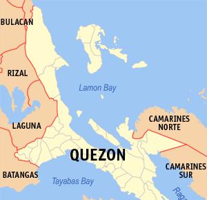
WLamon Bay is a large bay in the southern part of Luzon island in the Philippines. It is a body of water connecting the southern part of Quezon province to the Philippine Sea, a marginal sea of the Pacific Ocean. It borders on the coastal towns of Atimonan, Gumaca, Plaridel, Lopez, Calauag, and the islands of Alabat.
 W
WMalepunyo Range is an extinct volcano located on Luzon Island in the Philippines. The mountain range is located between the provinces of Batangas, Laguna and Quezon. It is popular among mountaineers, and has three interconnected destinations: Mt. Malepunyo, the highest; Bagwis Peak ; and Mount Dalaga.
WThe Maulawin Spring Protected Landscape is a protected landscape area of forested hills and several rivers and streams located in the province of Quezon on southern Luzon island in the Philippines. It was originally created in 1939 to protect the watershed in the municipality of Guinayangan known as the Maulawin Spring Watershed Forest Reserve declared through Proclamation No. 365 by President Manuel Luis Quezon. It had an initial area of 60 hectares. In 2000, the forest reserve was enlarged and was redesignated as a protected landscape under the National Integrated Protected Areas System by virtue of Proclamation No. 295 issued by President Joseph Estrada. It is the only source of potable water for domestic consumption of the more than 40,000 residents of Guinayangan.
 W
WMount Mayabobo is a cinder cone situated at the base of Mount Banahaw, in Barangay Mayabobo, Candelaria, Quezon in Luzon island, Philippines. Approximately with a height of 300 metres (980 ft), it is a tourist destination for local residents of Candelaria and nearby municipalities, since it has a telecommunication site at its summit for sight-seeing and hiking.
WMount Maclayao a mountain in the Philippines. It is located in Mulanay, Quezon, in the Calabarzon region, north-west of the country, 200 km south-east of the national capital Manila.
 W
WRagay Gulf is a large gulf in the Bicol Peninsula of Luzon island in the Philippines, part of the Sibuyan Sea. It is separated from Tayabas Bay by the Bondoc Peninsula in the west. The gulf covers the provinces of Quezon and Camarines Sur.
 W
WMount San Cristobal is a potentially active volcano at the boundary of the provinces of Laguna and Quezon on the island of Luzon, Philippines. The mountain rises to an elevation of 1,470 m (4,820 ft) above mean sea level and is one of the volcanic features of Macolod Corridor.
 W
WThe Sierra Madre is the longest mountain range in the Philippines. Spanning for over 540 kilometers (340 mi), it runs from the province of Cagayan down to the province of Quezon, forming a north–south direction on the eastern portion of Luzon, the largest island of the archipelago. It is bordered by the Pacific Ocean to the east, Cagayan Valley to the northwest, Central Luzon to the midwest, and Calabarzon to the southwest. The Pacific coast of Luzon along the Sierra Madre is less developed as the lofty and continuous mountains form a bold and almost inaccessible shore, exposed to the full force of the northeast monsoon and the waves of the Pacific Ocean. Some of communities east of the mountain range and along the coast are so remote they are only accessible by plane or boat.
 W
WTayabas Bay is a large bay in the southern part of Luzon island in the Philippines. Several islands are located in the bay, largest of which is Marinduque.
WTayabas Isthmus, separates the Bicol Peninsula from the main part of Luzon Island, and the Bondoc Peninsula which lies between Tayabas Bay and Ragay Gulf.
WUmiray River is the river that separates Aurora and Quezon provinces. It is bounded by the towns of Dingalan in Aurora and General Nakar in Quezon.