 W
WThe Antilles is an archipelago bordered by the Caribbean Sea to the south and west, the Gulf of Mexico to the northwest, and the Atlantic Ocean to the north and east.
 W
WThe Greater Antilles is a grouping of the larger islands in the Caribbean Sea, including Cuba, Hispaniola, Puerto Rico, Jamaica, and the Cayman Islands. Six island states share the region of the Greater Antilles in total, with Haiti and the Dominican Republic sharing the island of Hispaniola. Geologically, the Virgin Islands are also part of the Greater Antilles, though politically they are considered part of the Lesser Antilles. At an area of 207,411 square kilometres (80,082 sq mi), not counting the Virgin Islands, the Greater Antilles constitute nearly 90% of the land mass of the entire West Indies, as well as over 90% of its population. The remainder of the land belongs to the archipelago of the Lesser Antilles, which is a chain of islands to the east, running north–south and encompassing the eastern edge of the Caribbean Sea where it meets the Atlantic Ocean, as well as to the south, running east–west off the northern coast of South America. The Lucayan Archipelago is not considered to be a part of the Antilles archipelagos but rather of the North Atlantic.
 W
WThe Anglo-French War, also known as the War of 1778 or the Bourbon War in Britain, was a military conflict fought between France and Great Britain, sometimes with their respective allies, between 1778 and 1783. As a consequence, Great Britain was forced to divert resources used to fight the war in North America to theatres in Europe, India and the West Indies, and to rely on what turned out to be the chimera of Loyalist support in its North American operations. From 1778 to 1783, with or without their allies, France and Britain fought over dominance in the English Channel, the Mediterranean, the Indian Ocean and the Caribbean.
 W
WThe Confederación Antillana or Antillean Confederation was the vehement idea of Ramón Emeterio Betances about the need for natives of the Spanish Caribbean to unite into a regional entity that would seek to preserve the sovereignty and well-being of Cuba, the Dominican Republic and Puerto Rico.
 W
WThe Cayman Islands is an autonomous British Overseas Territory in the western Caribbean Sea. The 264-square-kilometre (102-square-mile) territory comprises the three islands of Grand Cayman, Cayman Brac and Little Cayman, which are located to the south of Cuba and northeast of Honduras, between Jamaica and Mexico's Yucatán Peninsula. The capital city is George Town on Grand Cayman, which is the most populous of the three islands.
 W
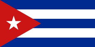
WCuba, officially the Republic of Cuba is a country comprising the island of Cuba, as well as Isla de la Juventud and several minor archipelagos. Cuba is located in the northern Caribbean where the Caribbean Sea, Gulf of Mexico and Atlantic Ocean meet. It is east of the Yucatán Peninsula (Mexico), south of both the U.S. state of Florida and the Bahamas, west of Hispaniola, and north of both Jamaica and the Cayman Islands. Havana is the largest city and capital; other major cities include Santiago de Cuba and Camagüey. The official area of the Republic of Cuba is 109,884 square kilometers (42,426 sq mi). The main island of Cuba is the largest island in Cuba and in the Caribbean, with an area of 104,556 square kilometers (40,369 sq mi). Cuba is the second-most populous country in the Caribbean after Haiti, with over 11 million inhabitants.
 W
WThe Dominican Republic is a country located on the island of Hispaniola in the Greater Antilles archipelago of the Caribbean region. It occupies the eastern five-eighths of the island, which it shares with Haiti, making Hispaniola one of only two Caribbean islands, along with Saint Martin, that are shared by two sovereign states. The Dominican Republic is the second-largest nation in the Antilles by area at 48,671 square kilometers (18,792 sq mi), and third-largest by population with approximately 10.8 million people, of whom approximately 3.3 million live in the metropolitan area of Santo Domingo, the capital city. The official language of the country is Spanish.
 W
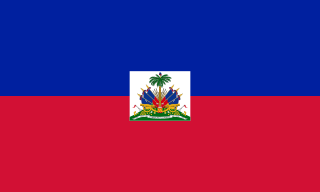
WHaiti, officially the Republic of Haiti and formerly known as Hayti, is a country located on the island of Hispaniola in the Greater Antilles archipelago of the Caribbean Sea, to the east of Cuba and Jamaica and south of The Bahamas and the Turks and Caicos Islands. It occupies the western three-eighths of the island which it shares with the Dominican Republic. To its south-west lies the small island of Navassa Island, which is claimed by Haiti but is disputed as a United States territory under federal administration. Haiti is 27,750 square kilometers (10,714 sq mi) in size, the third largest country in the Caribbean by area, and has an estimated population of 11.4 million, making it the most populous country in the Caribbean.
 W
WHispaniola is an island in the Caribbean archipelago known as the Greater Antilles. It is the most populous island in the West Indies and the region's second largest after Cuba.
 W
WThe Greater Antilles were severely impacted by Hurricane Sandy, whom's effects were spread over five countries, including Jamaica, Haiti, Cuba, the Dominican Republic and Puerto Rico, and included at least 120 deaths, primarily on October 24 and 25, 2012. Sandy formed in the central Caribbean Sea south of Jamaica on October 22 as part of the 2012 Atlantic hurricane season. It later struck Jamaica as an intensifying hurricane and then Cuba as a major hurricane. Total damages equaled up to nearly $3 billion.
 W
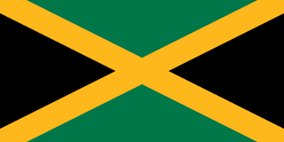
WJamaica is an island country situated in the Caribbean Sea. Spanning 10,990 square kilometres (4,240 sq mi) in area, it is the third-largest island of the Greater Antilles and the Caribbean. Jamaica lies about 145 kilometres (90 mi) south of Cuba, and 191 kilometres (119 mi) west of Hispaniola ; the British Overseas Territory of the Cayman Islands lies some 215 kilometres (134 mi) to the north-west.
 W
WNavassa Island is a small uninhabited island in the Caribbean Sea. Located northeast of Jamaica, south of Cuba, 40 nautical miles west of Jérémie on the south west peninsula of Haiti, it is subject to an ongoing territorial dispute between Haiti and the United States, which administers the island through the U.S. Fish and Wildlife Service. The U.S. has claimed the island since 1857, based on the Guano Islands Act of 1856. Haiti's claim over Navassa goes back to the Treaty of Ryswick in 1697 that established French possessions in mainland Hispaniola, that were transferred from Spain by the treaty as well as other specifically named nearby islands. Its 1801 constitution also claimed unnamed "other adjacent islands", with Navassa not specifically named. Since its 1874 Constitution, and after the establishment of the 1857 U.S. claim, Haiti has explicitly named "la Navase" as one of the territories it claims. Médéric Louis Élie Moreau de Saint-Méry, who was a member of the French Parliament best known for his publications on Saint-Domingue, referred to la Navasse as the "small French island of Saint-Domingue" in 1798.
 W
WPuerto Rico, officially the Commonwealth of Puerto Rico and from 1898 to 1932 also called Porto Rico in English, is an unincorporated territory of the United States located in the northeast Caribbean Sea, approximately 1,000 miles (1,600 km) southeast of Miami, Florida.