 W
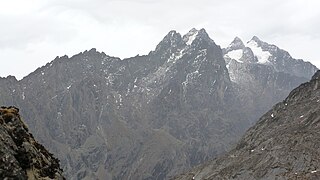
WThe Ruwenzori, also spelled Rwenzori and Rwenjura, are a range of mountains in eastern equatorial Africa, located on the border between Uganda and the Democratic Republic of the Congo. The highest peak of the Ruwenzori reaches 5,109 metres (16,762 ft), and the range's upper regions are permanently snow-capped and glaciated. Rivers fed by mountain streams form one of the sources of the Nile. Because of this, European explorers linked the Ruwenzori with the legendary Mountains of the Moon, claimed by the Greek scholar Ptolemy as the source of the Nile. Virunga National Park in eastern DR Congo and Rwenzori Mountains National Park in southwestern Uganda are located within the range.
 W
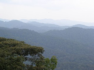
WThe Albertine Rift montane forests is a tropical moist broadleaf forest ecoregion in east-central Africa. The ecoregion covers the mountains of the northern Albertine Rift, and is home to distinct Afromontane forests with high biodiversity.
 W
WMount Baker or Kiyanja is a mountain in the Rwenzori Mountains National Park in Uganda, 2.8 kilometres (1.7 mi) from the border with the Democratic Republic of the Congo. With a height of 4,844 metres (15,892 ft), it is the sixth highest mountain in Africa. Together with Mount Stanley and Mount Speke, it forms a triangle enclosing the upper Bujuku Valley. The nearest peak is Mount Stanley, which is 2.26 kilometres (1.40 mi) to the west. The mountains lie within an area called "The Mountains of the Moon".
 W
WDendrosenecio adnivalis is one of the giant groundsels of the mountains of Eastern Africa. D. adnivalis grows on the Rwenzori Mountains and on the Virunga Mountains in Uganda and the Democratic Republic of Congo.
 W
WMutwanga Hydroelectric Power Station, also referred to as Mutwanga Hydropower Station, is a 9.4-megawatt (12,600 hp) hydroelectric power station in the Democratic Republic of the Congo.
 W
WRwenzori Mountains National Park is a Ugandan national park and UNESCO World Heritage Site located in the Rwenzori Mountains. Almost 1,000 km2 (386 sq mi) in size, the park has Africa's third highest mountain peak and many waterfalls, lakes, and glaciers. The park is known for its beautiful plant life.
 W
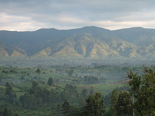
WRwenzururu is a subnational kingdom in western Uganda, located in the Rwenzori Mountains on the border with the Democratic Republic of the Congo. The kingdom includes the districts of Bundibugyo, Kasese and Ntoroko. Rwenzururu is also the name given to the region the kingdom is located in.
 W
WMount Speke lies in the Ruwenzori Mountains National Park in Uganda and is the second highest mountain in this range. Together with Mount Stanley and Mount Baker, it forms a triangle enclosing the upper Bujuku Valley. The nearest peak is Mount Stanley, which is 3.55 kilometres (2.21 mi) to the south-southwest. The mountains lie within an area called 'The Mountains of the Moon'.
 W
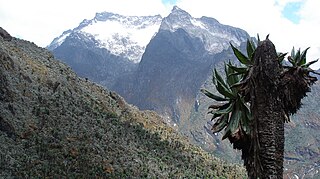
WMount Stanley or Mount Ngaliema is a mountain located in the Rwenzori range. With an elevation of 5,109 m (16,763 ft), it is the highest mountain of both the Democratic Republic of the Congo and Uganda, and the third highest in Africa, after Kilimanjaro (5,895 m) and Mount Kenya (5,199 m). The peak and several other surrounding peaks are high enough to support glaciers. Mount Stanley is named for the journalist and explorer, Sir Henry Morton Stanley. It is part of the Rwenzori Mountains National Park, a UNESCO world Heritage Site.
 W
WVirunga National Park is a national park in the Albertine Rift Valley in the eastern part of the Democratic Republic of the Congo. It was created in 1925 and is among the first protected areas in Africa. In elevation, it ranges from 680 m (2,230 ft) in the Semliki River valley to 5,109 m (16,762 ft) in the Rwenzori Mountains. From north to south it extends about 300 km (190 mi), largely along the international borders with Uganda and Rwanda in the east. It covers an area of 8,090 km2 (3,120 sq mi) and is listed in the List of World Heritage in Danger since 1994.