 W
WThe Chihuahuan Desert is a desert and ecoregion designation covering parts of northern Mexico and the southwestern United States. It occupies much of West Texas, parts of the middle and lower Rio Grande Valley and the lower Pecos Valley in New Mexico, and a portion of southeastern Arizona, as well as the central and northern portions of the Mexican Plateau. It is bordered on the west by the Sonoran Desert and the extensive Sierra Madre Occidental range, along with northwestern lowlands of the Sierra Madre Oriental range. On the Mexican side, it covers a large portion of the state of Chihuahua, along with portions of Coahuila, north-eastern Durango, the extreme northern part of Zacatecas, and small western portions of Nuevo León. With an area of about 501,896 km2 (193,783 sq mi), it is the largest desert in North America.
 W
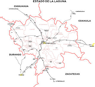
WThe Comarca Lagunera or La Comarca de la Laguna is a region of northern Mexico occupying large portions of the states of Durango and Coahuila, with rich soils produced by periodic flooding of the Nazas and Aguanaval rivers. Neither river drains into either the Pacific Ocean or the Gulf of Mexico, but rather they created a series of inland lakes. The region was developed for large-scale irrigated cotton agriculture. During the Mexican Revolution, the region was the site of fierce fighting. Following the military phase of the Revolution, the region was part of the agrarian reform under President Lázaro Cárdenas. The dam named for Cárdenas now controls flooding of the rivers, but the groundwater resources are no longer recharged as a result. It is the 8th largest metropolitan area in Mexico.
 W
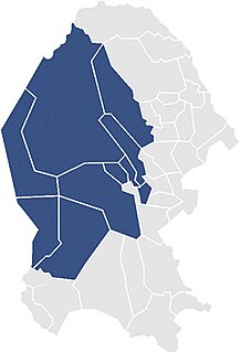
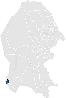
WThe First Federal Electoral District of Coahuila (I Distrito Electoral Federal de Coahuila) is one of the 300 Electoral Districts into which Mexico is divided for the purpose of elections to the federal Chamber of Deputies and one of seven such districts in the state of Coahuila.
 W
WThe Second Federal Electoral District of Coahuila (II Distrito Electoral Federal de Coahuila) is one of the 300 Electoral Districts into which Mexico is divided for the purpose of elections to the federal Chamber of Deputies and one of seven such districts in the state of Coahuila.
 W
WThe Third Federal Electoral District of Coahuila (III Distrito Electoral Federal de Coahuila) is one of the 300 Electoral Districts into which Mexico is divided for the purpose of elections to the federal Chamber of Deputies and one of seven such districts in the state of Coahuila.
 W
WThe Fourth Federal Electoral District of Coahuila (IV Distrito Electoral Federal de Coahuila) is one of the 300 Electoral Districts into which Mexico is divided for the purpose of elections to the federal Chamber of Deputies and one of seven such districts in the state of Coahuila.
 W
WThe Fifth Federal Electoral District of Coahuila (V Distrito Electoral Federal de Coahuila) is one of the 300 Electoral Districts into which Mexico is divided for the purpose of elections to the federal Chamber of Deputies and one of seven such districts in the state of Coahuila.
 W
WThe Sixth Federal Electoral District of Coahuila (VI Distrito Electoral Federal de Coahuila) is one of the 300 Electoral Districts into which Mexico is divided for the purpose of elections to the federal Chamber of Deputies and one of seven such districts in the state of Coahuila.
 W
WThe Seventh Federal Electoral District of Coahuila (VII Distrito Electoral Federal de Coahuila) is one of the 300 Electoral Districts into which Mexico is divided for the purpose of elections to the federal Chamber of Deputies and one of seven such districts in the state of Coahuila.
 W
WThe Aguja Formation is a geological formation in North America, exposed in Texas, United States and Chihuahua and Coahuila in Mexico, whose strata date back to the Late Cretaceous. Dinosaur remains are among the fossils that have been recovered from the formation.