 W
WThe Beaverhead–Deerlodge National Forest is the largest of the National Forests in Montana, United States. Covering 3.36 million acres (13,600 km2), the forest is broken into nine separate sections and stretches across eight counties in the southwestern area of the state. President Theodore Roosevelt named the two forests in 1908 and they were merged in 1996. Forest headquarters are located in Dillon, Montana. In Roosevelt's original legislation, the Deerlodge National Forest was called the Big Hole Forest Reserve. He created this reserve because the Anaconda Copper Mining Company, based in Butte, Montana, had begun to clearcut the upper Big Hole River watershed. The subsequent erosion, exacerbated by smoke pollution from the Anaconda smelter, was devastating the region. Ranchers and conservationists alike complained to Roosevelt, who made several trips to the area. (Munday 2001)
 W
WThe Anaconda–Pintler Wilderness is located in southwestern Montana, in the northwestern United States. It runs for 40 miles (64 km) along both sides of the crest of the Anaconda Range, covering almost 250 square miles (650 km2). To the north are the Sapphire Mountains, and to the south is the Big Hole Valley. Elevations range from about 5,000 feet (1,500 m) up to 10,793 feet (3,290 m) at West Goat Peak. West Pintler Peak, located in a more commonly visited area, rises to 9,894 feet (3,016 m). Visitors can most easily access this area via trailheads at Pintler Lake to the south, and at Lutz Creek and Moose Lake to the north. The wilderness lies in parts of Deer Lodge, Granite, Ravalli, and Beaverhead counties.
WThe Beaverhead Mountains, highest point Scott Peak, el. 11,393 feet (3,473 m), are a mountain range straddling the Continental Divide in the U.S. states of Montana and Idaho. They are a sub-range of the Bitterroot Range, and divide Beaverhead County, Montana from Lemhi County, Idaho and Clark County, Idaho.
 W
WThe Conrow Fire is a wildfire currently burning seven miles northeast of Whitehall in the Beaverhead-Deerlodge National Forest in Montana in the United States. The fire was started by a lightning strike on August 24, 2017. It has burned 2,741 acres (11 km2) and has threatened homes, ranches and mining operations in the area.
 W
WThe Lee Metcalf Wilderness is located in the Northern Rocky Mountains of the U.S. state of Montana. Created by an act of Congress in 1983, this rugged alpine wilderness is in four separated parcels typified by complex mountain topography: Bear Trap Canyon unit, Spanish Peaks unit, Taylor-Hilgard unit, and Monument Mountains unit. The Bear Trap Canyon unit was the first designated wilderness area to be managed by the U.S. Bureau of Land Management, and comprises a region of canyonlands adjacent to the Madison River. The other three sections of the wilderness are jointly managed by Beaverhead-Deerlodge and Gallatin National Forests both of which are a part of the U.S. Department of Agriculture. The wilderness was named after the late Montana congressman Lee Metcalf.
WLemhi Pass is a high mountain pass in the Beaverhead Mountains, part of the Bitterroot Range in the Rocky Mountains and within Salmon-Challis National Forest. The pass lies on the Montana-Idaho border on the continental divide, at an elevation of 7,373 feet (2,247 m) above sea level. It is accessed via Lemhi Pass Road in Montana, and the Lewis and Clark Highway in Idaho, both dirt roads. Warm Springs Road, which roughly follows the divide in Montana, passes just west of the pass's high point.
 W
WThe Madison Range is a mountain range located in the Rocky Mountains of Montana and Idaho in the United States. The range was named in honor of future President of the United States, then U.S. Secretary of State James Madison by Meriwether Lewis as the Lewis and Clark Expedition travelled through Montana in 1805. The range extends 80 miles (130 km) from West Yellowstone, Montana to Bozeman, Montana and is flanked by the Madison River on the west and the Gallatin River to the east. The highest point in the range is Hilgard Peak at 11,316 ft (3,449 m), a remote peak that wasn't climbed until 1948.
 W
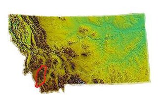
WThe Pioneer Mountains cover 2,000 square miles (5,200 km2) in Beaverhead County in southwestern Montana, USA.
 W
WThe Sapphire Mountains are a range of mountains located in southwestern Montana in the northwestern United States. From a point near the Clark Fork River and the city of Missoula, they run in a southerly direction for a distance of approximately 60 miles (100 km), making up much of the border between Ravalli County and Granite County. To the west is the Bitterroot Valley, and to the east is Rock Creek. The southern end of the range meets the larger Anaconda Range at West Pintler Peak.
 W
WThe Tobacco Root Mountains lie in the northern Rocky Mountains, between the Jefferson and Madison Rivers in southwest Montana. The highest peak is Hollowtop at 10,604 feet (3,232 m). The range contains 43 peaks rising to elevations greater than 10,000 feet.