 W
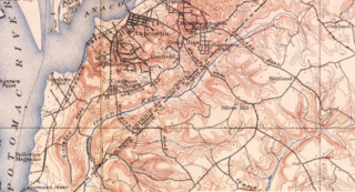
WThe Anacostia River is a river in the Mid Atlantic region of the United States. It flows from Prince George's County in Maryland into Washington, D.C., where it joins with the Washington Channel to empty into the Potomac River at Buzzard Point. It is approximately 8.7 miles (14.0 km) long. The name "Anacostia" derives from the area's early history as Nacotchtank, a settlement of Necostan or Anacostan Native Americans on the banks of the Anacostia River.
The Anacostia Waterfront Corporation (AWC) was a government-owned corporation established in 2004 by the government of District of Columbia, to revitalize neighborhoods next to the Anacostia River and to coordinate the environmental rehabilitation and use of the river. The corporation was intended to have a 20-year lifespan, during which it would oversee an $8 billion public-private redevelopment plan covering the Anacostia River waterfront, as well as numerous parcels of land in the city east of the river. However, a change in mayoral administrations and frustration with the slow pace of redevelopment resulted in abolition of the corporation after three years.
 W
WBuzzard Point is an urbanized area located on the peninsula formed by the confluence of the Potomac and Anacostia Rivers in the southwest quadrant of Washington, D.C., United States.
 W
WNortheast Branch Anacostia River is a 3.2-mile-long (5.1 km) free-flowing stream in Prince George's County, Maryland. It is a tributary of the Anacostia River, which flows to the Potomac River and the Chesapeake Bay.
 W
WNorthwest Branch Anacostia River is a 21.5-mile-long (34.6 km) free-flowing stream in Montgomery County and Prince George's County, Maryland. It is a tributary of the Anacostia River, which flows to the Potomac River and the Chesapeake Bay.
 W
WOxon Run is a tributary stream of Oxon Creek and the Potomac River in Prince George's County, Maryland, and Washington, D.C.
 W
WPaint Branch is a 14.0-mile-long (22.5 km) stream that flows through Montgomery County and Prince George's County, Maryland. It is a tributary of the Northeast Branch, which flows to the Anacostia River, Potomac River and the Chesapeake Bay.
 W
WThe Washington Channel is a channel that parallels the Potomac River in Washington, D.C. It is located between the Southwest Waterfront on the east side and East Potomac Park on the west side. The channel is two miles (3.2 km) long, receives outflow from the Tidal Basin at its north end, and empties into the Anacostia River at Hains Point at its south end. The channel's depth ranges from 8.8 feet (2.7 m) to 23 feet (7.0 m).
 W
WThe Washington City Canal operated from 1815 until the mid-1850s in Washington, D.C. The canal connected the Anacostia River, termed the "Eastern Branch" at that time, to Tiber Creek, the Potomac River, and later the Chesapeake and Ohio Canal (C&O). The canal became disused during the late 19th century and the city government covered over or filled in various sections in 1871.
 W
WWatts Branch is a tributary stream of the Anacostia River in Prince George's County, Maryland, and Washington, D.C.